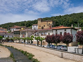
Marañón is a town and municipality located in the province and autonomous community of Navarre, northern Spain.

Hatsik, formerly known as Toparli, is a village in the Shirak Province of Armenia.
Karadzor is a town in the Lori Province of Armenia.
Siemieniakowszczyzna is a village in the administrative district of Gmina Narewka, within Hajnówka County, Podlaskie Voivodeship, in north-eastern Poland, close to the border with Belarus. A place with the longest single-word name in Poland.

Ostrów is a village in the administrative district of Gmina Łowicz, within Łowicz County, Łódź Voivodeship, in central Poland. It lies approximately 6 kilometres (4 mi) west of Łowicz and 45 km (28 mi) north-east of the regional capital Łódź.

Qarakənd is a village in the Martuni Province of the Republic of Artsakh and Khojavend Rayon of Azerbaijan. Berdashen means "village of the fortress" in Armenian. Qarakənd means "black village" in the Caucasian Turkic.
Dobrzanówka is a village in the administrative district of Gmina Tomaszów Lubelski in eastern Poland. The administrative district where it is located is within Tomaszów Lubelski County of Lublin Voivodeship.

Gucheng District is a county-level district located in Lijiang City Prefecture, Yunnan, China.
Feliksin is a village in the administrative district of Gmina Garwolin, within Garwolin County, Masovian Voivodeship, in east-central Poland. It lies approximately 7 kilometres (4 mi) south of Garwolin and 59 km (37 mi) south-east of Warsaw.
Czartowo is a village in the administrative district of Gmina Drezdenko, within Strzelce-Drezdenko County, Lubusz Voivodeship, in western Poland.
Pączewo is a village in the administrative district of Gmina Skórcz, within Starogard County, Pomeranian Voivodeship, in northern Poland. It lies approximately 6 kilometres (4 mi) north of Skórcz, 14 km (9 mi) south of Starogard Gdański, and 58 km (36 mi) south of the regional capital Gdańsk.
Zielony Gaj is a village in the administrative district of Gmina Giżycko, within Giżycko County, Warmian-Masurian Voivodeship, in northern Poland. It lies approximately 7 kilometres (4 mi) north-east of Giżycko and 94 km (58 mi) east of the regional capital Olsztyn.
Glimy is a village in the administrative district of Gmina Miłomłyn, within Ostróda County, Warmian-Masurian Voivodeship, in northern Poland.
Drzonowo is a village in the administrative district of Gmina Biały Bór, within Szczecinek County, West Pomeranian Voivodeship, in north-western Poland. It lies approximately 10 kilometres (6 mi) south of Biały Bór, 16 km (10 mi) north-east of Szczecinek, and 156 km (97 mi) east of the regional capital Szczecin.
Duomo is an under-construction underground metro station that will serve Line 1 on the Naples Metro. It is located near the city's main cathedral, the Duomo, for which it is named. Designed by the Italian architect Massimiliano Fuksas, the station is primarily located in a central roundabout in Corso Umberto I (Rettifilo), with secondary entrances along Via Marina and Via Duomo.
Rava is a village in Järva Parish, Järva County in northern-central Estonia.

Zeoke is a village in the municipality of Lučani, Serbia. According to the 2011 census, the village has a population of 222 people.
Češljeva Bara is a village in the municipality of Veliko Gradište, Serbia. According to the 2002 census, the village has a population of 489 people.
Mazraeh-ye Siah Daneh is a village in Alamarvdasht Rural District, Alamarvdasht District, Lamerd County, Fars Province, Iran. At the 2006 census, its existence was noted, but its population was not reported.
Malo Mramorani is a village in Municipality of Dolneni, central Republic of Macedonia.


