Wel te Vreeden is a community in the East Berbice-Corentyne Region of Guyana, located on the Canje River at 05°51′N57°28′W. The community has also been called New Ground Village. Wel te Vreeden is 20 miles west of Corriverton and just north of the Torani Canal's connection to the Canje River.

Laškovce is a village and municipality in Michalovce District in the Kosice Region of eastern Slovakia.

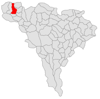
Blatina is a village in northern Montenegro, within Kolašin Municipality.
Scărișoara is a commune located in Alba County, Romania. It has a population of 1,850 (2002). It is composed of fourteen villages: Bârlești, Botești, Fața-Lăzești, Florești, Lăzești (Lezest), Lespezea, Maței, Negești, Preluca, Runc, Scărișoara, Sfoartea, Știuleți and Trâncești.

Tyniewicze Małe is a village in the administrative district of Gmina Narew, within Hajnówka County, Podlaskie Voivodeship, in north-eastern Poland. It lies approximately 8 kilometres (5 mi) south-west of Narew, 15 km (9 mi) north-west of Hajnówka, and 36 km (22 mi) south-east of the regional capital Białystok.

Ghilad is a commune in Timiș County, Romania. It is composed of two villages, Gad (Gád) and Ghilad. These were part of Ciacova Commune until 2004, when they were split off.
Opacionka is a village in the administrative district of Gmina Brzostek, within Dębica County, Subcarpathian Voivodeship, in south-eastern Poland. It lies approximately 23 kilometres (14 mi) south of Dębica and 44 km (27 mi) south-west of the regional capital Rzeszów.
Bledzianów is a village in the administrative district of Gmina Ostrzeszów, within Ostrzeszów County, Greater Poland Voivodeship, in west-central Poland. It lies approximately 13 kilometres (8 mi) north-west of Ostrzeszów and 122 km (76 mi) south-east of the regional capital Poznań.
Załakowo is a village in the administrative district of Gmina Sierakowice, within Kartuzy County, Pomeranian Voivodeship, in northern Poland. It's located approximately 5 kilometres (3 mi) north-west of Sierakowice, 24 km (15 mi) west of Kartuzy, and 51 km (32 mi) west of the regional capital Gdańsk.

Donja Nevlja is a village in the municipality of Dimitrovgrad, Serbia and in municipality of Dragoman, Bulgaria. According to the 2002 Serbian census, the village has a population of 31 people. According to the 2014 data of the Bulgarian Citizen Registry, the village has a population of 2
Teketo is a village in the municipality of Haskovo, in Haskovo Province, in southern Bulgaria.
Sladun is a village in the municipality of Svilengrad, in Haskovo Province, in southern Bulgaria.
Davidovac is a village in the municipality of Vranje, Serbia. According to the 2002 census, the village has a population of 502.
Donja Otulja is a village in the municipality of Vranje, Serbia. According to the 2002 census, the village has a population of 101 people.
Gornje Trebešinje is a village in the municipality of Vranje, Serbia. According to the 2002 census, the village has a population of 213 people.
Golemo Selo is a village in the municipality of Vranje, Serbia. According to the 2002 census, the village has a population of 1051 people.
Nastavce is a village in the municipality of Vranje, Serbia. According to the 2002 census, the village has a population of 52 people.
Stari Glog is a village in the municipality of Vranje, Serbia. According to the 2002 census, the village has a population of 44 people.

German submarine U-1210 was a Type VIIC U-boat of Nazi Germany's Kriegsmarine during World War II.


