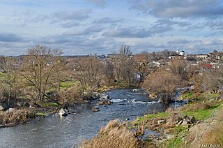
Ros is a river in Ukraine, 346 km in length, a right tributary of the Dnieper river. The Ros river finds its source in the village of Ordyntsi in Pohrebyschenskyi Raion, Vinnytsia Oblast.
Zalduondo is a village and municipality located in the province of Araba (Álava), in the Basque Country, northern Spain. In 2012 the population was 185 persons and the extension of the village is 12,03 km².
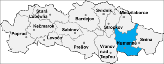
Brestov is a village and municipality in Humenné District in the Prešov Region of north-east Slovakia. The mayor is Ľudmila Nováková (Independent).
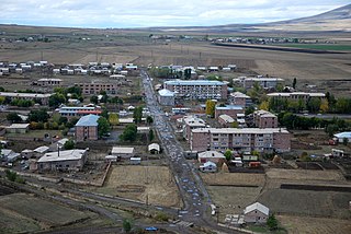
Tsaghkahovit, known as Haji Khalil until 1946, is a village in the Aragatsotn Province of Armenia. There are many Late Bronze Age remains which are in the process of being excavated.
Siemieniakowszczyzna is a village in the administrative district of Gmina Narewka, within Hajnówka County, Podlaskie Voivodeship, in north-eastern Poland, close to the border with Belarus. A place with the longest single-word name in Poland.

Myuskanly is a village in the Qubadli Rayon of Azerbaijan.

Prząsław Mały is a village in the administrative district of Gmina Jędrzejów, within Jędrzejów County, Świętokrzyskie Voivodeship, in south-central Poland. It lies approximately 6 kilometres (4 mi) west of Jędrzejów and 39 km (24 mi) south-west of the regional capital Kielce.
Zalesie is a village in the administrative district of Gmina Chynów, within Grójec County, Masovian Voivodeship, in east-central Poland. It lies approximately 6 kilometres (4 mi) south-east of Chynów, 20 km (12 mi) east of Grójec, and 39 km (24 mi) south of Warsaw.
Piotrkowice is a village in the administrative district of Gmina Kozienice, within Kozienice County, Masovian Voivodeship, in east-central Poland. It lies approximately 7 kilometres (4 mi) north of Kozienice and 75 km (47 mi) south-east of Warsaw.
Kornelin is a village in the administrative district of Gmina Szczytniki, within Kalisz County, Greater Poland Voivodeship, in west-central Poland.
Lubnica is a village in the administrative district of Gmina Okonek, within Złotów County, Greater Poland Voivodeship, in west-central Poland. It lies approximately 12 kilometres (7 mi) north of Okonek, 33 km (21 mi) north of Złotów, and 138 km (86 mi) north of the regional capital Poznań.
Kawcze is a village in Gmina Miastko, Bytów County, Pomeranian Voivodeship, in northern Poland. It lies approximately 41 kilometres (25 mi) south-west of Bytów and 119 km (74 mi) south-west of Gdańsk.

Vysoká u Příbramě is a village and municipality in Příbram District in the Central Bohemian Region of the Czech Republic.

Čukurovac is a village in the municipality of Aleksinac, Serbia. According to the 2002 census, the village has a population of 122 people.
Dobrosin is a village in the municipality of Bujanovac, in southern Serbia.

Ksar Boukhari is a town and commune in Médéa Province, Algeria. According to the 1998 census it had a population of 53,637. The town is bordered by woods and the Atlas mountains, and is built on the Chelif river.

Ocnița is a village in the Camenca sub-district of Transnistria, Moldova. It is currently under the administration of the breakaway government of the Transnistrian Moldovan Republic.
Tumba is a village in the municipality of Vranje, Serbia. According to the 2002 census, the village has a population of 44 people.
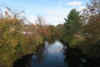
The Otter River is a river in Massachusetts that flows approximately 10 miles and is a major tributary of the Millers River which in turn is a tributary of the Connecticut River. The Otter River enters the Millers River in Winchendon in Otter River State Forest.

Kober kayaran, is a village in the Lori Province of Armenia. It belongs to the municipality of Tumanyan. At the top of the tiny hillside village is Kobayr Monastery


