Singidunum was an ancient city which later evolved into modern Belgrade, the capital of Serbia. The name is of Celtic origin, going back to the time when Celtic tribe Scordisci settled the area in the 3rd century BC, following the Gallic invasion of the Balkans. Later on, the Roman Republic conquered the area in 75 BC and incorporated it into the province of Moesia. It was an important fort of the Danubian Limes and Roman Legio IV Flavia Felix was garrisoned there since 86 AD. Singidunum was the birthplace of the Roman Emperor Jovian. It was sacked by Huns in 441, and by Avars and Slavs in 584. At the beginning of the 7th century, the Singidunum fort was finally destroyed.

Grocka or Grocka na Dunavu is a municipality of the city of Belgrade. According to the 2011 census results, the municipality has 83,906 inhabitants.
Mali Mokri Lug is an urban neighborhood of Belgrade, Serbia. It is located in the south-eastern section of Belgrade's municipality of Zvezdara. It marks the border with the municipality of Grocka. It mostly stretches between Bulevar kralja Aleksandra and the Highway Belgrade–Niš, but also north of the boulevard. It extends into the neighborhoods of Mirijevo on the north, Konjarnik on the west, Medaković III on the south-west, Veliki Mokri Lug on the south and Kaluđerica on the east.

Ivanovo is a village located in the Pančevo municipality, in the South Banat District of Vojvodina, Serbia. It has a population of 1,053 inhabitants.

Ražanj is a village and municipality located in the Nišava District of southern Serbia. The municipality consists of 23 settlements having a total population of 9,150 inhabitants, with 1,245 inhabitants living in Ražanj itself. The municipality covers an area of 289 square kilometers and it is located 50 kilometers (31 mi) northwest of Niš.

Brestovik is a suburban settlement of Belgrade, the capital of Serbia. It is located in the municipality of Grocka.
Leštane is a suburban settlement of Belgrade, Serbia. It is located in the municipality of Grocka.
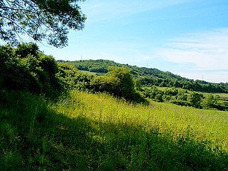
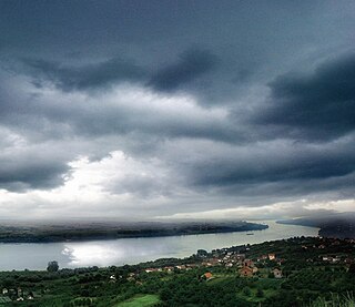
Ritopek is a suburban settlement of Belgrade, Serbia. It is located in the municipality of Grocka, 20 km east of Belgrade and 19 km west of the municipal seat, on the right bank of the Danube, across from the village of Ivanovo in Banat region of the Vojvodina province.

Zaklopača is a suburban settlement of Belgrade, Serbia. It is located in Belgrade's municipality of Grocka.
Vrčin is a suburban settlement of Belgrade, Serbia. It is located in Belgrade's municipality of Grocka.
Vinča is a suburban settlement of Belgrade, Serbia. It is part of the municipality of Grocka. Vinča-Belo Brdo, an important archaeological site that gives its name to the Neolithic Vinča culture, is located in the village.

Pančevački Rit is a small geographical area in south-western Banat, Serbia. It is situated between the rivers Danube and Tamiš, in Belgrade's municipality of Palilula.
Glogonjski Rit is a suburban settlement of Belgrade, the capital of Serbia. It is located in the Belgrade's municipality of Palilula.

Serbia's capital city of Belgrade is divided into 17 municipalities.
Široka Bara is a bog and also a suburban settlement of Belgrade, the capital of Serbia. Both are located in Belgrade's municipality of Palilula.
Padinska Skela, or colloquially Padinjak (Падињак), is a suburban settlement of Belgrade, the capital of Serbia. It is located in the Belgrade's municipality of Palilula.

Radmilovac is a suburban settlement of Belgrade, the capital of Serbia, and an experimental farm of the University of Belgrade's Faculty of Agriculture. It is located in the Belgrade municipality of Grocka. It is also known for the hotel of the same name.

The Bolečica is a short river in north-central Serbia, a 12 km-long right tributary to the Danube. During its entire flow it runs through the suburban section of Belgrade and despite being short it flows through the three Belgrade's municipalities, next to the half dozen of suburbs of Belgrade with a total population of 35,000 and is a route to important roads.
Stari Đeram, colloquially Đeram, is an open greenmarket and an urban neighborhood of Belgrade, the capital of Serbia. It is located in Belgrade's municipality of Zvezdara.
Janko Gagić was a Serbian hajduk leader (buljubaša) He was killed during the Slaughter of the Knezes, the incident that sparked the Serbian Revolution, ultimately leading to Serbia's liberation from the Ottoman Empire.