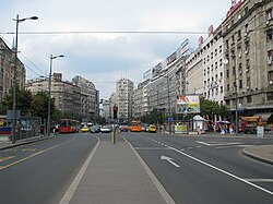
Most of the municipalities are situated on the southern side of the Danube and Sava rivers, in the Šumadija region. Three municipalities (Zemun, Novi Beograd, and Surčin) are on the northern bank of the Sava, in the Syrmia region, and the municipality of Palilula, spanning the Danube, is in both the Šumadija and Banat regions.
A municipality is a part of the territory of the City of Belgrade, in which certain operations of local self-government laid down by the City Charter are run. Pursuant to the Constitution, legislation, present Charter and bylaws of the municipality, the citizens participate in conducting operations of the municipality through the councilors elected to the municipal assembly, civil initiative, local citizens’ meeting and referendum.
The bodies of the municipality are:
Municipal Assembly
Municipal Council
The number of councilors in the Municipal Assembly ranges from 19 to 75 councilors.
The District Council Chairman presides over the Municipal Assembly and is a chairperson of the Municipal Council. The Municipal Assembly elects the District Council Chairman among the municipal councilors.
The Municipal Council is composed of the District Council Chairman, Deputy District Council Chairman and at the most 7 members. The Municipal Council members are elected by the Municipal Assembly among both councilors and citizens further to the proposal by the District Council Chairman.
History
18th century
House at 10 Cara Dušana Street, the oldest house in Belgrade and the only surviving part of German Town, administrative neighborhood of Belgrade from the 1730s
During the First Serbian Uprising, the Serbian Administrative Council divided the liberated territory in 12 nahiyah in 1807, confirming more or less the already existing division. One of them, Belgrade Nahiyah, covered mostly the present part of the Šumadija section of the territory of City of Belgrade. The existence of the Belgrade Nahiyah was retained after the Second Serbian Uprising in 1815. In order to replace the division inherited from the Ottoman period, the new, military-based division was introduced in 1834. Belgrade Nahiya was replaced with the Belgrade Okrug, which itself was part of the super-unit of Podunavlje Serdarstvo. Belgrade Okrug occupied territory much wider than the city itself, and was divided into the srez of Kolubara (seated in Šopić), Kosmaj (Sopot), Podunavlje (Grocka), Posavina (Ostružnica) and Turija (Darosava). Almost all villages became seats of the municipalities. In 1837, Kosmaj was annexed to Podunavlje. In 1838 the military administration was replaced with the civilian one.[4]
After 1806, the rebellion leaders divided Belgrade into quarters, for practical purposes. The city had no officially named streets at the time, so the houses were numbered by the quarter to which they belonged.[5] The administration of Belgrade City was established in 1839, according to the Law on the organization of municipalities. In 1841 the administration was made independent from the Ministry of the Interior, though the government still supervised the courts, police and administration.[6] On 15 March 1847, the city administration asked from the Ministry of the Interior to do the numbering of the houses. The ministry suggested the division of the entire city into quarters and on 9 February 1848 proposed division into six quarters: Metropolitan, Zerek (Dorćol), Savamala, Terazije, Palilula and Vračar.[3][5]
On 2 July 1856 the srez of Turija was abolished and divided between Kosmaj and Kolubara, and the new srez of Vračar was formed from the parts of Podunavlje (which was renamed to Grocka) and Posavina. The Vračar Srez covered the area directly surrounding the city itself, including the villages of Banjica, Beli Potok, Jajinci, Kaluđerica, Kumodraž, Leštane, Mali Mokri Lug, Mirijevo, Pinosava, Rakovica, Resnik, Rušanj, SlanciVeliki Mokri Lug, Vinča and Višnjica from Podunavlje and Kneževac, Žarkovo and Železnik from Posavina. Additions to Vračar included Ostružnica on 14 March 1861, Ripanj on 14 February 1886 and Zuce in 1890, while Topčider was transferred from Podunavlje directly under the Belgrade administration, becoming part of the city on 1 July 1863.[4]
In December 1859, mayor of Belgrade, at that time called "city administrator", Nikola Hristić, again suggested the division of Belgrade into quarters, which would move the city further from the oriental way of administration and mark the beginning of the modern, European way of local governing. Ministry of interior forwarded his request to the State Council and to Prince of SerbiaMiloš Obrenović. They accepted the proposition and on 5 September[O.S. 24 July]1860, Prince Miloš signed ukaz by which Belgrade, with some 3,000 houses at the time, was divided into six quarters. The quarters were sub-areal organs of the municipal administration and had certain jurisdiction over political and public security, construction, administrative works, education, health care, social care, etc.[7] By the 1883 census, the city had a population of 36,177, or by the quarters: Palilula 7,118, Terazije 6,333, Vračar 5,965, Dorćol 5,728, Savamala 5,547 and Varoš 4,519. Remaining 767 inhabitants lived in Topčider, which wasn't organized as a quarter.[8][9] Additional quarter called Grad (Town), which occupied the fortress area while it was inhabited, existed between the censuses of 1890 and 1910,[10] before being abolished on 24 August 1913.[4]
Nikola Hristić, mayor who divided Belgrade into quarters in the 1860sBelgrade Fortress in 1914, while it was still populated and made one of the city quarters
After the administrative reforms on 25 November 1889 (concerning municipalities) and 15 March 1890 (administrative division), Belgrade Okrug merged with Smedervo Okrug into Podunavlje Okrug while Vračar Srez consisted of 16 municipalities and 22 settlements in total, all of which were villages: Beli Potok (including Selo Rakovica), Kumodraž, Leštane (including Zuce), Mali Mokri Lug, Mirijevo, Pinosava, Resnik, Ripanj, Rušanj, Slanci, Veliki Mokri Lug, Veliko Selo, Vinča, Višnjica, Žarkovo and Železnik.[4]
The surrounding Belgrade Okrug and its constituent srez:
Okrug/Srez
1890
1895
1900
1905
1910
1921
1931
Belgrade Okrug
104.462
113.357
127.353
141.235
157.220
138.920
151.196
Vračar Srez
20.159
21.615
25.176
28.059
32.608
30.562
34.996
Grocka Srez
17.422
18.675
20.711
22.852
25.049
22.433
27.108
Kolubara Srez
20.876
21.461
23.806
26.417
29.702
24.874
30.272
Kosmaj srez
25.021
28.532
32.359
35.607
38.519
33.518
24.397
Posavina Srez
20.984
23.074
25.301
28.300
31.342
27.533
34.423
20th century
Before World War II
Belgrade Okrug was restored in its previous borders on 24 January 1900, with the division of Podunavlje. Čukarica was transferred from Vračar Srez to the Belgrade City administration on 8 July 1907. In 1913 Belgrade Okrug consisted of two srez: Vračar, in its previous borders, and Grocka. Grocka Srez included Begaljica, Boleč, Brestovik, Vrčin, Grocka, Dražanj, Zaklopača, Kamendol, Mala Ivanča, Mali Požarevac, Pudarci, Ritopek, Senaja, Umčari and Šepšin. The law on 24 August 1913 confirmed the division of Belgrade into 7 quarters.[4]
Regional map of the Yugoslav division into the banovinas, showing the area of the Administration of Belgrade City (1929-1941)
After the May Coup, a new law was adopted on 18 June[O.S. 5 June]1903 which created a modern local self-governance. The city was administered by the cabinet of the president of the municipality, with offices for different aspects of city life, like modern secretariats. Two specific directories were the one for the trams and another for the social and health care.[6] Still, the division on six quarters remained until the Austro-German occupation of the city in 1915, during World War I. After the liberation in 1918, city was administratively expanded to include its outer suburbs like Dušanovac and Voždovac.[7]
In the 1918-1921 period, after the creation of the Kingdom of Serbs, Croats and Slovenes, the division was kept and the Belgrade Okrug was restored to its pre-1913 borders. In 1922 the new state was divided into oblasts. Belgrade Oblast included just the immediate southwest surroundings of Belgrade but on the north it spread all over to the Hungarian and Romanian border. The oblasts were abolished in 1929 and replaced with banovinas.[4]
In 1922 a new statute envisioned a regular elections for the city assembly every 3 years. Winning party would de allocated two thirds of the seats, while the rest would be divided among the opposition parties, using the proportional system. After the 6 January Dictatorship was introduced by the king Alexander I of Yugoslavia in 1929, part of the 1922 statute was abolished and the opposition's third in the city assembly was allocated by the prerogative of the Minister of the Interior. Administratively, area of Belgrade was expanded.[6] Towns of Zemun, across the Sava, and Pančevo, across the Danube, were annexed to the city territory on 4 October 1929,[13] forming the Administration of Belgrade City, but remained separate settlements. Zemun lost its separate status and became part of the Belgrade settlement in 1934.[14] The area of the city was divided into 14 quarters (including the original 6),[7] for the purposes of the more effective administration, police and courts.[6] In 1935 3 additional quarters were formed, lifting the total number to 17.[6]
New law on municipalities in March 1933 stipulated for the creation of relatively large municipalities, with over 3,000 inhabitants. This caused a major regrouping of the municipalities in the state. Also, the self-administration of the municipalities was limited as they were heavily administered by the state administration which now became the supervising organs. In the 1921–1931, only one new municipality was formed in the Vračar Srez.[4]
World War II
After occupation of Yugoslavia in April 1941, German occupational administration divided Occupied Serbia into 14 okrugs, one of them being Belgrade Okrug. They kept the division into srez and further into municipalities.[4] The okrug in this period included 9 srez: Belgrade [Municipality], Grocka, Umka, Sopot, Lazarevac, Mladenovac, Smederevo, [Smederevska] Palanka and Veliko Orašje.[15]Yugoslav Partisans in time formed their own administrative bodies, called people's liberation boards (NOO). At first temporary organs, after the German defeat in 1944-1945 they became the units of the new administrative division. Some of such local bodies on the present Belgrade territory included NOO Zemun (in 1943), NOO Mladenovac Srez, NOO Grocka Srez and NOO Kosmajski Srez (all in 1944).[4]
After World War II
Accelerated construction of New Belgrade began in 1948. A new Raion X was created in 1950 encompassing the new city. New Belgrade became municipality in 1952 and annexed the neighboring Bežanija in 1955
After the World War II liberation, new Communist authorities abolished the quarters on formed 14 raions in November 1944. Each had its own NOO. On 11 December 1944 the raions were organized as the full local administrations, with corresponding departments. They were subordinated to the Executive Board of the Belgrade City NOO. They were merged on 8 September 1945, leaving a total of 7 raions. In June 1945, NOO's for the neighborhoods, as parts of the raions (mimicking the former quarters), were formed, but were abolished in December 1946. In May 1947 the raions were reorganized and re-numerated, lifting their number to 8 and labeling from I to VIII. Raion IX was formed in April 1949 and raion X in April 1950 (New Belgrade and Bežanija).[4][6]
Belgrade Okrug was restored by the new authorities on 1 September 1945, but was abolished on 18 April 1947, with all the other okrugs in Serbia. Belgrade Okrug was divided in two: Belgrade Srez and Kosmaj Srez. Srez' were not part of the local self-administration, that is, not administered by the city government but directly by the state government. On 16 May 1950, additional administrative super-units of oblasts were created. Belgrade Oblast included 24 srez' and the Belgrade City. Oblasts were abolished on 1 December 1951.[4]
Belgrade's downtown square Terazije had a separate municipality from 1952 to 1957Borča had its own municipality from 1952 until 1955 when was annexed to Krnjača. In turn, Krnjača became part of the Palilula municipality in 1965Surčin municipality, abolished in 1965, was recreated in 2003 as the youngest, 17th municipality of Belgrade
By the 1952 reform, Belgrade Srez (also colloquially called Vračar Srez) consisted of 37 municipalities. In 1955, parts of the Zemun and Podunavlje srez' were annexed to the Belgrade Srez, which encircled the urban area of the city and consisted of 35 municipalities. In December 1956 the Belgrade Srez was abolished as such and the administration was taken over by the City of Belgrade, as the srez-level administrative unit. Some parts of the former srez didn't become part of the city, but were added to the surrounding, newly formed Lazarevac and Mladenovac srez'. With numerous mergers, the city was reorganized into 20 municipalities, 10 urban and 10 suburban.[4] At this point, the area was enlarged to 2,090km2.[17][18][19] The core consisting of 10 urban municipalities remained unchanged since then: Čukarica, New Belgrade, Palilula, Rakovica, Savski Venac, Stari Grad, Voždovac, Vračar, Zemun and Zvezdara. In 1957, by the new law, city was divided into 17 municipalities.[4]
Since then, municipalities were being merged, abolished an annexed. In July 1955 many municipalities, especially from the former Belgrade Srez, have been annexed to the municipalities. For example:[4][17]
Čukarica (Železnik, Žarkovo)
Krnjača (Borča, Ovča, Padinska Skela)
New Belgrade (Bežanija)
Voždovac (Beli Potok, Jajinci, Kumodraž, Pinosava)
Enlargement of the municipalities continued by the reorganization on 3 January 1957, which is also when separate municipalities became subordinated to the Belgrade City administration:[4][17]
Palilula (Karaburma, Višnjica)
Savski Venac (West Vračar, Topčidersko Brdo)
Stari Grad (Skadarlija, part of Terazije)
Voždovac (Lekino Brdo)
Vračar (recreated; East Vračar, Neimar, part of Terazije)
Zvezdara (Stari Đeram)
After the 1955-1958 reorganization of municipalities and districts, Barajevo, Obrenovac, Sopot and Grocka became parts of Belgrade. Further changes by 1960 included:[4][17][18][19]
Barajevo (Arnajevo, Baćevac, Beljina, Boždarevac, Lisović, Veliki Borak, Vranić)
Čukarica (Rakovica, Velika Moštanica, Umka, Sremčica, Rušanj, Ostružnica, Resnik)
Grocka (Begaljica, Boleč, Brestovik, Vrčin (partly to Voždovac), Zaklopača; former municipalities of Kaluđerica, Leštane and Vinča detached from Zvezdara and annexed to Grocka)
Voždovac (Ripanj, Zuce (previously merged into the Vrčin municipality); former municipality of Veliki Mokri Lug detached and annexed to Zvezdara)
Zemun (Batajnica, Ugrinovci)
Zvezdara (former municipalities of Kaluđerica, Leštane and Vinča detached and annexed to Grocka; former municipality of Veliki Mokri Lug detached from Voždovac and annexed to Zvezdara)
In 1959 Belgrade was organized in 15 municipalities: Barajevo, Čukarica, Grocka, Krnјаča, New Belgrade, Obrenovac, Palilula, Savski Venac, Sopot, Stari Grad, Surčin, Voždovac, Vračar, Zemun and Zvezdara. Rakovica was abolished and annexed to Čukarica.[4] By the constitutional reforms in 1963, People's Boards, which administered the municipalities were transformed into the Municipal Assemblies.[7] In 1965 municipalities of Surčin (annexed to Zemun) and Krnjača (annexed to Palilula) were abolished, reducing the number of municipalities to 13. Additionally, with the abolishment of Kolari municipality and its division between Smederevo and Grocka, former municipalities of Umčari, Pudarci and Kamendol were annexed to Grocka and, thus, to Belgrade. Srez' in the entire state were abolished on 13 March 1967 and Belgrade City began to fully operate as one administrative unit over its municipalities. Administrative division on urban and suburban municipalities was also abolished.[4]
Municipalities of Lazarevac (14) and Mladenovac (15) were administratively annexed to Belgrade in November 1970, finishing the formation of the present city territory.[4] Rakovica (16) was reestablished on 15 October 1974 after splitting from Čukarica, while Surčin (17) split from Zemun on 24 September 2003.
Development of the Belgrade administrative division by the census years:[18][19][20]
Since 2006, all municipalities which constitute the cities are officially named “city municipalities”, so all 17 municipalities of the City of Belgrade were legally renamed (City municipality of Zemun, City municipality of Sopot, etc.).[7] The name is administrative and same for all municipalities, regardless of the statistical (urban/rural) or practical and colloquial division (urban/suburban).
6 municipalities which are fully urban and integrated into the Belgrade as a settlement (New Belgrade, Rakovica, Stari Grad, Savski Venac, Zvezdara, Vračar)
4 municipalities which are partially urban/integrated and partially suburban, including rural areas (Palilula, Zemun, Voždovac, Čukarica)
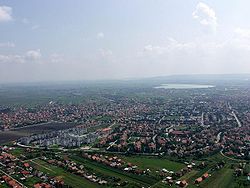
6 municipalities which are suburban, with both urban (usually municipal seats) and rural settlements (Obrenovac, Lazarevac, Sopot, Grocka, Mladenovac, Surčin)
1 municipality which is suburban and fully rural (Barajevo)
In 2019 it was announced that the new law will restore the old distinction between the 10 urban and 7 suburban municipalities. In May 2019 the changed Law on the Capital City was adopted in the National Assembly of Serbia but it made no distinction between two zones, urban and suburban, and the official name of the suburban municipalities remained "City Municipality of...", though some of the regulations point to somewhat different jurisdiction between the two.[21]
↑ Dušan Gavrilović, ed. (2018). "Statistical yearbook of the Republic of Serbia 2018". Statistički Godišnjak Srbije. Belgrade: Statistical Office of the Republic of Serbia: 418. ISSN0354-4206.
1 2 Goran Vesić (31 January 2019). Како су улице добијале имена[How the streets were named]. Politika (in Serbian). p.18.
1 2 3 4 5 6 7 Nikola Belić (December 2011), "Varoš, obština, kvartovi, rejoni..." [Town, municipality, quarters, raions...], Politika (in Serbian)
1 2 3 4 5 Slobodan Kljakić (2 August 2010), "Od šest kvartova do sedamnaest opština" [From six quarters to seventeen municipalities], Politika (in Serbian)
↑ Dejan Aleksić (9 May 2017), "Šest decenija opštine Palilula - Nekad selo, a danas urbana celina grada", Politika (in Serbian)
1 2 Претходни резултати пописа становништва и домаће стоке у Краљевини Србији 31 декембра 1910 године, Књига V, стр. 10[Preliminary results of the census of population and husbandry in Kingdom of Serbia on 31 December 1910, Vol. V, page 10]. Управа државне статистике, Београд (Administration of the state statistics, Belgrade). 1911.
↑ Final results of the census of population from 31 January 1921, page 4. Kingdom of Yugoslavia - General State Statistics, Sarajevo. June 1932.
↑ Final results of the census of population from 31 March 1931, page 12. Kingdom of Yugoslavia - General State Statistics, Belgrade. 1937.
↑ Službene novine KJ br. 232/29 (Official Gazette of the Kingdom of Yugoslavia, No. 232/29) (in Serbian). 1929.
↑ Miodrag A. Dabižić. Prilog prošlosti gradskog parka u Zemunu od sedamdesetih godina XIX veka do 1914. godine (A contribution to the past history of the town park in Zemun from the 1870s to 1914) (in Serbian and English).
↑ Mladenko Colić (17 July 2021). Осамдесет година од стварања партизанског покрета и оружаног отпора окупатору: 5 - Подела на окупационе зоне[Eighty years since the formation of Partisan movement and armed resistance against occupiers: 5 - Division in occupational zones]. Politika (in Serbian). p.20.
1 2 Final results of the population census of March 15th 1948, Volume IX, Population by ethnic nationality, page 300. Federal Statistical, Belgrade. 1954.
1 2 3 4 5 Oto Bihalji-Merin, ed. (1959). Mala enciklopedija Prosveta, I edition, Vol. I & II. Prosveta.
1 2 3 4 Popis stanovništva 1953, Stanovništvo po narodnosti (pdf). Savezni zavod za statistiku, Beograd.
1 2 3 4 Popis stanovništva 1961, Stanovništvo prema nacionalnom sastavu (pdf). Savezni zavod za statistiku, Beograd.
1 2 Comparative overview of the number of population in 1948, 1953, 1961, 1971, 1981, 1991, 2002 and 2011 – Data by settlements, pages 28-32. Statistical Office of the Republic of Serbia, Belgrade. 2014. ISBN978-86-6161-109-4.
This page is based on this Wikipedia article Text is available under the CC BY-SA 4.0 license; additional terms may apply. Images, videos and audio are available under their respective licenses.