Mladenovac is a municipality of the city of Belgrade. According to the 2011 census results, the municipality has a population of 53,050 inhabitants, while the urban area has 23,314 inhabitants.
Obrenovac is a municipality of the city of Belgrade. According to the 2011 census results, the municipality has a population of 71,419 inhabitants, while the urban area has 24,568 inhabitants.

Sopot is a municipality of the city of Belgrade. According to the 2011 census results, the town has a population of 4,548 inhabitants while the municipality has 20,367 inhabitants.

Avala is a mountain in Serbia, overlooking Belgrade. It is situated in the south-eastern corner of the city and provides a great panoramic view of Belgrade, Vojvodina and Šumadija, as the surrounding area on all sides is mostly lowlands. It stands at 511 metres (1,677 ft) above sea level, which means that it enters the locally defined mountain category just by 11 m (36 ft).
Palilula is a municipality of the city of Belgrade. It has the largest area of all municipalities of Belgrade. The core of Palilula is close to the center of the city, but the municipality also includes sparsely populated land left of the Danube.

Voždovac is a municipality of the city of Belgrade. According to the 2011 census results, the municipality has a population of 158,213 inhabitants.

Grocka or Grocka na Dunavu is a municipality of the city of Belgrade. According to the 2011 census results, the municipality has 83,906 inhabitants.

Barajevo is a municipality of the city of Belgrade. According to the 2011 census results, the municipality has a population of 27,110 inhabitants.

Čukarica is a municipality of the city of Belgrade.

Resnik is an urban neighborhood of Belgrade, Serbia. It is located in Belgrade's municipality of Rakovica.

Bogatić is a town and municipality located in the Mačva District of western Serbia. As of 2011 census, it has 28,843 residents.

Bubanj Potok is a non-residential suburban settlement of Belgrade, the capital of Serbia. It is located in Belgrade's municipality of Voždovac.

Beli Potok is a small town and a suburban settlement of Belgrade, Serbia. It is located in Belgrade's municipality of Voždovac.

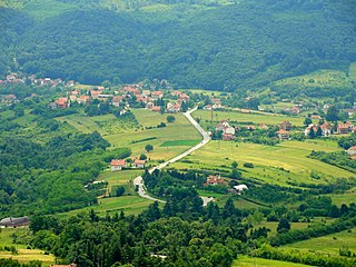
Pinosava is a small town and a suburb of Belgrade, Serbia. It is located in Belgrade's municipality of Voždovac, on the western slope of the Avala mountain, in the valley of the Topčiderka river, over 15 kilometers south of downtown Belgrade. It is located in the Low Šumadija, and the neighboring plateau is named after the town.
Omoljica is a village located in the municipality of Pančevo, South Banat District, Vojvodina, Serbia. The village population is 6,309 people.
Veliko Selo is a suburban settlement of Belgrade, Serbia. It is located in the Belgrade's municipality of Palilula.
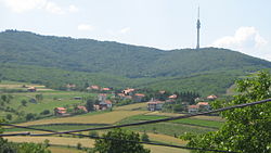
Ripanj is a suburban settlement of Belgrade, Serbia. It is located in Belgrade's municipality of Voždovac. It has a distinction of being "the largest village of Serbia" taking in account its number of population, but also because it has the largest area of all rural settlements in the country.

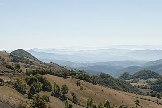
Kosmaj is a mountain south of Belgrade, the capital of Serbia. With an elevation of 626 meters, it is the highest point of the entire Belgrade City area and is nicknamed one of two "Belgrade mountains".

Žrnov or Žrnovan (Жрнован) was a medieval fortress on the highest top of the Avala Mountain, at 511 metres (1,677 ft), in Belgrade, Serbia. At the top Ancient Romans built an outpost, and later the Serbs expanded it into a fortress. It was completely demolished in 1934 to make the way to the Monument to the Unknown Hero.
Taor is a village in the municipality of Valjevo, Serbia. According to the 2011 census, the village has a population of 303.