
Coyote Creek is a river that flows through the Santa Clara Valley in Northern California. Its source is on Mount Sizer, in the mountains east of Morgan Hill. It eventually flows into Anderson Lake in Morgan Hill and then northwards through Coyote Valley to San Jose, where it empties into San Francisco Bay.

Alameda Creek is a large perennial stream in the San Francisco Bay Area. The creek runs for 45 miles (72 km) from a lake northeast of Packard Ridge to the eastern shore of San Francisco Bay by way of Niles Canyon and a flood control channel. Along its course, Alameda Creek provides wildlife habitat, water supply, a conduit for flood waters, opportunities for recreation, and a host of aesthetic and environmental values. The creek and three major reservoirs in the watershed are used as water supply by the San Francisco Public Utilities Commission, Alameda County Water District and Zone 7 Water Agency. Within the watershed can be found some of the highest peaks and tallest waterfall in the East Bay, over a dozen regional parks, and notable natural landmarks such as the cascades at Little Yosemite and the wildflower-strewn grasslands and oak savannahs of the Sunol Regional Wilderness. After an absence of half a century, ocean-run steelhead trout are able to return to Alameda Creek to mingle with remnant rainbow trout populations. Completion of a series of dam removal and fish passage projects, along with improved stream flows for cold-water fish and planned habitat restoration, enable steelhead trout and Chinook salmon to access up to 20 miles (32 km) of spawning and rearing habitat in Alameda Creek and its tributaries. The first juvenile trout migrating downstream from the upper watershed through lower Alameda Creek toward San Francisco Bay was detected and documented in April 2023.

San Leandro Creek is a 21.7-mile-long (34.9 km) year-round natural stream in the hills above Oakland in Alameda County and Contra Costa County of the East Bay in northern California.
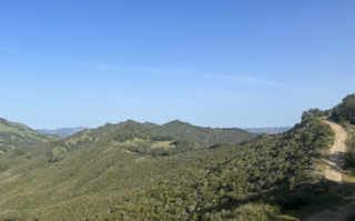
Las Trampas Regional Wilderness is a 5,342-acre (21.62 km2) regional park located in Alameda and Contra Costa counties in Northern California. The nearest city is Danville, California. Las Trampas is Spanish for the traps, or the snares. The park belongs to the East Bay Regional Park District (EBRPD).

Wildcat Creek is a 13.4-mile-long (21.6 km) creek which flows through Wildcat Canyon situated between the Berkeley Hills and the San Pablo Ridge, emptying into San Pablo Bay in Contra Costa County, northern California.
Rodeo Creek is an 8.3-mile-long (13.4 km) intermittent stream in western Contra Costa County, California running through the town of Rodeo to San Pablo Bay.

Pinole Creek is a stream in western Contra Costa County, in the East Bay region of the San Francisco Bay Area, California.
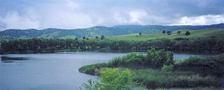
Marsh Creek is a stream in east Contra Costa County, California in Northern California which rises on the eastern side of Mount Diablo and flows 30 miles (48 km) to the Sacramento–San Joaquin River Delta at Oakley, California, near Big Break Regional Shoreline. The creek flows through Marsh Creek State Park (California), where water is impounded to form Marsh Creek Reservoir, then through the city of Brentwood, California.

Saratoga Creek is a north-northeast flowing creek in Santa Clara County, California.
San Felipe Creek is a 14 miles (23 km) stream that originates in the western Diablo Range in Santa Clara County, California. It flows south by southeast through two historic ranchos, Rancho Los Huecos and Rancho Cañada de San Felipe y Las Animas before it joins Las Animas Creek just above Anderson Reservoir. One of the nine major tributaries of Coyote Creek, the creek's waters pass through the Santa Clara Valley and San Jose on the way to San Francisco Bay.

The Walnut Creek mainstem is a 12.3-mile-long (19.8-kilometer) northward-flowing stream in northern California. The Walnut Creek watershed lies in central Contra Costa County, California and drains the west side of Mount Diablo and the east side of the East Bay Hills. The Walnut Creek mainstem is now mostly a concrete or earthen flood control channel until it reaches Pacheco Creek on its way to Suisun Bay. Walnut Creek was named for the abundant native Northern California walnut trees which lined its banks historically. The city of Walnut Creek, California was named for the creek when its post office was established in the 1860s.

Las Trampas Creek is a 12.37 mile long north-east flowing stream in Contra Costa County, California. Its watershed comprises an area of 17,238 acres. It's mean daily flow is approximately 15.4 cfs.

Grizzly Creek is a 3.2-mile-long northwest-flowing perennial stream in Contra Costa County, California. It is a major tributary of Las Trampas Creek, which is part of the larger Walnut Creek watershed, which in turn drains into Suisun Bay.

The East Bay Redwoods are an isolated population of coast redwoods that exist a considerable distance inland from the coast in the Berkeley Hills in western Contra Costa County, California. Stands of Sequoia sempervirens, the Coast Redwood, occur on the west coast from Big Sur to extreme southwestern Oregon. Their preferred habitat is the temperate and perennially foggy western slopes of the California Coast Ranges; a reliance on marine climates generally restricts their range to a narrow band along the central and northern coasts of California.

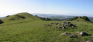
Las Trampas Peak is a 1,827 ft (557 m) peak in the Inner Coast Ranges in western Contra Costa County, California, in the San Francisco Bay Area.

Rocky Ridge is a 2,020 ft (620 m) ridge in the Inner Coast Ranges in western Contra Costa County, California, in the San Francisco Bay Area. Being the second-highest mountain in the county, it is visible from much of the surrounding area. The ridge is a very prominent feature in the geography of the towns of Lafayette, Moraga and Orinda, California.
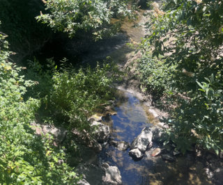
Lafayette Creek is a 3.78 mi (6.08 km) long creek in Contra Costa County, California in the San Francisco Bay Area. It is a tributary of Las Trampas Creek.

Tice Creek is a minor creek in Contra Costa County, California in the San Francisco Bay Area. It is approximately 4.1 miles (6.6 km) long. It is a tributary of Las Trampas Creek, which itself is a major tributary to Walnut Creek which in turn drains into Suisun Bay. The name comes from the surname of a settler family who settled in the Tice valley.

Buckhorn Creek is a 2.1 mile long creek in Contra Costa County, California, in the San Francisco Bay Area. It gets its name from the Buckhorn family who settled on the creek in the late 19th century.
Las Trampas Ridge is an 1,827 ft ridge in western Contra Costa County, California, in the San Francisco Bay Area. It comprises the western side of the San Ramon Valley.


