Boogardie Station

Last updated

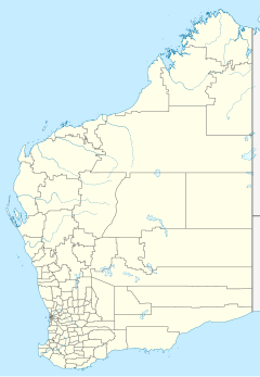
Australia Western Australia location map.svg
Red pog.svg
Boogardie Station

Boogardie Station is a pastoral lease that operates as a sheep station in Western Australia.

A pastoral lease is an arrangement used in both Australia and New Zealand where Crown land is leased by government generally for the purpose of grazing on rangelands.

Sheep station type of ranch in Australia or New Zealand

A sheep station is a large property in Australia or New Zealand whose main activity is the raising of sheep for their wool and meat. In Australia, sheep stations are usually in the south-east or south-west of the country. In New Zealand the Merinos are usually in the high country of the South Island. These properties may be thousands of square kilometres in size and run low stocking rates to be able to sustainably provide enough feed and water for the stock.

It is situated approximately 20 kilometres (12 mi) west of Mount Magnet and 72 km (45 mi) south west of Cue on Palmers Well Road.

Mount Magnet, Western Australia Town in Western Australia

Mount Magnet is one of the Mid West region’s original gold mining towns, and the longest surviving gold mining settlement in Western Australia. The prominent hill that is adjacent to the current townsite was called West Mount Magnet in 1854 by explorer Robert Austin, having named a smaller hill 64 km away, East Mount Magnet. Both hills had an extremely high iron content which affected the readings of his compass. West Mount Magnet had its Aboriginal name reinstated by the Surveyor General in 1972, 'Warramboo," meaning campfire camping place. The magnetic variation at Mount Magnet is zero: magnetic north equals true north.

Cue, Western Australia Town in Western Australia

Cue is a small town in the Mid West region of Western Australia, located 620 km north-east of Perth. At the 2016 census, Cue had a population of 178. It is also known as the Queen of the Murchison. Cue is administered through the Cue Shire Council, which has its chambers in the historic Gentlemans Club building. The current president is Ross Pigdon. The Cue Parliament is held twice yearly in May and November.

It has in its area Boogardie quarry, and is situated away from the location of the ghost town Boogardie.

Boogardie quarry is a quarry on Boogardie Station, 35 km from Mount Magnet in the Mid West of Western Australia, that is a location of a rare deposit of orbicular granite.

Boogardie, Western Australia Town in Western Australia

Boogardie is an abandoned town in the Mid West of Western Australia.

Robert Austin traversed the area as part of an expedition in 1854, reporting it as a fine goldfield and good grazing country. The Jones family established the station in about 1880. [1]

Robert Austin (1825–1905) led the Austin expedition of 1854, one of the first European inland explanations of Western Australia with Kenneth Brown. They explored Geraldton, Mount Magnet, and the Murchison River area. Lake Austin and the town of Austin were named after him.

The Austin expedition of 1854 was an expedition of exploration undertaken in Western Australia by Robert Austin in 1854. Members of Austin's party comprised John Hardey, Kenneth Brown, J.T. Fraser (artist), Thomas Whitfield, James Guerin, Richard Buck, J. Edwards, W. Cant, Charles Farmer, and J. Woodward; and aboriginals Narryer, Wambinning, Wooddang and Souper.

The property occupied an area of 374,000 acres (151,352 ha) in 1931 when the owner Henry Jones died. [2]

In 2011 the property was held by brothers David, Paul, Henry and John Jones who are all descendents of the Jones family that originally settled the property. The station's sheep flock had contracted to about 7,000 head of sheep after several dry seasons. [3]
See also

Related Research Articles

Shire of Mount Magnet Local government area in Western Australia

The Shire of Mount Magnet is a local government area in the Mid West region of Western Australia, about 570 kilometres (354 mi) north-northeast of the state capital, Perth. The Shire covers an area of 13,692 square kilometres (5,287 sq mi), and its seat of government is the town of Mount Magnet. The Shire of Mount Magnet current president is Jorgen Jensen, manager and owner of Yoweragabbie Station.

Yoweragabbie, Western Australia Town in Western Australia

Yoweragabbie is a small town in the Mid West region of Western Australia between the towns of Mount Magnet and Yalgoo.

Cooya Pooya sheep station in Western Australia

Cooya Pooya Station most often referred to as Cooya Pooya or Cooyapooya is a pastoral lease operating as a sheep station in Western Australia.

Boolathana Station

Boolathana Station is a pastoral lease currently operating as a cattle station that once operated as a sheep station in Western Australia.

Moorarie Station

Moorarie Station is a pastoral lease currently operating as a sheep station in the Murchison district of Western Australia's Mid West region.

Mount Gould Station

Mount Gould Station is a pastoral lease that used to operate as a sheep station but now operates as a cattle station in Western Australia.

Melangata Station

Melangata Station is a pastoral lease that has operated as a goat transhipment location, as well as sheep station in Western Australia.

Gabyon Station pastoral lease in Western Australia

Gabyon Station, commonly referred to as Gabyon, is a pastoral lease that operates as a sheep station in Western Australia.

Murrum Station human settlement in Australia

Murrum Station most often referred to as Murrum is a pastoral lease operating as a sheep station in Western Australia.

Yuinmery

Yuinmery Station is a pastoral lease that once operated as a sheep station and currently operates as a cattle station. It is located about 69 kilometres (43 mi) south west of Sandstone and 127 kilometres (79 mi) south east of Mount Magnet in the Mid West region of Western Australia. The western boundary of the station adjoins Youanmi Downs and the southern boundary adjoins vacant crown land and Cashmere Downs Station.

Youanmi Downs human settlement in Australia

Youanmi Downs or Youanmi Downs Station is a pastoral lease that once operated as a cattle station. It is located about 78 kilometres (48 mi) south west of Sandstone and 109 kilometres (68 mi) south east of Mount Magnet in the Mid West region of Western Australia. The eastern boundary of the station adjoins Yuinmery and the southern boundary adjoins Lake Barlee Station.

Yarraquin human settlement in Australia

Yarraquin or Yarraquin Station is a pastoral lease that currently operates as a cattle station and had previously operated as a sheep station.

Ullawarra

Ullawarra Station, often referred to as Ullawarra, is a pastoral lease that has operated as a sheep station but now operates as a cattle station.

Korong Station

Korong Station was a pastoral lease that operated as a sheep station in Western Australia.

Lake Way Station human settlement in Australia

Lake Way Station is a pastoral lease that once operated as a cattle station and now operates as a sheep station in Western Australia.

Myrtle Springs Station

Myrtle Springs Station is a pastoral lease that operates as a sheep station in outback South Australia.

Emu Creek Station

Emu Creek or Emu Creek Station is a pastoral lease and cattle station located approximately 150 kilometres (93 mi) east of Coral Bay and 180 kilometres (112 mi) south east of Exmouth in the Pilbara region of Western Australia.

Mount Keith Station

Mount Keith Station is a pastoral lease in Western Australia.

Boodanoo Station

Boodanoo Station is a pastoral lease that was once a sheep station but now operates as a cattle station in Western Australia.

Bulga Downs Station

Bulga Downs Station is a pastoral lease that once operated as a sheep station but is now a cattle station located in the Mid West region of Western Australia.

References

  1. "Pastoralists". Shire of Mount Magnet. 2015. Retrieved 5 December 2015.
  2. "Personal". Geraldton Guardian and Express . Geradton: National Library of Australia. 5 September 1931. p. 2. Retrieved 5 December 2015.
  3. Haidee Vandenberghe (5 May 2011). "Sheep commitment pays off". The West Australian . Yahoo7 . Retrieved 5 December 2015.

Coordinates: 28°02′21″S117°14′14″E / 28.03917°S 117.23722°E / -28.03917; 117.23722 (Boogardie)