Moorarie Station

Last updated

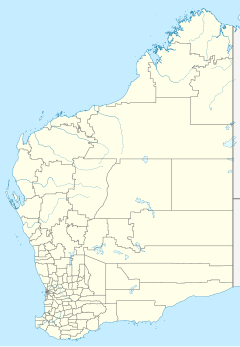
Coordinates: 25°55′20″S117°36′00″E / 25.9221°S 117.6001°E / -25.9221; 117.6001 (Moorarie) Moorarie Station is a pastoral lease currently operating as a sheep station in the Murchison district of Western Australia's Mid West region.

Geographic coordinate system Coordinate system

A geographic coordinate system is a coordinate system that enables every location on Earth to be specified by a set of numbers, letters or symbols. The coordinates are often chosen such that one of the numbers represents a vertical position and two or three of the numbers represent a horizontal position; alternatively, a geographic position may be expressed in a combined three-dimensional Cartesian vector. A common choice of coordinates is latitude, longitude and elevation. To specify a location on a plane requires a map projection.

A pastoral lease is an arrangement used in both Australia and New Zealand where Crown land is leased by government generally for the purpose of grazing on rangelands.

Sheep station type of ranch in Australia or New Zealand

A sheep station is a large property in Australia or New Zealand whose main activity is the raising of sheep for their wool and meat. In Australia, sheep stations are usually in the south-east or south-west of the country. In New Zealand the Merinos are usually in the high country of the South Island. These properties may be thousands of square kilometres in size and run low stocking rates to be able to sustainably provide enough feed and water for the stock.

Contents

The property is situated approximately 117 kilometres (73 mi) northwest of Meekatharra and 400 kilometres (249 mi) east of Carnarvon. It is watered by the southern branch of the Murchison River, the Hope River and the Yalgar River. [1]

Meekatharra, Western Australia Town in Western Australia

Meekatharra is a town in the Mid West region of Western Australia. Meekatharra is a Yamatji word meaning 'place of little water'. At the 2016 census, Meekatharra had a population of 708, with 34.0% being of Aboriginal descent.

Carnarvon, Western Australia Town in Western Australia

Carnarvon is a coastal town situated approximately 900 kilometres (560 mi) north of Perth, Western Australia. It lies at the mouth of the Gascoyne River on the Indian Ocean. The popular Shark Bay world heritage area lies to the south of the town and the Ningaloo Reef and the popular tourist town of Exmouth lie to the north. Within Carnarvon is the Mungullah Aboriginal Community. Inland, Carnarvon has strong links with the town of Gascoyne Junction and the Burringurrah Community. At the 2016 census, Carnarvon had a population of 4,426.

Murchison River (Western Australia) river in Western Australia

The Murchison River is the second longest river in Western Australia. It flows for about 820 km (510 mi) from the southern edge of the Robinson Ranges to the Indian Ocean at Kalbarri. The Murchison-Yalgar-Hope river system is the longest river system in Western Australia. It has a mean annual flow of 208 gigalitres, although in 2006, the peak year on record since 1967, flow was 1,806 gigalitres.

History

Moorarie was established by Edward William Butcher in 1875. Two years later Butcher sold the station to Dr James William Hope and his future father-in-law John Henry Monger. Hope operated the station with a sequence of partners, initially Alexander Crawford, later William Dalgety Moore, until 1891. [2] [3] [4]

William Dalgety Moore Australian businessman

William Dalgety Moore was a businessman in Fremantle, Western Australia, and also a pastoralist and politician.

In 1886 the property occupied an area of 1,100,000 acres (445,154 ha), watered by two major rivers, several clay pans and numerous shallow wells. At the time there were 14,000 sheep, 250 cattle and 40 horses, with Aboriginal labour for shepherding, shearing and mustering. [1]

Muster (livestock) process of gathering livestock; usually involve cattle, sheep or horses, but may also include goats, camels, buffalo or other animals

A muster (Au/NZ) or a roundup (US) is the process of gathering livestock. Musters usually involve cattle, sheep or horses, but may also include goats, camels, buffalo or other animals. Mustering may be conducted for a variety of reasons including routine livestock health checks and treatments, branding, shearing, lamb marking, sale, feeding and transport or droving to another location. Mustering is a long, difficult and sometimes dangerous job, especially on the vast Australian cattle stations of the Top End, 'The Falls' (gorge) country of the Great Dividing Range and the ranches of the western United States. The group of animals gathered in a muster is referred to as a "mob" in Australia and a "herd" in North America.

William Kerr owned Moorarie from at least 1907 and held it until his death in 1936. [5] [6]

Floods

In 1884 the Murchison flooded out to a distance of 6 miles (10 km) from the river bank and the main homestead was washed away with about 3,000 ewes and lambs. [7]

In April 1800 the Ord (Yalgar) River was twelve miles wide near Moorarie, and the Murchison River was six miles wide in places. [8]

In March 1926 the property was isolated for a week by floods. One shepherd spent five days stuck up a tree before being rescued by a passerby who swam his horse two miles to reach him. At least 400 sheep were lost to floodwaters but workers managed to save another 400 by swimming them to higher ground over a period of two days. [9]

See also

Related Research Articles

Austin Downs human settlement in Western Australia

Austin Downs Station or Austin Downs is a pastoral lease in the Mid West of Western Australia.

Shire of Murchison Local government area in Western Australia

The Shire of Murchison covers a large area of the Murchison sub-region of the central part of Western Australia, 300 kilometres (186 mi) northeast of Geraldton. The shire and the older 'Murchison' region and goldfield are now part of the designated Mid West region. It is Australia's second least populated local government area and the only one without a town.

Boolardy

Boolardy Station is a remote sheep station in the mid-west of Western Australia, about 194 km north-north-east of Pindar and 200 km west-south-west of Meekatharra. It is within the Shire of Murchison and situated on pastoral lease no. 3114/406. The area of the lease is 3,467.48 square kilometres (1,338.80 sq mi).

The Yalgar River is a 185-kilometre-long tributary of the Murchison River, located in the Shire of Meekatharra in central Western Australia. It rises in the Glengarry Range 25 km southeast of Mooloogool Station homestead, about 80 kilometres northeast of Meekatharra, flowing 145 kilometres westward to a junction with the Hope River. From there it flows north-northwesterly for about 40 kilometres, emptying into the upper reaches of the Murchison River, near Moorarie Station homestead on the Carnarvon-Meekatharra Road.

Hope River is a river in central Western Australia. It is a tributary of the Yalgar River, which is in turn a tributary of the Murchison River. It rises as an overflow of Lake Anneen about 40 kilometres southwest of Meekatharra, and flows in a northwesterly direction for about 102 kilometres before discharging into the Yalgar.

The Minilya River is a river in the Gascoyne region of Western Australia.

Wooleen Station

Wooleen Station is a pastoral lease that was previously operated as a sheep station and currently runs cattle. The station was established in 1886 in the Murchison Region of Western Australia that is bisected by the Murchison River. The station is situated approximately 680 kilometres (423 mi) north of Perth in the shire of Murchison.

Sherlock Station

Sherlock Station is a pastoral lease and sheep station located approximately 54 kilometres (34 mi) East of Roebourne in the Pilbara region of Western Australia. Covering an area of 216,700 acres (87,695 ha) pasture the lease provides good grazing land. In 2015 it was purchased by Bettini Bros, now Bettini Beef, in a package with Mallina and Pyramid Stations. The Bettinis still owed the lease in 2018 Sherlock is operating under the Crown Lease number CL311-1966 and has the Land Act number LA3114/558.

Byro Station

Byro Station is a pastoral lease and sheep station that also carries cattle located in the Mid West region of Western Australia.

Milly Milly

Milly Milly or Milly Milly Station is a pastoral lease and operating sheep and cattle station located about 188 kilometres (117 mi) west of Meekatharra in the Mid-West of Western Australia. The neighbouring stations are Nookawarra to the south and Beringarra Station to the northeast.

Belele Station

Belele Station is a pastoral lease in Western Australia that operates as a cattle station and as a sheep station for the production of wool.

Yeeda Station

Yeeda Station is a pastoral lease that operates as a cattle station in the Kimberley region of Western Australia.

Jimba Jimba Station

Jimba Jimba Station, most often referred to as Jimba Jimba, is a pastoral lease currently operating as a cattle station in Western Australia, that once operated as a sheep station.

Minilya Station

Minilya Station, most often referred to as Minilya, is a pastoral lease currently operating as a cattle station that once operated as a sheep station in Western Australia.

Boolathana Station

Boolathana Station is a pastoral lease currently operating as a cattle station that once operated as a sheep station in Western Australia.

Beringarra Station

Beringarra Station most commonly referred to as Beringarra is a pastoral lease that once operated as a sheep station but is currently operating as a cattle station in Western Australia.

Yarraloola

Yarraloola or Yarraloola Station is a pastoral lease that once operated as a sheep station but is currently operating as a cattle station in Western Australia.

Billabalong Station

Billabalong Station is a pastoral lease that once operated as a sheep station but currently operates as cattle station in Western Australia.

Meka Station

Meka Station, commonly referred to as Meka, is a pastoral lease that operates as a sheep station in Western Australia.

References

  1. 1 2 "The Murchison". The West Australian . Perth, WA. 31 May 1886. p. 3. Retrieved 30 September 2013.
  2. Fyfe, Christopher (1983). The bale fillers: Western Australian wool, 1826-1916. Crawley, WA: University of Western Australian Press. p. 150. ISBN   9780855642242.
  3. Memory, R. Scott (1967). A Town Grows: Carnarvon, Western Australia. Service Printing. p. 180.
  4. "Our Flocks and Herds". Western Mail . Perth. 21 December 1917. p. 27. Retrieved 30 September 2013.
  5. "Commercial traveller drowned". The West Australian. Perth. WA. 26 March 1907. p. 5. Retrieved 30 September 2013.
  6. "Pastoralist's bequests". The Sydney Morning Herald . New South Wales. 28 August 1936. p. 10. Retrieved 30 September 2013.
  7. "Occasional Notes". The West Australian. Perth, WA. 13 May 1884. p. 3. Retrieved 30 September 2013.
  8. "Local and General". Murchison Advocate. Cue, WA. 14 April 1900. p. 2. Retrieved 18 December 2015.
  9. "Thrilling Flood Experiences". Geraldton Guardian . Western Australia. 23 March 1926. p. 3. Retrieved 7 October 2013.