The Mid West region is one of the nine regions of Western Australia. It is a sparsely populated region extending from the west coast of Western Australia, about 200 kilometres (120 mi) north and south of its administrative centre of Geraldton and inland to 450 kilometres (280 mi) east of Wiluna in the Gibson Desert.

Great Northern Highway is an Australian highway that links Western Australia's capital city Perth with its northernmost port, Wyndham. With a length of almost 3,200 kilometres (2,000 mi), it is the longest highway in Australia, with the majority included as part of the Perth Darwin National Highway. The highway, which travels through remote areas of the state, is constructed as a sealed, predominantly two-lane single carriageway, but with some single-lane bridges in the Kimberley. Economically, it provides vital access through the Wheatbelt and Mid West to the resource-rich regions of the Pilbara and Kimberley. In these areas, the key industries of mining, agriculture and pastoral stations, and tourism are all dependent on the highway.

Meekatharra is a town in the Mid West region of Western Australia. Meekatharra is a Yamatji word meaning "place of little water". At the 2016 census, Meekatharra had a population of 708, with 34.0% being of Aboriginal descent.

The Murchison River is the second longest river in Western Australia. It flows for about 820 km (510 mi) from the southern edge of the Robinson Ranges to the Indian Ocean at Kalbarri. The Murchison-Yalgar-Hope river system is the longest river system in Western Australia. It has a mean annual flow of 208 gigalitres, although in 2006, the peak year on record since 1967, flow was 1,806 gigalitres.

The Jack Hills are a range of hills in Mid West Western Australia. They are best known as the source of the oldest material of terrestrial origin found to date: Hadean zircons that formed around 4.404 billion years ago. These zircons have enabled deeper research into the conditions on Earth in the Hadean eon. Potentially biogenic carbon isotope ratios have been identified for graphite embedded within a 4.1 billion-year-old zircon from the site.

The Murchison is a loosely defined area of Western Australia located within the interior of the Mid West region. It was the subject of a major gold rush in the 1890s and remains a significant mining district. The Murchison is also included as an interim Australian bioregion. The bioregion is loosely related to the catchment area of the Murchison River and has an area of 281,205 square kilometres (108,574 sq mi).
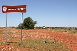
Nannine is a ghost town in the Mid West region of Western Australia. It is located on the northern bank of Lake Anneen, approximately 35 kilometres (22 mi) south-southwest of Meekatharra, and 735 kilometres (457 mi) north-northeast of Perth.

The Shire of Murchison is a 49,500 km² local government area (LGA), within the Murchison sub-region, in the Mid West region of Western Australia. Encompassing most of the Murchison and East Murchison goldfields, the shire is named after the Murchison River. It is Australia's least-populated LGA and the only one without an official town. Five sparsely-populated rural localities, with a collective population of 101, comprise the entire shire. The shire offices, located 300 kilometres (186 mi) northeast of Geraldton, are the focal point of Murchison Settlement, a small part of the Murchison locality.

The Shire of Meekatharra is a local government area in the Mid West region of Western Australia, about halfway between the town of Port Hedland and the state capital, Perth, Western Australia. The Shire covers an area of 100,789 square kilometres (38,915 sq mi), and its seat of government is the town of Meekatharra.
Boolardy Station is a remote former sheep and cattle station in the Mid West (Murchison) region of Western Australia, about 194 km (121 mi) north-north-east of Pindar and 200 km (120 mi) west-south-west of Meekatharra. It is within the Shire of Murchison and situated on pastoral lease no. 3114/406. The area of the lease is 3,467.48 square kilometres (1,338.80 sq mi).
Peak Hill is the name of a goldfield, locality and the site of a gold mining ghost town in the Murchison Region of Western Australia. The gold mine covers 2,162 hectares and consists of four open-cut mines, titled: Main, Jubilee, Fiveways and Harmony.
The Yalgar River is a 185-kilometre-long tributary of the Murchison River, located in the Shire of Meekatharra in central Western Australia. It rises in the Glengarry Range 25 km southeast of Mooloogool Station homestead, about 80 kilometres northeast of Meekatharra, flowing 145 kilometres westward to a junction with the Hope River. From there it flows north-northwesterly for about 40 kilometres, emptying into the upper reaches of the Murchison River, near Moorarie Station homestead on the Carnarvon-Meekatharra Road.
Yeelirrie is an East Murchison pastoral lease or sheep station on state Crown land, located approximately 80 kilometres (50 mi) south west of Wiluna, in the Mid West region of Western Australia. The nearest population centre to Yeelirrie homestead is Mount Keith Mine village, 45 kilometres (28 mi) to the east. The regional centre is Meekatharra, located 180 kilometres (112 mi) to the west.
Wooleen Station is a pastoral lease that was previously operated as a sheep station and currently runs cattle. The station was established in 1886 in the Murchison region of Western Australia that is bisected by the Murchison River. The station is situated approximately 680 kilometres (423 mi) north of Perth in the Shire of Murchison.

The Mullewa–Meekatharra railway was a section of the Northern Railway in Western Australia.
Belele Station is a pastoral lease in Western Australia that operates as a cattle station and as a sheep station for the production of wool.
Moorarie Station is a pastoral lease currently operating as a sheep station in the Murchison district of Western Australia's Mid West region.
Mount Gould Station is a pastoral lease that used to operate as a sheep station but now operates as a cattle station in Western Australia.
Karbar or Karbar Station is a pastoral lease that currently operates as a cattle station and has previously operated as a sheep station.
Yarrabubba Station, often referred to as Yarrabubba, is a pastoral lease that currently operates as a cattle station but has previously operated as a sheep station.
