The Kimberley is the northernmost of the nine regions of Western Australia. It is bordered on the west by the Indian Ocean, on the north by the Timor Sea, on the south by the Great Sandy and Tanami deserts in the region of the Pilbara, and on the east by the Northern Territory.

The Gibb River Road is a road in the Kimberley region of Western Australia.

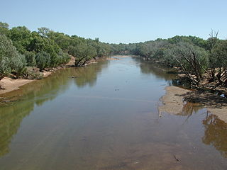
The Fitzroy River, also known as Martuwarra, is located in the West Kimberley region of Western Australia. It has 20 tributaries and its catchment occupies an area of 93,829 square kilometres (36,228 sq mi), within the Canning Basin and the Timor Sea drainage division.

The Wunaamin Miliwundi Ranges are a range of hills in the western Kimberley region of Western Australia.

The Shire of Derby–West Kimberley is one of four local government areas in the Kimberley region of northern Western Australia, covering an area of 104,080 square kilometres (40,186 sq mi), most of which is sparsely populated. The Shire's population as at the 2016 Census was almost 8,000, with most residing in the major towns of Derby, which is also the Shire's seat of government, and Fitzroy Crossing. There are also around 70 Aboriginal communities within the Shire.

The Napier Ranges are located in the Kimberley region of Western Australia. The range is south of and runs parallel to the Wunaamin-Miliwundi Ranges.
The Hann River is a river in the Kimberley region of Western Australia.
The Gibb River is a river in the Kimberley region of northern Western Australia.
The Margaret River is a river in the Kimberley region of Western Australia.
Mary River is a river in the Kimberley region of Western Australia.

The Carson River is a river in the Kimberley region of Western Australia.
The Fitzroy River, a perennial river of the Glenelg Hopkins catchment, is located in the Western District of Victoria, Australia.
Louisa Downs, also commonly just referred to as "Louisa", is a large cattle station midway between Fitzroy Crossing and Halls Creek in the Kimberley region in Western Australia.
The May River is a river in the Kimberley region of Western Australia.

The Barnett River is a river in the Kimberley region of Western Australia.
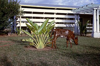
Yeeda Station is a pastoral lease that operates as a cattle station in the Kimberley region of Western Australia.
Mount House Station, commonly referred to as Mount House, is a pastoral lease that operates as a cattle station in Western Australia.
Glenroy Station is a pastoral lease that operates as a cattle station in Western Australia.
Mount Elizabeth Station is a pastoral lease that operates as a cattle station in Western Australia.
