The Greenough River is a river in the Mid West region of Western Australia.
Hill River is a river in the Wheatbelt region of Western Australia.

Gairdner River is a river located in the Great Southern region of Western Australia.

Lennard River is a river in the Kimberley region of Western Australia. The river was named on 8 June 1879 by the explorer Alexander Forrest, during an expedition in the Kimberley area, after Amy Eliza Barrett-Lennard (1852-1897), who he was to marry on 15 January 1880.
Hutt River is a river in the Mid West region of Western Australia.

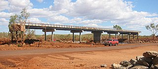
The Fortescue River is an ephemeral river in the Pilbara region of Western Australia. It is the third longest river in the state.

The Harding River, known as the Ngurin in Ngarluma language, is a river in the Pilbara region of Western Australia. It was named on 31 July 1861 by the surveyor and explorer Francis Gregory while on expedition in the area, after one of the volunteer members of his expedition, John Harding. The river continues to be known as the Ngurin by traditional owners and local Aboriginal people.
The Maitland River is a river in the Pilbara region of Western Australia.
The Nullagine River is a river in the Pilbara region of Western Australia.

The Oakover River is a river in the Pilbara region of Western Australia.
The Sherlock River is a river in the Pilbara region of Western Australia. It was named on 11 July 1861 by the surveyor and explorer Frank Gregory while on expedition in the area.
The Yule River is an ephemeral river in the Pilbara region of Western Australia. It was named on 10 August 1861 by the surveyor and explorer Frank Gregory while on expedition in the area, after Thomas Newte Yule, at times farmer of Toodyay, winemaker, Acting Colonial Secretary and Magistrate.
The Coongan River is an ephemeral river in the Pilbara region of Western Australia.
The Shaw River is an ephemeral river in the Pilbara region of Western Australia. It was named by explorer F.T. Gregory on 21 August 1861 after Norton Shaw, Secretary of the Royal Geographical Society.
The Nambung River is a river in the Wheatbelt region of Western Australia, 170 kilometres (106 mi) north of Perth. The river drains an area between the towns of Cervantes and Badgingarra. In its lower reaches the Nambung River forms a chain of waterholes in the Nambung Wetlands where it disappears underground into a limestone karst system 5.5 kilometres (3 mi) from the Indian Ocean.
De Grey Station is a pastoral lease, formerly a sheep station and now a cattle station, approximately 80 kilometres (50 mi) east of Port Hedland on the mouth of the De Grey River in the Pilbara region of Western Australia.
The George River is a river in the Pilbara region of Western Australia. The river was named on 16 July 1861 by the surveyor and explorer Frank Gregory, who was conducting an expedition in the area. It is not known after whom he named the river.

The Gregory River is a river in the Northern Territory and the state of Queensland, Australia. The river is the largest perennial river in arid and semi-arid Queensland, one of the few permanently flowing rivers in the northwest of Queensland.
The Nyamal are an Indigenous Australian people of the Pilbara area of north-western Western Australia.
