Related Research Articles

The Principality of Hutt River, often referred to by its former name, the Hutt River Province, was a micronation in Australia, proclaimed on 21 April 1970 when farmer Leonard Casley declared his farm to be a sovereign state, the "Hutt River Province". He claimed to have seceded from Australia, which occurred during his dispute with the authorities concerning wheat production quotas. A few years later, Casley began styling himself as "Prince Leonard" and granting family members royal titles, although he did not include the word "principality" in the official name until 2006. In 2017, Casley's claim to rulership was taken over by his son Graeme, who dropped the claim to sovereignty on 3 August 2020.

The Murchison River is the second longest river in Western Australia. It flows for about 820 km (510 mi) from the southern edge of the Robinson Ranges to the Indian Ocean at Kalbarri. The Murchison-Yalgar-Hope river system is the longest river system in Western Australia. It has a mean annual flow of 208 gigalitres, although in 2006, the peak year on record since 1967, flow was 1,806 gigalitres.

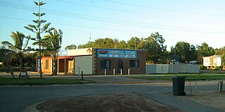
Eneabba is a town on the Brand Highway 278 kilometres (173 mi) north of Perth, Western Australia.

A castaway is a person who is cast adrift or ashore. While the situation usually happens after a shipwreck, some people voluntarily stay behind on a desert island, either to evade captors or the world in general. A person may also be left ashore as punishment (marooned).

The Gascoyne River is a river in the Gascoyne region of Western Australia. At 865 kilometres (537 mi), it is the longest river in Western Australia.
The Greenough River is a river in the Mid West region of Western Australia.

The Dale River is a perennial river located in the Wheatbelt region of Western Australia.
Hill River is a river in the Wheatbelt region of Western Australia.

Chapman River is a river in the Mid West region of Western Australia.

Vivonne Bay is a bay in the Australian state of South Australia located on the south coast of Kangaroo Island about 61 kilometres (38 mi) from Kingscote, the island's main town, and which was named by the members of Baudin expedition to Australia who visited the bay in January 1803. In a survey of 10,000 beaches by Professor Andrew Short, director of Sydney University's marine studies centre, the beach at Vivonne Bay was adjudged as one of the best in Australia.
Gregory is a small town and fishing port located 7 km (4.3 mi) northwest of the mouth of the Hutt River, in the Mid West region of Western Australia. At the 2016 census, Gregory had a population of 64 in 83 dwellings. Most of the dwellings are holiday houses. The population of Gregory fluctuates depending on tourism; with the town at full capacity during school holidays and throughout the summer. During the census 50% of dwellings were unoccupied.

Hutt Lagoon is a marine salt lake located near the Indian Ocean coast 2 kilometres (1.2 mi) north of the mouth of the Hutt River, in the Mid West region of Western Australia.
The Bowes River is a river in the Mid West region of Western Australia. It was named on 6 April 1839 by the explorer George Grey while on his second exploration expedition along the Western Australian coast. It was named for Mary Bowes, Dowager Countess of Strathmore, the wife of Sir William Hutt. Hutt was a British Liberal politician who was heavily involved in the colonization of New Zealand and South Australia, and the brother of John Hutt, the second governor of Western Australia. Sir William Hutt was a member of the 1836 select committee on Disposal of Lands in the British Colonies. Grey named the nearby Hutt River after Hutt.

Rupert Gerritsen was an Australian historian and a noted authority on Indigenous Australian prehistory. Coupled with his work on early Australian cartography, he played an influential part in re-charting Australian history prior to its settlement by the British in 1788, and noted evidence of agriculture and settlements on the continent before the arrival of settlers.
Wouter Loos was a soldier on board the Dutch East India Company ship Batavia, which sank on Morning Reef in the Wallabi Group of the Houtman Abrolhos Islands off the coast of Western Australia in 1629. Loos had a critical role in the subsequent Batavia Mutiny, becoming the leader of the mutiny after the original leader, Jeronimus Cornelisz (Corneliszoon), was captured.
The Buller River is a river in the Mid West region of Western Australia, near Geraldton.

The Natchiowatchouan River is a tributary of the Nottaway River, in the administrative region of Nord-du-Québec, in the Canadian province of Quebec, in Canada. Most of the course of the river flows into Millet Township.
The Deux Orignaux River is a tributary of the Obatogamau River, flowing into the Regional County Municipality (RCM) of Eeyou Istchee Baie-James, in the administrative region of Nord-du-Québec, in the province of Quebec, in Canada. The course of the river flows entirely into the canton of Dolomieu.

The Waconichi River is a tributary of the Mistassini Lake, flowing into the Regional County Municipality (MRC) of Eeyou Istchee Baie-James, in Jamésie, in the administrative region of Nord-du-Québec, in the province of Quebec, in Canada.
Amisquioumisca Lake is a freshwater body consisting of a major body of water in the Nipukatasi River, on the South Hydrographic Slope of the Broadback River, in the Municipality of Eeyou Istchee Baie-James (municipality), in the administrative region of Nord-du-Québec, in Quebec, in Canada.
References
- ↑ "The Hutt River". Rivers of Western Australia. Greening Australia Ltd. 2008. Archived from the original on 18 February 2012. Retrieved 23 July 2012.
- ↑ Brearley, Anne (2005). Ernest Hodgkin's Swanland: Estuaries and coastal lagoons of Southwestern Australia. University of Western Australia Press. pp. 272–274. ISBN 1-920694-38-2.
- ↑ Handford, C . Robertson (1991). "Marginal Marine Halite: Sabkhas and Salinas". In Judith L Melvin (ed.). Evaporites, Petroleum and Mineral Resources. Vol. 50. Amsterdam: Elsevier. p. 47. ISBN 0-444-88680-X . Retrieved 23 July 2012.[ permanent dead link ]
- ↑ Gerritsen, Rupert (2007). "The debate over where Australia's first European residents were marooned in 1629 – Part 1'". Hydrographic Journal. 126: 20–25.
- ↑ Gerritsen, Rupert (2009). "The debate over where Australia's first European residents were marooned in 1629 – Part 2'". Hydrographic Journal. 128–129: 35–41.
- 1 2 Grey, George (1841). Journals of two expeditions of discovery in North-West and Western Australia, during the years 1837, 38, and 39, describing many newly discovered, important, and fertile districts, with observations on the moral and physical condition of the aboriginal inhabitants, etc. etc. Vol. 2. London: T. and W. Boone. p. 239. Retrieved 17 March 2012.
- ↑ "The Australind Settlement - Its Foundation Inaugurated". The West Australian. 24 December 1919. pp. 7–8. Retrieved 23 July 2012.
- ↑ "Principality of Hutt River - Official website". 2008. Retrieved 28 October 2008.
28°13′15″S114°18′12″E / 28.22083°S 114.30333°E
Rivers of Western Australia | |
|---|---|
| Rivers of the Gascoyne region | |
| Rivers of the Goldfields-Esperance region | |
| Rivers of the Great Southern region | |
| Rivers of the Kimberley region |
|
| Rivers of the Mid West region | |
| Rivers of the Peel and Perth regions | |
| Rivers of the Pilbara region | |
| Rivers of the South West region | |
| Rivers of the Wheatbelt region | |