
Stirling Range National Park is a national park in the Great Southern region of Western Australia, approximately 337 kilometres (209 mi) south-east of Perth.

The Avon River is a river in Western Australia. A tributary of the Swan River, the Avon flows 240 kilometres (150 mi) from source to mouth, with a catchment area of 125,000 square kilometres (48,000 sq mi).

The Noongar are Aboriginal Australian people who live in the south-west corner of Western Australia, from Geraldton on the west coast to Esperance on the south coast. There are 14 different groups in the Noongar cultural bloc: Amangu, Ballardong, Yued, Kaneang, Koreng, Mineng, Njakinjaki, Njunga, Pibelmen, Pindjarup, Wadandi, Whadjuk, Wiilman and Wudjari. The Noongar people refer to their land as Noongar boodja.

Northam is a town in the Wheatbelt region of Western Australia, situated at the confluence of the Avon and Mortlock Rivers. It is the largest town and regional centre in the Avon Valley region of the Central Wheatbelt. It is located approximately 97 kilometres north east of Perth, the capital city of Western Australia. At the time of the 2021 census, Northam had a population of 6,679.
Dumbleyung is a town and shire in the Wheatbelt region of Western Australia, 267 kilometres (166 mi) south-east of Perth between Wagin and Lake Grace on State Route 107.

Toodyay, known as Newcastle between 1860 and 1910, is a town on the Avon River in the Wheatbelt region of Western Australia, 85 kilometres (53 mi) north-east of Perth. The first European settlement occurred in the area in 1836. After flooding in the 1850s, the townsite was moved to its current location in the 1860s. It is connected by railway and road to Perth. During the 1860s, it was home to bushranger Moondyne Joe.

The Wheatbelt is one of nine regions of Western Australia defined as administrative areas for the state's regional development, and a vernacular term for the area converted to agriculture during colonisation. It partially surrounds the Perth metropolitan area, extending north from Perth to the Mid West region, and east to the Goldfields–Esperance region. It is bordered to the south by the South West and Great Southern regions, and to the west by the Indian Ocean, the Perth metropolitan area, and the Peel region. Altogether, it has an area of 154,862 square kilometres (59,793 sq mi).

York is the oldest inland town in Western Australia, situated on the Avon River, 97 kilometres (60 mi) east of Perth in the Wheatbelt, on Ballardong Nyoongar land, and is the seat of the Shire of York.

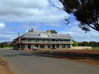
Beverley is a town in the Wheatbelt region of Western Australia, 133 kilometres (83 mi) south-east of the state capital, Perth, between York and Brookton on the Great Southern Highway. It is on the Great Southern railway line.

Lieutenant Robert Dale was the first European explorer to cross the Darling Range in Western Australia.

The Wagyl is the Noongar manifestation of the Rainbow Serpent in Australian Aboriginal mythology, from the culture based around the south-west of Western Australia. The Noongar describe the Wagyl as a snakelike Dreaming creature responsible for the creation of the Swan and Canning rivers and other waterways and landforms around present day Perth and the south-west of Western Australia.

Avondale Agricultural Research Station or Avondale Discovery Farm is one of thirteen research farms and stations operated by Western Australia's Department of Agriculture and Food. In addition to its research, Avondale has historical buildings, a farming equipment museum and operates as an agriculture education centre specialising in introducing primary school children to farming, and teaching of its history in Western Australia.
County Peak, also known as Mt Quajabin or Quajabin Peak, is located in the western zone of the Wheatbelt region of Western Australia, about 120 km south-east of Perth.
The Shire of Beverley is a local government area in the Wheatbelt region of Western Australia about 130 kilometres (80 mi) southeast of Perth, the state capital. The Shire covers an area of 2,372 square kilometres (916 sq mi), starting 20 kilometres (12 mi) outside Armadale in the Darling Scarp and extending eastwards beyond the scarp into agricultural lands which support broad acre activities such as livestock and cropping. Its seat of government is the town of Beverley, which accommodates just over half of the Shire's population.

The Murray River is a river in the southwest of Western Australia. It played a significant part in the expansion of settlement in the area south of Perth after the arrival of British settlers at the Swan River Colony in 1829. It should not be confused with the Murray River in southeastern Australia, which is the longest river in the country.
Westdale or West Dale is a locality near the Beverley-Westdale road in the Wheatbelt region of Western Australia, 93 kilometres (58 mi) from Perth. The locality was referred to as West Dale, Beverley in publications in the twentieth century.

Clackline Brook is an 11.6-kilometre-long (7.2 mi) waterway in the Wheatbelt region of Western Australia. From near Clackline, it runs east-south-easterly towards Mokine, before turning north and ending near Mokine Hill. Clackline Brook joins onto Spencers Brook, with the name changing at the confluence with Corolin Brook.
Ballardong are an indigenous Noongar people of the south western area of Western Australia.

Boyagin Rock is located 10 km (6.2 mi) south west of Brookton and 26 km (16 mi) north west of Pingelly in the Wheatbelt region of Western Australia, which is approximately 175 km (109 mi) south east of Perth. The Boyagin Rock outcrop rises 50 m (160 ft) above the surrounding land and is an crestal area of a granite inselberg within the geological Yilgarn Craton framework.
Lake Yealering, also known as Yealering Lakes, is an ephemeral salt lake in the Wheatbelt region of Western Australia located on the southern edge of the town of Yealering, 30 km (19 mi) north west of Wickepin and about 250 km (160 mi) south east of Perth.

