
The Division of Cowan is an Australian Electoral Division in Western Australia.
Embleton is a suburb of Perth, the capital city of Western Australia, located 7 kilometres (4.3 mi) north-east of the central business district, between the suburbs of Morley and Bayswater. Its local government area is the City of Bayswater.

Ellenbrook is an outer suburb and planned community in Perth, Western Australia, within the City of Swan. It is 28 km (17 mi) north-east of Perth's central business district and 18 km (11 mi) north of the Swan city centre of Midland. It was developed in the 1990s as a joint venture between the Government of Western Australia and private landowners in the area.

Beechboro is a suburb of Perth, Western Australia, located within the City of Swan.

Whiteman Park is a 4,000-hectare bushland area located 22 km (14 mi) north of Perth, Western Australia. The park is in the suburb of Whiteman, in the Swan Valley in the upper reaches of the Swan River.

Henley Brook is an outer rural suburb of Perth, Western Australia, part of the Swan Valley wine region. The Ellen brook and Swan River meet in the northeastern corner of the suburb. This is also the farthest upstream Captain Stirling's 1827 exploration reached before deciding on the settlement site of the new colony in 1829. The All Saints Church, the oldest church in Western Australia, is also at this site.
Lockridge is a suburb of Perth, in the Bassendean division of Western Australia, and the City of Swan local government area.

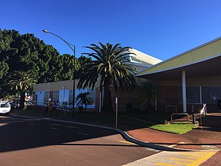
Whiteman, formerly Urban Growth Corridor, is a northeastern suburb of Perth, Western Australia. As of 2021, Whiteman’s population is 21,476.

Beechboro Road is a north–south arterial road located in the northeastern suburbs of Perth, Western Australia, connecting Morley and Bayswater with areas further north. Until the construction of the nearby section of Tonkin Highway between 1984 and 1992, and later, during the NorthLink WA road project between 2016 and 2019, Beechboro Road was one of northeastern Perth's most important routes. The road is discontinuous at Tonkin Highway, with the section from Tonkin Highway to Walter Road officially known as Beechboro Road North, and the section running through Bayswater as Beechboro Road South.
Aveley is an outer suburb of Perth, Western Australia, located 30 kilometres (19 mi) north-east of Perth's central business district in the City of Swan. It is adjacent to and forms a common urban area with the secondary metropolitan centre of Ellenbrook. The suburb was developed during the 2000s and the 2010s as a masterplanned community.
Bennett Springs is a northeastern suburb of Perth, Western Australia, located in the City of Swan. Formed from parts of the suburbs of Beechboro, Whiteman and West Swan, it was originally a subdivision from Beechboro until April 2011 when it was gazetted following a 10-year campaign by residents. The suburb was named after Matilda Bennett, the wife of John Septimus Roe.

Gnangara Road is an arterial east–west road in Perth, Western Australia. It is located within the northern suburbs of Perth, from Madeley in the west, to Henley Brook in the east. Gnangara Road provides a connection between Great Northern Highway and Wanneroo Road. The construction of the Ocean Reef Road extension in 2011 altered the road network in the Landsdale area in Landsdale. The plans show Gnangara Road as discontinuous between Mirrabooka Avenue and Alexander Drive, with the Mirrabooka Avenue and Ocean Reef Road extensions linking the two sections. Following construction, those linking road sections were named as Gnangara Road, allowing the road to remain continuous.

Ellenbrook Transfer Station was a Transperth bus station located on the corner of Lord Street and Gnangara Road, in Henley Brook, just south of Ellenbrook. It had 3 stands and was served by 7 Transperth routes operated by Swan Transit.
NorthLink WA was a road construction project in Perth, Western Australia, that saw both the northern section of Tonkin Highway upgraded, and the road extended northwards as the Swan Valley Bypass, to bypass Great Northern Highway. These two component projects were separately funded, with both the state and federal governments contributing to each project. Construction commenced in June 2016 and was completed on 23 April 2020.

Ellen Brook is an ephemeral stream which runs from south of Gingin to the Swan River in Western Australia.

The Ellenbrook line, known as the Morley–Ellenbrook line during construction, is an unopened suburban railway line and service in Perth, Western Australia, which will be operated by the Public Transport Authority as part of the Transperth system. The line branches from the Midland line at Bayswater station and heads north-north-west to serve five new stations along a 21.3-kilometre (13.2 mi) route to Ellenbrook. Ellenbrook line services will continue west of Bayswater station alongside Midland and Airport line services to terminate at Perth station in the central business district.
Ballajura railway station is an unopened suburban railway station on the Ellenbrook line in Perth, Western Australia. The station is located east of Tonkin Highway, north of Marshall Road, and west of Beechboro Road North, within the rural area of Whiteman, and near the residential areas of Ballajura, Beechboro, and Bennett Springs.

Whiteman Park railway station is an unopened suburban railway station on the Ellenbrook line in Perth, Western Australia. The station is located on the western side of Drumpellier Drive in Whiteman, and will serve the surrounding suburbs of Brabham, Dayton, Henley Brook and West Swan, as well as the nature reserve and tourism destination of Whiteman Park.

Drumpellier Drive is a north-south road linking Ellenbrook with Reid Highway in the north-eastern suburbs of Perth, Western Australia. The southern section was opened as Lord Street, and was the main link between Ellenbrook and the rest of Perth until the extension of Tonkin Highway north to Gnangara Road. The road corridor has had several proposals put forward for it, including a highway, a bus rapid transitway and a railway. In 2019, a new alignment for Lord Street south of Gnangara Road opened, and it was renamed to Drumpellier Drive, making the naming consistent with the section of road north of Gnangara Road.

Manton Lewis Cyril Whiteman was an Australian businessman and collector. He owned Whitemans Brick and is the namesake of Whiteman Park.

