
Margaret River is a town in the South West of Western Australia, located in the valley of the eponymous Margaret River, 277 kilometres (172 mi) south of Perth, the state capital. Its Local Government Area is the Shire of Augusta-Margaret River.

Western Australia is a state of Australia occupying the western third of the land area of Australia, excluding external territories. It is bounded by the Indian Ocean to the north and west, the Southern Ocean to the south, the Northern Territory to the north-east, and South Australia to the south-east. Western Australia is Australia's largest state, with a total land area of 2,527,013 square kilometres (975,685 sq mi). It is the second-largest country subdivision in the world, surpassed only by Russia's Sakha Republic. As of 2021, the state has 2.76 million inhabitants—11 percent of the national total. The vast majority live in the south-west corner; 79 percent of the population lives in the Perth area, leaving the remainder of the state sparsely populated.

The Swan River is a major river in the southwest of Western Australia. The river runs through the metropolitan area of Perth, Western Australia's capital and largest city.

Albany is a port city in the Great Southern region in the Australian state of Western Australia, 418 kilometres (260 mi) southeast of Perth, the state capital. The city centre is at the northern edge of Princess Royal Harbour, which is a part of King George Sound. The central business district is bounded by Mount Clarence to the east and Mount Melville to the west. The city is in the local government area of the City of Albany. While it is the oldest colonial, although not European, settlement in Western Australia - predating Perth and Fremantle by over two years - it was a semi-exclave of New South Wales for over four years until it was made part of the Swan River Colony.

The Great Southern region is one of the nine regions of Western Australia, as defined by the Regional Development Commissions Act 1993, for the purposes of economic development. It is a section of the larger South coast of Western Australia and neighbouring agricultural regions.

Albany Highway links Western Australia's capital city Perth with its oldest settlement, Albany, on the state's south coast. The 405-kilometre-long (252 mi) highway travels through the southern Wheatbelt and Great Southern regions, and is designated State Route 30 for most of its length. Outside of Perth the highway is predominately a sealed, single carriageway with regular overtaking lanes in some undulating areas. Albany Highway commences at The Causeway, a river crossing that connects to Perth's central business district. The highway heads south-east through Perth's metropolitan region, bypassed in part by Shepperton Road and Kenwick Link, and continues south-eastwards through to Albany. It intersects several major roads in Perth, including the Leach, Tonkin, Brookton, and South Western highways. The rural section of Albany Highway connects to important regional roads at the few towns and roadhouses along the route, including Coalfields Highway at Arthur River, Great Southern Highway at Cranbrook, and Muirs Highway at Mount Barker.

The Murchison River is the second longest river in Western Australia. It flows for about 820 km (510 mi) from the southern edge of the Robinson Ranges to the Indian Ocean at Kalbarri. The Murchison-Yalgar-Hope river system is the longest river system in Western Australia. It has a mean annual flow of 208 gigalitres, although in 2006, the peak year on record since 1967, flow was 1,806 gigalitres.

Mount Barker is a town on Albany Highway and the administrative centre of the Shire of Plantagenet in the Great Southern region of Western Australia. At the 2021 census, Mount Barker had a population of 2,855.
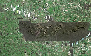
The Stirling Range or Koikyennuruff is a range of mountains and hills in the Great Southern region of Western Australia, 337 kilometres (209 mi) south-east of Perth. It is over 60 kilometres (37 mi) wide from west to east, stretching from the highway between Mount Barker and Cranbrook eastward past Gnowangerup. The Stirling Range is protected by the Stirling Range National Park, which was gazetted in 1913, and has an area of 1,159 km2 (447 sq mi).

King George Sound is a sound on the south coast of Western Australia. Named King George the Third's Sound in 1791, it was referred to as King George's Sound from 1805. The name "King George Sound" gradually came into use from about 1934, prompted by new Admiralty charts supporting the intention to eliminate the possessive 's' from geographical names.

South Western Highway is a highway in the South West region of Western Australia connecting Perth's southeast with Walpole. It is a part of the Highway 1 network for most of its length. It is about 406 kilometres (252 mi) long.

The Blackwood River is a major river and catchment in the South West of Western Australia.

The Shire of Cranbrook is a local government area in the Great Southern region of Western Australia, about 92 kilometres (57 mi) north of Albany and about 320 kilometres (200 mi) south-southeast of the state capital, Perth. The Shire covers an area of 3,277 square kilometres (1,265 sq mi), and its seat of government is the town of Cranbrook.
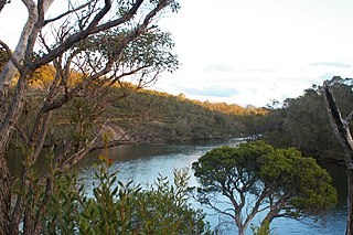
The Kalgan River is a river in the Great Southern region of Western Australia.
Bremer Bay is a coastal town situated on the south coast of Western Australia in the Great Southern region between Albany and Esperance, at the mouth of the Bremer River. Bremer Bay is 515 kilometres (320 mi) southeast of the state capital, Perth, and 180 kilometres (112 mi) east of Albany. It is on the lands of Southern Noongar people of the Noongar nation. The Wagyl Kaip and Southern Noongar claim for Native Title was made in September 2006, and is in progress today.
Thundelarra is a conservation reserve that was previously run as a pastoral lease in Western Australia, located 70 kilometres (43 mi) south east of Yalgoo and 160 kilometres (99 mi) north of Dalwallinu in the Murchison region.

Forrest Highway is a 95-kilometre-long (59 mi) highway in Western Australia's Peel and South West regions, extending Perth's Kwinana Freeway from east of Mandurah down to Bunbury. Old Coast Road was the original Mandurah–Bunbury route, dating back to the 1840s. Part of that road, and the Australind Bypass around Australind and Eaton, were subsumed by Forrest Highway. The highway begins at Kwinana Freeway's southern terminus in Ravenswood, continues around the Peel Inlet to Lake Clifton, and heads south to finish at Bunbury's Eelup Roundabout. There are a number of at-grade intersections with minor roads in the shires of Murray, Waroona, and Harvey including Greenlands Road and Old Bunbury Road, both of which connect to South Western Highway near Pinjarra.
Angove River or Angove Creek is a river located in the Great Southern region of Western Australia most of the river is found within Two Peoples Bay Nature Reserve.

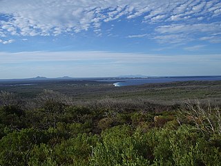
Wilson Inlet is a shallow, seasonally open estuary located on the coast of the Great Southern region of Western Australia.
Tourist Drives in Western Australia are routes through areas of scenic or historic significance, designated by route markers with white numbers on a brown shield. Tourist Drives were introduced into Western Australia while Eric Charlton was the state government Minister for Transport in the 1990s. The 28 numbered routes collectively traverse more than 2,000 kilometres (1,200 mi) across the state. In addition to the Tourist Drives, there are unnumbered routes such as the Golden Pipeline Heritage Trail, and local governments may designate and maintain local scenic drives, generally unnamed and unnumbered.
