Related Research Articles

Busselton is a city in the South West region of the state of Western Australia approximately 220 km (140 mi) south-west of Perth. Busselton has a long history as a popular holiday destination for Western Australians; however, the closure of the Busselton Port in 1972 and the contemporaneous establishment of the nearby Margaret River wine region have seen tourism become the dominant source of investment and development, supplemented by services and retail. The city is best known for the Busselton Jetty, the longest wooden jetty in the Southern Hemisphere.

The Margaret River is a river in southwest Western Australia. In a small catchment, it is the eponym of the town and tourist region of Margaret River.
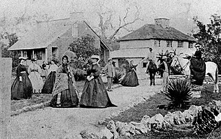
The Bussell family were a family of early settlers in colonial Western Australia. The four brothers John, Joseph Vernon, Alfred and Charles emigrated from England on Warrior, arriving at Fremantle on 12 March 1830. Lenox, Frances and Elizabeth arrived at Fremantle on Cygnet on 27 January 1833, and Mrs Frances Louisa and Mary arrived at Albany on 19 June 1834.

John Garrett Bussell was an early settler in Western Australia.
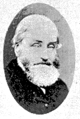
Alfred Pickmore Bussell was an early settler in Western Australia.
The Flinders Bay Branch Railway, also known as the Boyanup to Flinders Bay Section ran between Boyanup and Flinders Bay, in South Western Western Australia. The section from Flinders Bay to Busselton has now been converted into a rail trail for bushwalkers and cyclists, called the Wadandi Trail.
Samuel Yebble Isaacs was an Aboriginal Australian stockman and farmer from the South West of Western Australia, who was best known for his role in the rescue of the SS Georgette in 1876, together with Grace Bussell.

Bussell Highway is a generally north–south highway in the South West region of Western Australia. The highway links the city of Bunbury with the town of Augusta and is approximately 140 kilometres (87 mi) in length. The highway is signed State Route 10, except in Busselton where the construction of the Busselton Bypass in 2000 resulted in this stretch being changed to Alternate State Route 10 with the Bypass signed State Route 10.

Vasse Highway is a Western Australian highway connecting Busselton and the South Western Highway 15 kilometres (9.3 mi) south of Manjimup. It is 151 kilometres (94 mi) long and travels through jarrah and karri hardwood forests for most of its length, with some small agricultural areas and wineries nearby, and forms the main street of the towns of Nannup and Pemberton.

The Peel-Harvey Estuarine System is a natural estuarine system that lies roughly parallel to the coast of Western Australia and south of the town of Mandurah.

Vasse is a suburb of the city of Busselton in the South West region of Western Australia, 10 kilometres (6 mi) west of Busselton and 240 kilometres (149 mi) southwest of Perth. Its local government area is the City of Busselton. At the 2021 census, Vasse had a population of 2,853.

The Carbunup River is located in the south-west corner of Western Australia. The mouth of the Carbunup River is approximately 20 kilometres (12 mi) west of Busselton where the river flows into Geographe Bay.

The Capel River is a river in the South West region of Western Australia that rises in the Darling Range east of Mullalyup, and flows into the Indian Ocean at Peppermint Grove Beach.
The Sabina River is a river in the South West of Western Australia.

The Vasse River is a river in the South West of Western Australia.
Whicher Range, also known as Whicher Scarp, is a range in the South West region of Western Australia.
The Ludlow River is a river in the South West region of Western Australia. It was named after Frank Ludlow, one of the first Western Australian colonists, an arrival on the barque Parmelia in 1829, who explored the locality in 1834.
The Abba River is a river in the South West region of Western Australia.
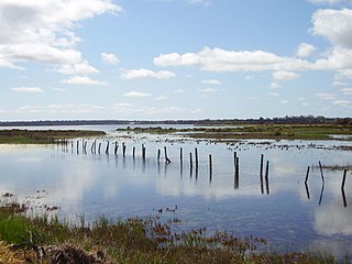
The Vasse-Wonnerup Estuary is an estuary in the South West region of Western Australia close to the town of Busselton. The estuary is listed with DIWA. It was also recognised as a wetland of international importance under the Ramsar Convention on 7 June 1990 when an area of 1,115 ha was designated Ramsar Site 484 as an important dry-season habitat for waterbirds. It is also the main part of the 2,038 ha (5,040-acre) Busselton Wetlands Important Bird Area.

St Mary's Anglican Church is a heritage-listed Anglican church in Peel Terrace, Busselton, Western Australia. It is possibly the oldest stone church in the state. Opened in 1845, and consecrated in 1848, it has been the subject of a number of additions, and has also been repaired or conserved on several occasions.
References
- ↑ "Bonzle Digital Atlas – Map of Buayanyup River". 2009. Retrieved 9 April 2011.
- ↑ "Water Corporation - Catchment Characteristics". 2009. Archived from the original on 25 July 2008. Retrieved 9 April 2011.
- ↑ Garnett, Ron (2004), Buayanup Drain, Busselton, 20 January 2004 , retrieved 22 July 2024
- ↑ "Buayanyup River Action Plan" (PDF). 2010. Archived from the original (PDF) on 30 March 2011. Retrieved 9 April 2011.
- ↑ Beatty, S; Morgan, D; Allen, M (2009), Freshwater fish and crayfish communities of the Carbunup and Buayanyup Rivers: conservation significance and management considerations, Murdoch University. Centre for Fish & Fisheries Research, retrieved 22 July 2024
- ↑ "History of river names – B". Western Australian Land Information Authority. Archived from the original on 19 April 2021. Retrieved 9 March 2011.
Rivers of Western Australia | |
|---|---|
| Rivers of the Gascoyne region | |
| Rivers of the Goldfields-Esperance region | |
| Rivers of the Great Southern region | |
| Rivers of the Kimberley region |
|
| Rivers of the Mid West region | |
| Rivers of the Peel and Perth regions | |
| Rivers of the Pilbara region | |
| Rivers of the South West region | |
| Rivers of the Wheatbelt region | |