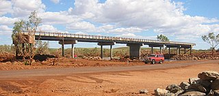
The Hotham River is one of the major tributaries of the Murray River in Western Australia. It is about 160 kilometres (99 mi) long with its upper reaches being the Hotham River North, which begins in the Dutarning Range and joins the Hotham at its crossing of the Great Southern Highway near Popanyinning. A 15 km (9.3 mi) long southern tributary, Hotham River South, begins near Cuballing and flows generally northerly before joining the Hotham near Yornaning.

The Collie River is a river in the South West region of Western Australia.

The Carbunup River is located in the south-west corner of Western Australia. The mouth of the Carbunup River is approximately 20 kilometres (12 mi) west of Busselton where the river flows into Geographe Bay.
The Beaufort River is a river in the South West region of Western Australia.

The Arthur River is located in the south-west of Western Australia. The river was named by Governor James Stirling in October 1835 after Arthur Trimmer, who was a member of the exploring expedition led by Stirling.
The Bow River is a river in the Great Southern region of Western Australia.
Jerdacuttup River is a river located in the Goldfields-Esperance region of Western Australia. The water in the river is naturally saline.

The Fortescue River is an ephemeral river in the Pilbara region of Western Australia. It is the third longest river in the state.

Isdell River is a river in the Kimberley region of Western Australia, named in 1898 by explorer Frank Hann after James Isdell, who was prominent in the region and later served as a member of parliament.
Bannister River is a river in the South West region of Western Australia.
The Impey River is a river in the Mid West region of Western Australia which rises south of Mount Murchison and flows east-north-east until it merges with the Murchison River of which it is a tributary.
The Beasley River is a river in the Pilbara region of Western Australia.

The Maitland River is a river in the Pilbara region of Western Australia.
The Tone River is a river in the South West of Western Australia.
The Nullagine River is a river in the Pilbara region of Western Australia.
The Munglinup River is an ephemeral river in the Goldfields-Esperance region of Western Australia.
The Buayanyup River is a river in the South West region of Western Australia.
Muradup is a small town and locality in the Shire of Kojonup, Great Southern region of Western Australia. Muradup is located between Kojonup and Boyup Brook, and is situated along the Balgarup River.
The Mackie River is a river in the Wheatbelt region of Western Australia. The river is ephemeral and flows following winter and spring rains. The water discharged is saline.
The Lunenburgh River is a perennial river in the South West region of Western Australia.


