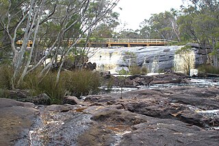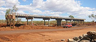
North West Coastal Highway is a generally north-south Western Australian highway which links the coastal city of Geraldton with the town of Port Hedland. The 1,300-kilometre-long (808 mi) road, constructed as a sealed two-lane single carriageway, travels through remote and largely arid landscapes. Carnarvon is the only large settlement on the highway, and is an oasis within the harsh surrounding environment. The entire highway is allocated National Route 1, part of Australia's Highway 1, and parts of the highway are included in tourist routes Batavia Coast Tourist Way and Cossack Tourist Way. Economically, North West Coastal Highway is an important link to the Mid West, Gascoyne and Pilbara regions, supporting the agricultural, pastoral, fishing, and tourism industries, as well as mining and offshore oil and gas production.

The Helena River is a tributary of the Swan River in Western Australia. The river rises in country east of Mount Dale and flows north-west to Mundaring Weir, where it is dammed. It then flows west until it reaches the Darling Scarp.
Simon Francis Beasley is a former Australian rules footballer who played for the Swan Districts Football Club in the West Australian Football League (WAFL) and for the Footscray Football Club in the Victorian Football League (VFL).

The Hotham River is one of the major tributaries of the Murray River in Western Australia. It is about 160 kilometres (99 mi) long with its upper reaches being the Hotham River North, which begins in the Dutarning Range and joins the Hotham at its crossing of the Great Southern Highway near Popanyinning. A 15 km (9.3 mi) long southern tributary, Hotham River South, begins near Cuballing and flows generally northerly before joining the Hotham near Yornaning.

Deep River is a river in the Great Southern region of Western Australia.

Balgarup River is a river in Western Australia that has its headwaters south-east of Kojonup just below Byenup Hill.
The Beaufort River is a river in the South West region of Western Australia.

The Fortescue River is an ephemeral river in the Pilbara region of Western Australia. It is the third longest river in the state.
Bannister River is a river in the South West region of Western Australia.
The Impey River is a river in the Mid West region of Western Australia which rises south of Mount Murchison and flows east-north-east until it merges with the Murchison River of which it is a tributary.
The Kent River is a river in the Great Southern of Western Australia.
The Hardey River is a river in the Pilbara region of Western Australia.

The Maitland River is a river in the Pilbara region of Western Australia.
The Tone River is a river in the South West of Western Australia.

The Turner River is a river in the Pilbara region of Western Australia.
Landor or Landor Station is a pastoral lease and sheep station located in the Gascoyne region of Western Australia.
Laura River is a river in the east Kimberley region of Western Australia.
Worsley River is a river in the South West region of Western Australia. The river rises in the Darling Range 2 kilometres (1.2 mi) south of the old timber town of Worsley then flows east and south discharging into the Collie River in Wellington Reservoir.


