
Fitzgerald River National Park is a national park in the Shires of Ravensthorpe and the Shire of Jerramungup in Western Australia, 419 kilometres (260 mi) southeast of Perth. The park is recognised on Australia's National Heritage List for its outstanding diversity of native plant species, including many plants which are unique to the local area.

Wolli Creek is an urban watercourse of the Cooks River catchment located in the southern suburbs of Sydney, in New South Wales, Australia.
Moore River (Garban) is a river in the Wheatbelt region of Western Australia.
Leschenault Estuary is an estuarine lagoon that lies to the north of Bunbury, Western Australia. It had in the past met the Indian Ocean at the Leschenault Inlet, but that has been altered by harbour works for Bunbury, and the creation of The Cut north of the historical inlet location.
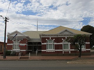
The Shire of Ravensthorpe is a local government area in the southern Goldfields-Esperance region of Western Australia, about halfway between the city of Albany and the town of Esperance and about 530 kilometres (329 mi) southeast of the state capital, Perth. The Shire covers an area of 13,551 square kilometres (5,232 sq mi), and its seat of government is the town of Ravensthorpe.
Bremer River is a river in Western Australia that rises near Jerramungup at the border of the Yilgarn plateau. The river flows in a generally south-easterly direction and the river valley becomes steadily deeper as the river approaches the coast, where it has eroded the Pallinup siltstone deposits that deposited over the underlying granite.

The Fitzgerald River is a river in the Great Southern region of Western Australia.

The Hay River is a river in the Great Southern region of Western Australia. The traditional owners of the area are the Noongar people, who know the river as Genulup.
Gairdner River is a river located in the Great Southern region of Western Australia.
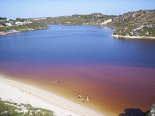
Pallinup River is a river located in the Great Southern region of Western Australia. It was previously known as Salt River.
The Young River is a river on the South coast of Western Australia that rises south of the Frank Hann National Park then flows in a south easterly direction for a distance of 95 kilometres (59 mi) before flowing into Stokes Inlet which discharges into the Southern Ocean.
Lort River is a river located in the Goldfields-Esperance region and the Eastern Mallee sub-region of Western Australia.
Jerdacuttup River is a river located in the Goldfields-Esperance region of Western Australia. The water in the river is naturally saline.
The Warren River is a river in the South West region of Western Australia with a catchment encompassing the towns of Manjimup and Pemberton. The river was named by Governor James Stirling, probably after Admiral Sir John Borlase Warren under whom Stirling served whilst in action in North America in 1813.
The Munglinup River is an ephemeral river in the Goldfields-Esperance region of Western Australia.
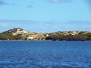
Culham Inlet is an inlet located in the Goldfields-Esperance region of Western Australia. The inlet is also referred to as a coastal salt lake or a transient estuary, as the sand bar that prevents it discharging is almost always closed. The wetlands formed by the system are DIWA listed due to their ecological significance.
The Steere River is a river in the Goldfields-Esperance region of Western Australia.

Wellstead Estuary is an estuarine inlet in the Great Southern region of Western Australia.
The Hamersley River is an ephemeral river in the Great Southern region of Western Australia.
The Nambung River is a river in the Wheatbelt region of Western Australia, 170 kilometres (106 mi) north of Perth. The river drains an area between the towns of Cervantes and Badgingarra. In its lower reaches the Nambung River forms a chain of waterholes in the Nambung Wetlands where it disappears underground into a limestone karst system 5.5 kilometres (3 mi) from the Indian Ocean.