Boston Township, Ohio

Last updated

Boston Township
Interstate 80 over the Cuyahoga River.jpg
View of Cuyahoga Valley National Park in northern Boston Township
Summit County Ohio incorporated and unincorporated areas Boston Township highlighted.svg
Location in Summit County and the state of Ohio.
Coordinates: 41°14′4″N81°33′39″W / 41.23444°N 81.56083°W / 41.23444; -81.56083
Country United States
State Ohio
County Summit
Area
  Total19.7 sq mi (51.0 km2)
  Land19.6 sq mi (50.8 km2)
  Water0.1 sq mi (0.2 km2)
Elevation
[1]
958 ft (292 m)
Population
 (2020) [2]
  Total1,401
  Density71.5/sq mi (27.6/km2)
Time zone UTC-5 (Eastern (EST))
  Summer (DST) UTC-4 (EDT)
FIPS code 39-07776 [3]
GNIS feature ID1086996 [1]

Boston Township is one of the nine townships of Summit County, Ohio, United States, about 15 miles north of Akron and 23 miles south of Cleveland. It is part of the Akron metropolitan area. The 2020 census found 1,401 people in the township.

Contents

Geography

Located in the northern part of the county, it borders the following townships and municipalities:

Two villages are located in Boston Township: most of Boston Heights, in the northeast, and Peninsula, in the center. Peninsula is still part of the township but Boston Heights is separate . Cuyahoga Falls annexed an area along State Road and Northfield Center has the Brandywine area due to annexation when Northfield Center was part of Northfield Village .

It occupies most of survey Town 4, Range 11 in the Connecticut Western Reserve.

Name

Named by James Stanford after Boston, Massachusetts, [4] it is the only Boston Township statewide.

History

Boston Township was established in 1811. [5] Boston Township's land has been in the following counties:

YearCounty
1788 Washington
1797 Jefferson
1800 Trumbull
1808 Portage
1840 Summit

Government

The township is governed by a three-member board of trustees, who are elected in November of odd-numbered years to a four-year term beginning on the following January 1. Two are elected in the year after the presidential election and one is elected in the year before it. There is also an elected township fiscal officer, [6] who serves a four-year term beginning on April 1 of the year after the election, which is held in November of the year before the presidential election. Vacancies in the fiscal officership or on the board of trustees are filled by the remaining trustees.

Transportation

Highways

Boston Township is served by Interstate 271, which has an exit onto State Route 303 at the border with Richfield Township, and by State Route 303, which goes east–west through the middle of the township. The Ohio Turnpike (Interstate 80) passes through the township without any exits.

Education

Schooling for the township is provided by Woodridge Local School District.

Related Research Articles

<span class="mw-page-title-main">Summit County, Ohio</span> County in Ohio, United States

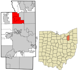
Summit County is an urban county in the U.S. state of Ohio. As of the 2020 census, the population was 540,428, making it the fourth-most populous county in Ohio. Its county seat and largest city is Akron. The county was formed on March 3, 1840, from portions of Medina, Portage and Stark Counties. It was named Summit County because the highest elevation on the Ohio and Erie Canal is located in the county.

<span class="mw-page-title-main">Brecksville, Ohio</span> City in Ohio, United States

Brecksville is a city in southern Cuyahoga County, Ohio, United States. The city's population was 13,635 at the 2020 census. A suburb of Cleveland, it is part of the Cleveland metropolitan area.

<span class="mw-page-title-main">Greater Cleveland</span> Metropolitan area in Ohio, United States

The Cleveland metropolitan area, or Greater Cleveland as it is more commonly known, is the metropolitan area surrounding the city of Cleveland in Northeast Ohio, United States. According to the 2020 census results, the six-county Cleveland, OH Metropolitan Statistical Area (MSA) consists of Cuyahoga County, Ashtabula County, Geauga County, Lake County, Lorain County, and Medina County, and has a population of 2,088,251, making it the 34th-most populous metropolitan area in the United States and the third largest metropolitan area in Ohio. The metro area is also part of the larger Cleveland–Akron–Canton Combined Statistical Area with a population of over 3.6 million people, the most populous statistical area in Ohio and the 17th most populous in the United States.

<span class="mw-page-title-main">Bath Township, Summit County, Ohio</span> Township in Ohio, United States

Bath Township is one of the nine townships of Summit County, Ohio, United States. A suburb of Akron, the 2020 census found 10,024 people in the township.

<span class="mw-page-title-main">Ohio State Route 8</span> State highway in Ohio, US

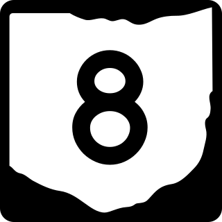
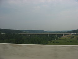
State Route 8 is a road in the U.S. state of Ohio. SR 8 stretches from the eastern junction of Interstate 76 (I-76) and I-77 in Akron to Public Square in Cleveland. It is one of nine routes to enter downtown Cleveland at Public Square. The route's first few miles are as a limited-access freeway from I-76 and I-77, heading north. The freeway section of the highway has 16 interchanges, and is cosigned with SR 59 for a short distance from Perkins Street in Akron to Front Street in Cuyahoga Falls. The freeway portion ends at I-271 in Macedonia.

<span class="mw-page-title-main">Hinckley Township, Medina County, Ohio</span> Township in Ohio, United States

Hinckley Township is one of the seventeen townships of Medina County, Ohio, United States, located in the northeast corner of the county. The 2020 census found 8,025 people in the township.

<span class="mw-page-title-main">Springfield Township, Summit County, Ohio</span> Township in Summit County, Ohio

Springfield Township is one of the nine townships of Summit County, Ohio, United States. The population was 14,162 at the 2020 census.

<span class="mw-page-title-main">Richfield Township, Summit County, Ohio</span> Township in Ohio, United States

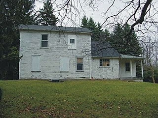
Richfield Township is one of the nine townships of Summit County, Ohio, United States. The 2020 census found 6,437 people in the township.

<span class="mw-page-title-main">Sylvania Township, Lucas County, Ohio</span> Township in Ohio, United States

Sylvania Township is one of the eleven townships of Lucas County, Ohio, United States. As of 2020, the total population was 50,679, making it the second most populous municipality of Lucas County, Northwest Ohio, and the 419 / 567 area codes.

<span class="mw-page-title-main">Olmsted Township, Cuyahoga County, Ohio</span> Township in Ohio, United States

Olmsted Township is a township located in Cuyahoga County, Ohio, United States. Situated in the southwest end of the county, Olmsted Township is a west side suburb of Cleveland, and a part of the even larger Greater Cleveland area. As of the 2020 Census, Olmsted Township had a population of 14,506. It is one of only two civil townships remaining in Cuyahoga County, and the only Olmsted Township statewide.

<span class="mw-page-title-main">Granger Township, Medina County, Ohio</span> Township in Ohio, United States

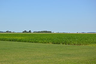
Granger Township is one of the seventeen townships of Medina County, Ohio, United States. The 2020 census found 4,556 people in the township.

<span class="mw-page-title-main">Richfield Township, Henry County, Ohio</span> Township in Ohio, United States

Richfield Township is one of the thirteen townships of Henry County, Ohio, United States. As of the 2020 census the population was 635.

<span class="mw-page-title-main">Richfield Township, Lucas County, Ohio</span> Township in Ohio, United States

Richfield Township is one of the eleven townships of Lucas County, Ohio, United States. The 2020 census found 1,575 people in the township.

<span class="mw-page-title-main">Twinsburg Township, Summit County, Ohio</span> Township in Ohio, United States

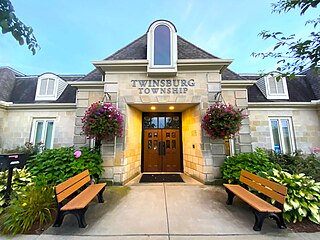
Twinsburg Township is one of the nine townships of Summit County, Ohio, United States. The 2020 census found 3,857 people in the township.

<span class="mw-page-title-main">Coventry Township, Summit County, Ohio</span> Township in Summit County, Ohio

Coventry Township is one of the nine townships of Summit County, Ohio, United States. The 2020 census found 10,238 people in the township.

<span class="mw-page-title-main">Northfield Center Township, Summit County, Ohio</span> Township in Ohio, United States

Northfield Center Township is one of the nine townships of Summit County, Ohio, United States. The 2020 census found 5,597 people in the township.

<span class="mw-page-title-main">Sharon Township, Noble County, Ohio</span> Township in Ohio, United States

Sharon Township is one of the fifteen townships of Noble County, Ohio, United States. The 2020 census found 330 people in the township.

<span class="mw-page-title-main">Sagamore Hills Township, Summit County, Ohio</span> Civil township in Ohio, United States

Sagamore Hills Township is one of the nine townships of Summit County, Ohio, United States. As of the 2020 census, the population was 10,845.

<span class="mw-page-title-main">Radnor Township, Delaware County, Ohio</span> Township in Ohio, United States

Radnor Township is one of the eighteen townships of Delaware County, Ohio, United States. As of the 2020 census the population was 1,570.

<span class="mw-page-title-main">Akron metropolitan area</span> Metropolitan area in Ohio, United States

The Akron, OH Metropolitan Statistical Area, sometimes referred to as Greater Akron, is defined by the United States Office of Management and Budget as an area consisting of two counties, Summit and Portage, in Northeast Ohio and anchored by the city of Akron. As of the 2020 census, the MSA had a population of 702,219. The Akron MSA is also part of the larger Cleveland–Akron–Canton, OH Combined Statistical Area, which has a population of 3,633,962 people as of the 2020 census, the largest metropolitan area in Ohio.

References

  1. 1 2 "US Board on Geographic Names". United States Geological Survey. October 25, 2007. Retrieved January 31, 2008.
  2. "Boston township, Summit County, Ohio - Census Bureau Profile". United States Census Bureau. Retrieved August 24, 2023.
  3. "U.S. Census website". United States Census Bureau . Retrieved January 31, 2008.
  4. Perrin, William Henry (1881). History of Summit County: With an Outline Sketch of Ohio. Baskin & Battey. p.  535.
  5. Overman, William Daniel (1958). Ohio Town Names. Akron, OH: Atlantic Press. p. 16.
  6. §503.24, §505.01, and §507.01 of the Ohio Revised Code. Accessed April 30, 2009.

Further reading