Bottom Wood

Last updated

Bottom Wood
Hillside, Radnage - geograph.org.uk - 1014623.jpg
Bottom Wood from an adjacent hillside
Map
Buckinghamshire UK location map.svg
Red pog.svg
Geography
LocationBuckinghamshire,England
OS grid SU795950
Coordinates 51°39′14″N0°51′04″W / 51.654°N 0.851°W / 51.654; -0.851 Coordinates: 51°39′14″N0°51′04″W / 51.654°N 0.851°W / 51.654; -0.851
Area14.5 hectares (36 acres)

Bottom Wood is a 14.5-hectare (36-acre) woodland in the English county of Buckinghamshire, located just north of the A40 near the hamlet of Studley Green. Since 1984, the wood has been owned by the Chiltern Society, which manages it as a nature reserve with the help of volunteers. Although an ancient woodland, most of the trees in the wood date from the end of the 1940s or later, as much of the wood was felled during the Second World War to produce Bryant and May matches. The wood is now home to a diverse range of flora and fauna, including rare species of butterfly and moth.

Contents

Geography

Bottom wood in the spring BottomWood 1.jpg
Bottom wood in the spring

Bottom Wood is located north of the A40 between Piddington and Stokenchurch, north-east of Studley Green and east of Beacon's Bottom. It is within the parish of Radnage, with the southern boundary meeting the border of Stokenchurch parish and the eastern edge meeting the boundary with West Wycombe parish. [1] The southern boundary of the wood also used to mark the border between the counties of Buckinghamshire and Oxfordshire, until county lines were redrawn in 1896. [2]

The wood is in a valley, with trees covering the south-facing valley slope. The elevation ranges from 132 metres (433 ft) above sea level to 162 metres (531 ft) above sea level. [3] The wood covers a crescent-shaped area of 14.5 hectares (36 acres); the original wood is 11.5 hectares (28 acres), and there is a newer plantation of 3 hectares (7 acres) on an area known as Toothill. [4] The name Toothill comes from the Old English word tot, which means 'look-out', and the top of Toothill provides a good view across the valley in which Bottom Wood is situated. [5] Typically for the Chilterns, chalk underlies the wood, with some clay and sand. [1] [3]

There is a central bridleway running through the wood, which formerly provided a route for packhorses carrying goods between Piddington and Oxford, via Beacon's Bottom. A sewer now runs underground along this route, taking waste away from Beacon's Bottom. [6]

History

The main part of Bottom Wood is ancient woodland, [nb 1] although it is not known exactly how long the area has been wooded. [7] Medieval documents show that the area was owned by the French Abbey of Fontrevaud, from the 12th century until 1413, when the land was returned to the Crown. The land was later given to Sir John Phillip and remained in the family for several years before coming under the ownership of Eton College and then the Earl of Caernarvon. It subsequently passed through several other hands, until it was acquired by John Scrope, owner of Wormsley Park, in 1737. The wood continued to be part of this estate until the 1930s. A tithe map from 1841 is the first known document naming the woodland as Bottom Wood; [8] at this time, the eastern section of the wood was known as Dean Hook. [9]

In the early 20th century, while the woodland was still part of the Wormsley estate, timber from Bottom Wood was sold each year at the King's Arms, Stokenchurch. [10] Evidence of some of the saw pits, over which trees were cut into planks, can still be found in the wood. [6] During a serious drought in 1921, the well in the wood proved to be an important feature, as it offered drinking water to local villagers when their personal water supplies ran dry. The well, which is now topped with concrete, is 30 metres (98 ft) deep and provided a constant supply even in periods of drought. [11] In the mid-1930s, the wood was sold to Mr Pitcher[ who? ]. During the Second World War, much of the wood was felled for the production of Bryant and May matches. [10] Consequently, most of the trees in the wood date from the late 1940s or later, except for a few in the north of the wood. After the war, various species began to grow again in the woods, including cherry, beech and oak trees. [10]

In the 1950s, Mr Pitcher sold the wood to Mr Deane[ who? ]. Helped by the local scout troop, Mr Deane planted the adjoining field of Toothill, at the south-east end of the wood, with Sitka spruce and Scots pine trees. At the eastern edge of the wood, he also introduced some Douglas firs. Mrs Ercolani later bought the wood and managed it as a nature reserve, although much of the wood was untended and deteriorated during this time. [12]

"We entered the wood from the Beacon's Bottom end. It was very scrubby with collapsing hazel and thorns with a bit of rubbish, including the remains of an old car at the entrance...The old beech wood was very dark with almost no ground vegetation. Lads on scramble bikes had worn a track up and down the hill over the old strip field system".

John Morris from the Chiltern Society, examining the wood in 1983. [13]

In 1984, the wood was given to the Chiltern Society, which had recently set up a Small Woodlands Project (later renamed the Chiltern Woodlands Project) in an attempt to reverse the decline of small woodlands in the Chilterns. This project was overseen by Chairman Charles Mills and Project Officer John Morris. Bottom Wood was chosen as a site in which to train those working in the project in good woodland management methods. The three broad aims of the project were to encourage the growth and planting of trees native to the area, to improve the overall quality of trees in the wood, and to manage the wood as a nature reserve. [14]

A small team managed by the Chiltern Society began working in the wood in September 1983, spending an initial ten-week period clearing the bridleway through the wood, getting rid of rubbish that had accumulated under previous owners, and felling some trees in an attempt to encourage the growth of healthier specimens. This included a complete felling of 0.5 hectares (1.2 acres) of the Toothill plantation, which was replanted with 350 trees consisting mainly of ash, cherry, beech and whitebeam. Volunteers continued working to improve the quality of the wood in subsequent years, with some timber being sold to local businesses to fund the management project. Further selective felling took place, including in 1989 when further trees were removed in the Toothill section of the wood, with a central section of 0.5 ha remaining unplanted to form a chalk glade. [15]

Present use

Bottom Wood is currently still owned by the Chiltern Society and managed as a nature reserve by volunteers from the Society's Bottom Wood Group, in conjunction with the Chiltern Woodlands Project. [4] It is open to the public, and can be accessed via Old Dashwood Hill in Studley Green, with some car parking available on the road. [4] Since 2010, the wood has been used by Mary Towerton School as part of a forest school educational programme. [16]

Wildlife

Bottom Wood is a diverse environment which is home to over 700 plant and animal species. [1] Formal cataloguing of some of these species has taken place, including research into the wood's plants by a PhD student, and a record of moths started in 1993. [17]

Flora

Bottom Wood supports a wide variety of plants, due to the range of soil acidity and moisture levels across the woodland area. [3] Rare flora includes coralroot bittercress ( Cardamine bulbifera ) and yellow bird's-nest. [18] The wood is particularly known for its Hyacinthoides non-scripta ('common' or 'English' bluebells). [4] The shrub layer is predominantly hazel. [19] There are also a wide range of trees in the wood, including cherry, oak, ash and beech, yew and hornbeam. [20]

Fauna

The wood is home to at least 25 different species of butterfly, which are particularly found in the area of open grassland in the Toothill section. Three rare species have been sighted, namely the grizzled skipper, the small blue and the white-letter hairstreak. The Duke of Burgundy was also recorded in the wood in 1989. [21] 251 different moth species have been recorded in the wood, including five species classified as 'nationally notable b', meaning that they have been recorded in less than 4% of Great Britain. These species are Drepana cultraria , Paradarisa consonaria , Paradarisa extersaria , Cerastis leucographa and Lithophane hepatica . [22]

Dormice are present in the wood, and are carefully monitored as a protected species. [23] Red kites are frequently seen in the area, as are other rare bird species such as lesser spotted woodpeckers and marsh tits. A red deer was also once sighted in the wood. [24]

As with other Chiltern woodlands, trees in Bottom Wood have been damaged by the introduced grey squirrel stripping their bark. Management measures are in place to control the squirrel population. [25]

Related Research Articles

<span class="mw-page-title-main">Stokenchurch</span> Human settlement in England

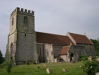
Stokenchurch is a village and civil parish in south-west Buckinghamshire, England. It is located in the Chiltern Hills, about 3 miles (5 km) south of Chinnor in Oxfordshire and 6 miles (10 km) west of High Wycombe. Stokenchurch is a commuter village, served by junction 5 of the M40 motorway to London, Oxford and Birmingham. The Stokenchurch BT Tower, to the west of the village, is a highly visible landmark on the edge of the Chilterns and pinpoints the village's location for miles ahead.

<span class="mw-page-title-main">Whittlewood Forest</span> Forest in the county of Northamptonshire in England

Whittlewood Forest is a former medieval hunting forest east of Silverstone in Northamptonshire in England. It is managed by the Forestry England. There are tracts of ancient woodland within it and old ditches can be found at the edges of several individual woods. The area has been the subject of extensive academic historical research. An area of 400 hectares in seven different patches has been designated a biological Site of Special Scientific Interest (SSSI), which is about half the size of an average English parish. It is a Nature Conservation Review site, Grade 2.

<span class="mw-page-title-main">Windsor Hill</span> Biological Site

Windsor Hill is a 61.8-hectare (153-acre) biological Site of Special Scientific Interest in Princes Risborough in Buckinghamshire. It lies within the Chilterns Area of Outstanding Natural Beauty, and it is featured in the Nature Conservation Review. A small part is managed by the Berkshire, Buckinghamshire and Oxfordshire Wildlife Trust, and access to this area requires a permit.

<span class="mw-page-title-main">Queendown Warren</span>

Queendown Warren is a 22.2-hectare (55-acre) biological Site of Special Scientific Interest south-east of Rainham in Kent. It is a Local Nature Reserve, a Nature Conservation Review site, Grade 2, and a Special Area of Conservation. It is in the Kent Downs Area of Outstanding Natural Beauty. It is managed by the Kent Wildlife Trust, and part of it is owned by Plantlife.

<span class="mw-page-title-main">Lewknor</span> Human settlement in England

Lewknor is a village and civil parish about 5 miles (8 km) south of Thame in Oxfordshire.The civil parish includes the villages of Postcombe and South Weston. The 2011 Census recorded the parish's population as 663.

<span class="mw-page-title-main">Forestry in the United Kingdom</span>

The United Kingdom, being in the British Isles, is ideal for tree growth, thanks to its mild winters, plentiful rainfall, fertile soil and hill-sheltered topography. Growth rates for broadleaved (hardwood) trees exceed those of mainland Europe, while conifer (softwood) growth rates are three times those of Sweden and five times those of Finland. In the absence of people, much of Great Britain would be covered with mature oaks, except for Scotland. Although conditions for forestry are good, trees do face damage threats arising from fungi, parasites and pests. The development of afforestation and the production and supply of timber in Wales come under Natural Resources Wales, as set out in the Forestry Act 1967.

<span class="mw-page-title-main">Aston Rowant National Nature Reserve</span> A Chiltern Hills nature reserve

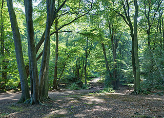
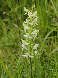
Aston Rowant National Nature Reserve is located on the north-west escarpment of the Chiltern Hills, in the Chilterns Area of Outstanding Natural Beauty. It has an area of 159.1 hectares, and most of it is a 128.5 hectares biological Site of Special Scientific Interest. It is listed as a Grade 1 site in A Nature Conservation Review. The reserve is in several sections, mostly in the parish of Lewknor in Oxfordshire, with smaller sections in the parish of Stokenchurch in Buckinghamshire.

<span class="mw-page-title-main">Horsleys Green</span> Human settlement in England

Horsleys Green is a hamlet located on the A40 between Piddington and Stokenchurch in Buckinghamshire, England. It consists of a few houses situated either side of a narrow lane.

<span class="mw-page-title-main">Naphill Common</span>

Naphhill Common is a 71.1-hectare (176-acre) Site of Special Scientific Interest in Naphill in Buckinghamshire. It is in of the Chilterns Area of Outstanding Natural Beauty, and it is listed in A Nature Conservation Review. It is common land, with commoners' rights to estovers, grazing and firebote.

<span class="mw-page-title-main">Waterend, Buckinghamshire</span> Human settlement in England

Waterend is a hamlet located on the A40 between Piddington and Stokenchurch in Buckinghamshire, England. Together with the adjacent hamlets of Horsleys Green, Beacon's Bottom and Studley Green, it is in an area known collectively as 'Studley Green'. It is within the Chiltern Area of Outstanding Natural Beauty.

<span class="mw-page-title-main">Philipshill Wood</span>

Philipshill Wood is a 77 acres (31 ha) area of woodland in the English county of Buckinghamshire, situated on the border with Hertfordshire about 1 mile (1.6 km) from the village of Chorleywood. It is within the Chiltern Hills Area of Outstanding Natural Beauty, and is owned by the Woodland Trust. The wood is fully open to the public, with some parking available in Old Shire Lane, to the east of the wood.

Backmuir Wood is a 140.58 acres (56.89 ha) woodland in the Scottish county of Angus, about 4 kilometres (2 mi) northwest of Dundee. It is located south of the A923, between the villages of Muirhead and Liff. Since 1996, the woodland has been under the ownership of the Woodland Trust, which manages it in partnership with a local community group. The area of the wood has been extended since then, including the acquisition of a further 17 acres in 2009. Backmuir Wood is a diverse woodland, which is home to a variety of different tree species. It also provides a habitat for the red squirrel, a protected species in the UK.

Lower Wye Gorge is a 65-hectare (160-acre) biological and geological Site of Special Scientific Interest in Gloucestershire, notified in 1954 and renotified 1987. The site includes two Gloucestershire Wildlife Trust nature reserves being Ban-y-gor Wood and Lancaut. The Natural England citation states a revision for Lancaut inclusion.

<span class="mw-page-title-main">Dymock Woods SSSI</span> Biological Site of Special Scientific Interest in Gloucestershire, England

Dymock Woods is a 53-hectare (130-acre) biological Site of Special Scientific Interest in Gloucestershire, notified in 1990. The site is listed in the 'Forest of Dean Local Plan Review' as a Key Wildlife Site (KWS).

<span class="mw-page-title-main">Bull Cross, The Frith and Juniper Hill</span> Site of Special Scientific Interest in Gloucestershire, England

Bull Cross, The Frith and Juniper Hill is a 42.33-hectare (104.6-acre) biological and geological Site of Special Scientific Interest in Gloucestershire, notified in 1954. The site is listed in the ‘Stroud District’ Local Plan, adopted November 2005, Appendix 6 as an SSSI and Regionally Important Geological Site (RIGS).

<span class="mw-page-title-main">East Wood, Tidenham</span> Nature reserve in Gloucestershire, England

East Wood and is a 0.82-hectare (2.0-acre) nature reserve in Gloucestershire, England. The west site is 0.45-hectare (1.1-acre). The east site is 0.37-hectare (0.91-acre). It is part of a larger area of woodland called East Wood, which is adjacent to Oakhill Wood and Woolaston Wood (east). The site was leased from the Forestry Commission in 1986 and is managed by the Gloucestershire Wildlife Trust. The site is listed in the 'Forest of Dean Local Plan Review' as a Key Wildlife Site (KWS).

<span class="mw-page-title-main">Tring Woodlands</span>

Tring Woodlands is a 23.8-hectare (59-acre) biological Site of Special Scientific Interest in Tring in Hertfordshire. It is part of the Chilterns Area of Outstanding Natural Beauty and the local planning authority is Dacorum District Council. The wood has a rich flora, showing that it is well established. It is a good example of a semi-natural beech wood in Hertfordshire. Plants that are abundant include woodruff, wood anemone and dog's mercury, and there are a variety of woodland birds. There is access to the wood from Hastoe Hill.

<span class="mw-page-title-main">Dancersend</span>

Dancersend is an 81.3-hectare (201-acre) Site of Special Scientific Interest (SSSI) south of Aston Clinton in Buckinghamshire. Part of the site is managed by the Forestry Commission and part by the Berkshire, Buckinghamshire and Oxfordshire Wildlife Trust (BBOWT). The BBOWT's 47 hectare nature reserve, called Dancersend with Pavis Woods, extends into fields west of the SSSI. It is in the Chilterns Areas of Outstanding Natural Beauty.

<span class="mw-page-title-main">Widdenton Park Wood</span>

Widdenton Park Wood is a 23.5-hectare (58-acre) Site of Special Scientific Interest west of High Wycombe in Buckinghamshire. It is on the site of a medieval deer park going back to the fourteenth century, and most of it is in the Chilterns Area of Outstanding Natural Beauty.

<span class="mw-page-title-main">Jones' Hill Wood</span> Ancient woodland in Buckinghamshire, UK

Jones' Hill Wood is a 1.8-hectare (4.4-acre) piece of ancient woodland near Wendover in Buckinghamshire, south England. Formed mainly of beech trees, the wood is part of the Chiltern Hills Area of Outstanding Natural Beauty. Almost half of the wood is planned to be chopped down to make way for the route of High Speed 2 (HS2) and the topsoil will be translocated. In October 2020, a protest camp was evicted.

References

Notes

  1. The term "ancient woodland" in the UK refers to woodlands that have existed continuously since at least 1600.

Citations

  1. 1 2 3 "About Bottom Wood". Bottom Wood. Chiltern Society. Archived from the original on 27 April 2015. Retrieved 30 July 2012.
  2. Figg, et al., Bottom Wood, p. 6.
  3. 1 2 3 Figg, et al., Bottom Wood, p. 31.
  4. 1 2 3 4 "Bottom Wood". The Chilterns AONB. Chilterns Conservation Board. Retrieved 27 July 2012.
  5. Figg, et al., Bottom Wood, p. 23.
  6. 1 2 Figg, et al., Bottom Wood, p. 22.
  7. Figg, et al., Bottom Wood, p. 5.
  8. Figg, et al., Bottom Wood, pp. 5-6.
  9. Figg, et al., Bottom Wood, p. 4.
  10. 1 2 3 Figg, et al., Bottom Wood, pp. 7-8.
  11. Figg, et al., Bottom Wood, p. 21.
  12. Figg, et al., Bottom Wood, pp. 8-9.
  13. Figg, et al., Bottom Wood, p. 9.
  14. Figg, et al., Bottom Wood, pp. 9-10.
  15. Figg, et al., Bottom Wood, pp. 10-13.
  16. "Forest School in the Wood". Bottom Wood. Chiltern Society. Archived from the original on 27 April 2015. Retrieved 30 July 2012.
  17. Figg, et al., Bottom Wood, p. 32.
  18. "Chiltern Society Bottom Wood Group". Woodland initiatives register. Small Woods Association. Archived from the original on 4 March 2016. Retrieved 31 July 2012.
  19. Figg, et al., Bottom Wood, p. 27.
  20. "Flora". Bottom Wood. Chiltern Society. Archived from the original on 23 November 2015. Retrieved 18 February 2016.
  21. Figg, et al., Bottom Wood, pp. 33-35.
  22. Figg, et al., Bottom Wood, pp. 37-39.
  23. "Dormice". Bottom Wood. Chiltern Society. Retrieved 30 July 2012.
  24. "Other species". Bottom Wood. Chiltern Society. Archived from the original on 27 April 2015. Retrieved 30 July 2012.
  25. Figg, et al., Bottom Wood, p. 20.

Bibliography