Boz | |
|---|---|
| Coordinates: 32°18′30″N96°55′45″W / 32.30833°N 96.92917°W | |
| Country | United States |
| State | Texas |
| County | Ellis |
| Elevation | 617 ft (188 m) |
| GNIS feature ID | 1378041 [1] |
Boz is a populated place in Ellis County, Texas, United States. [1]
Boz | |
|---|---|
| Coordinates: 32°18′30″N96°55′45″W / 32.30833°N 96.92917°W | |
| Country | United States |
| State | Texas |
| County | Ellis |
| Elevation | 617 ft (188 m) |
| GNIS feature ID | 1378041 [1] |
Boz is a populated place in Ellis County, Texas, United States. [1]
Boz is situated on Farm to Market Road 1493, and was settled in the late 1880s. A post office operated from 1891 to 1906. The community was the shooting location for several scenes of the 1984 film Places in the Heart . By 1992, all but one resident left the community due construction of the Superconducting Super Collider. [2] [3]

Texas is the most populous state in the South Central region of the United States. It borders Louisiana to the east, Arkansas to the northeast, Oklahoma to the north, New Mexico to the west, and an international border with the Mexican states of Chihuahua, Coahuila, Nuevo León, and Tamaulipas to the south and southwest. Texas has a coastline on the Gulf of Mexico to the southeast. Covering 268,596 square miles (695,660 km2), and with over 30 million residents as of 2023, it is the second-largest state by both area and population.

Washington County is a county in Texas. As of the 2020 census, the population was 35,805. Its county seat is Brenham, which is located along U.S. Highway 290, 72 miles northwest of Houston. The county was created in 1835 as a municipality of Mexico and organized as a county in 1837. It is named for George Washington, the first president of the United States.

Val Verde County is a county located on the southern Edwards Plateau in the U.S. state of Texas. The 2020 population is 47,586. Its county seat is Del Rio. The Del Rio micropolitan statistical area includes all of Val Verde County.

Llano County is a county located on the Edwards Plateau in the U.S. state of Texas. As of the 2020 census, its population was 21,243. Its county seat is Llano, and the county is named for the Llano River.

Kerr County is a county located on the Edwards Plateau in the U.S. state of Texas. As of the 2020 census, its population was 52,598. Its county seat is Kerrville. The county was named by Joshua D. Brown for his fellow Kentucky native, James Kerr, a congressman of the Republic of Texas. The Kerrville, TX Micropolitan Statistical Area includes all of Kerr County.

Kendall County is a county located on the Edwards Plateau in the U.S. state of Texas. In 2020 census, its population was 44,279. Its county seat is Boerne. The county is named for George Wilkins Kendall, a journalist and Mexican–American War correspondent.

Hays County is a county in the central portion of the U.S. state of Texas. It is part of the Austin-Round Rock metropolitan area. As of the 2020 census, its official population had reached 241,067. The county seat is San Marcos. Hays, along with Comal and Kendall Counties, was listed in 2017 as one of the nation's fastest-growing counties with a population of at least 10,000. From 2015 to 2016, Hays County, third on the national list, had nearly 10,000 new residents during the year.

Cherokee County is a county located in the U.S. state of Texas. As of the 2020 census, its population was 50,412. The county seat is Rusk, which lies 130 miles southeast of Dallas and 160 miles north of Houston. The county was named for the Cherokee, who lived in the area before being expelled in 1839. Cherokee County comprises the Jacksonville micropolitan statistical area, which is also included in the Tyler–Jacksonville combined statistical area.

Georgetown is a city in Texas and the county seat of Williamson County, Texas, United States. The population was 67,176 at the 2020 census, and according to 2023 census estimates, the city is estimated to have a population of 96,312. It is 30 miles (48 km) north of Austin and is part of the Austin–Round Rock–San Marcos metropolitan statistical area.

William Royce "Boz" Scaggs is an American singer, songwriter, and guitarist. He was a bandmate of Steve Miller in The Ardells in the early 1960s and the Steve Miller Band from 1967 to 1968.

Tilden is an unincorporated community, census-designated place (CDP), and the county seat of McMullen County, Texas, United States. The population was 190 at the 2020 census.
Independence is an unincorporated community in Washington County, Texas, United States. According to the Handbook of Texas, the community had a population of 140 in 2000. It is located about an hour northwest of the Greater Houston metropolitan area.

The Austin–Round Rock–San Marcos metropolitan statistical area, or Greater Austin, is a five-county metropolitan area in the U.S. state of Texas, as defined by the Office of Management and Budget. The metropolitan area is situated in Central Texas on the western edge of the American South and on the eastern edge of the American Southwest, and borders Greater San Antonio to the south.

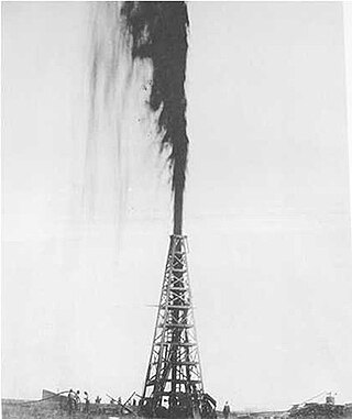
The Texas oil boom, sometimes called the gusher age, was a period of dramatic change and economic growth in the U.S. state of Texas during the early 20th century that began with the discovery of a large petroleum reserve near Beaumont, Texas. The find was unprecedented in its size (worldwide) and ushered in an age of rapid regional development and industrialization that has few parallels in U.S. history. Texas quickly became one of the leading oil-producing states in the U.S., along with Oklahoma and California; soon the nation overtook the Russian Empire as the top producer of petroleum. By 1940 Texas had come to dominate U.S. production. Some historians even define the beginning of the world's Oil Age as the beginning of this era in Texas.

Sisterdale is an unincorporated farming and ranching community established in 1847 and located 13 miles (21 km) north of Boerne in Kendall County, in the U.S. state of Texas. The community is located in the valley of Sister Creek. The elevation is 1,280 feet (390 m).

The Texas General Land Office (GLO) is a state agency of the U.S. state of Texas, responsible for managing lands and mineral rights properties that are owned by the state. The GLO also manages and contributes to the state's Permanent School Fund. The agency is headquartered in the Stephen F. Austin State Office Building in Downtown Austin.

The Edward Steves Homestead is located in the Bexar County city of San Antonio in the U.S. state of Texas. It was designed by architect Alfred Giles and designated a Recorded Texas Historic Landmark. The main house was donated to the San Antonio Conservation Society in 1952. The organization completely restored the main house as a museum, which closed in 2022. The complete homestead property consists of four individual structures: the main house museum, the carriage house, the river house, and the servants' quarters. It is listed on the National Register of Historic Places listings in Bexar County, Texas, as a contributing structure of the King William Historic District.

The Woman's Club of San Antonio is a philanthropic civic organization located in Bexar County in the U.S. state of Texas. It was founded October 1, 1898 by Mary Eleanor Brackenridge, Marin B. Fenwick and sixteen other individuals who had been inspired by the National Federation of Women's Clubs. Brackenridge served as the organization's first president. The sororal organization is the oldest civic organization in San Antonio. They partner with businesses, local government and other civic organizations to promote health, safety, welfare and education. One of its original goals was to bring the Nineteenth Amendment to the United States Constitution to fruition, and was the first Texas woman's club to promote the issue.