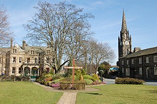
Bingley is a market town and civil parish in the metropolitan borough of the City of Bradford, West Yorkshire, England. It is sited on the River Aire and the Leeds and Liverpool Canal. The town had a population of 18,040 at the 2021 Census.

Wilsden is a village and civil parish in west Bradford, in West Yorkshire, England. Wilsden is 6 miles (9.7 km) west of Bradford and is close to the Aire Valley and the nearby villages of Denholme, Cullingworth, Harden, Cottingley and Allerton. Wilsden re-acquired civil parish status in 2004. The 2001 census revealed a population of 3,697, increasing to 4,807 at the 2011 Census.

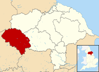
Craven was a non-metropolitan district in the west of North Yorkshire, centred on the market town of Skipton. The name Craven is much older than the modern district and encompassed a larger area. This history is also reflected in the way the term is still commonly used, such as by the Church of England.

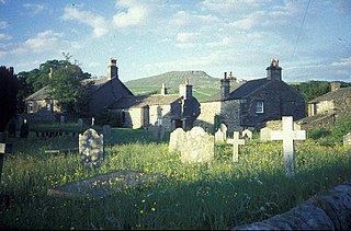
Horton in Ribblesdale is a small village and civil parish in Ribblesdale in the former Craven district of North Yorkshire, England. It is situated on the Settle–Carlisle Railway to the west of Pen-y-ghent.

Silsden is a town and civil parish in the City of Bradford in West Yorkshire, England, on the River Aire and Leeds and Liverpool Canal between Keighley and Skipton, which had a population of 8,390 at the 2021 Census. The parish includes the hamlet of Brunthwaite.

Queensbury is a village in the metropolitan borough and city of Bradford, West Yorkshire, England. Perched on a high vantage point above Halifax, Clayton and Thornton and overlooking Bradford, Queensbury is one of the highest parishes in England, with views beyond the West Yorkshire conurbation to the hills of Brontë Country and the Yorkshire Dales to the north and north west. Its population of 8,718 in 2001 increased to 16,273 in the 2011 Census.

Burley in Wharfedale is a village and civil parish in West Yorkshire, England, in the Wharfedale valley. In 2011, it had a population of 7,041.

Horton-in-Ribblesdale is a railway station on the Settle and Carlisle Line, which runs between Carlisle and Leeds via Settle. The station, situated 47 miles 40 chains (76.4 km) north-west of Leeds, serves the village of Horton-in-Ribblesdale in North Yorkshire, England. It is owned by Network Rail and managed by Northern.

Halton Gill is a hamlet and civil parish in Littondale in the Yorkshire Dales in North Yorkshire, England. It is situated 2 miles (3.2 km) up Littondale from Litton. A minor road leads south west to Silverdale and Stainforth in Ribblesdale.

Ribblesdale is one of the Yorkshire Dales in England. It is the dale or upper valley of the River Ribble in North Yorkshire. Towns and villages in Ribblesdale include Selside, Horton-in-Ribblesdale, Stainforth, Langcliffe, Giggleswick, Settle, Long Preston and Hellifield. Below Hellifield the valley of the river is generally known as the Ribble Valley.
Counties 1 Yorkshire is an English rugby union division, the seventh tier of the domestic competition, and the top level for local rugby union in parts of Yorkshire. The champions are automatically promoted to Regional 2 North East, a division with a wider geographical area that also encompasses northeast England. The runners-up participate in a playoff against the 2nd place team from the equivalent regional league, Counties 1 Durham & Northumberland, for promotion to Regional 2 North East. The bottom two clubs are relegated to Counties 2 Yorkshire.
Counties 2 Yorkshire, previously known as Yorkshire 2 is an English rugby union league at the eighth tier of the domestic competition for teams from Yorkshire. Club rugby in Yorkshire operates without promotion play-offs meaning that the top two teams are automatically promoted to Counties 1 Yorkshire and the bottom two teams are relegated to Counties 3 Yorkshire. Each season a team from Yorkshire 2 is picked to take part in the RFU Senior Vase - a national competition for clubs at level 8.

A Dales High Way is a long-distance footpath in northern England. It is 90 miles (140 km) long and runs from Saltaire in West Yorkshire to Appleby-in-Westmorland, Cumbria, roughly parallel to the line of the Settle and Carlisle Railway.

Laycock is a small village in the Bradford District of West Yorkshire that overlooks the hamlet of Goose Eye. The village is 1.9 miles (3 km) west of the town of Keighley and 1.2 miles (2 km) north of Oakworth village. The village is in the council ward of Keighley West.

Egypt is a hamlet near Thornton, in the City of Bradford, West Yorkshire, England.

Hainworth is a hamlet 1 mile (2 km) south of Keighley in West Yorkshire, England. The hamlet faces north across the lower end of the Worth Valley with a steep wooded incline towards Keighley.

Ryecroft is a hamlet near to the village of Harden in West Yorkshire, England. The hamlet is on the road between Harden and Haworth, 1.9 miles (3 km) south of Keighley, 1.9 miles (3 km) west of Bingley and 0.6 miles (1 km) west of the centre of Harden.
Horton in Ribblesdale is a civil parish in the Craven district of North Yorkshire, England. It contains 32 listed buildings that are recorded in the National Heritage List for England. Of these, one is listed at Grade I, the highest of the three grades, one is at Grade II*, the middle grade, and the others are at Grade II, the lowest grade. The parish contains the village of Horton in Ribblesdale, smaller settlements including Selside, and the surrounding countryside. Most of the listed buildings are farmhouses, private houses and cottages, and the others include a church, bridges, and boundary stones.

St Oswald's Church is the parish church of Horton in Ribblesdale, a village in North Yorkshire, in England.


