Bradley Junction, Florida

Last updated

Bradley Junction, Florida
FL37nRoad-BradleyJunctionSign (30733232602).jpg
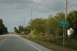
Northbound Florida State Road 37 as it enters Bradley Junction
USA Florida location map.svg
Red pog.svg
Bradley Junction
Usa edcp location map.svg
Red pog.svg
Bradley Junction
Coordinates: 27°47′43″N81°58′49″W / 27.79528°N 81.98028°W / 27.79528; -81.98028
Country United States
State Florida
County Polk
Area
[1]
  Total2.15 sq mi (5.57 km2)
  Land2.11 sq mi (5.46 km2)
  Water0.04 sq mi (0.11 km2)
Elevation
138 ft (42 m)
Population
 (2020)
  Total542
  Density257.12/sq mi (99.25/km2)
Time zone UTC-5 (Eastern (EST))
  Summer (DST) UTC-4 (EDT)
ZIP codes
33835 [2]
Area code 863
FIPS code GNIS feature ID

Bradley Junction (also known as Bradley) is an unincorporated community and census-designated place in southwestern Polk County, Florida, United States. Its population was 542 as of the 2020 census.

Contents

History

A CSX train on the Brewster Subdivision at the namesake for Bradley Junction. K343 Bradley.jpg
A CSX train on the Brewster Subdivision at the namesake for Bradley Junction.

Bradley Junction is named for the railroad junction located in the community, which was historically the junction between the Seaboard Air Line Railroad (the east-west track) and the Charlotte Harbor and Northern Railway (the north-south track). The junction itself is named after phosphate mining company executive Peter B. Bradley, who chartered the Charlotte Harbor and Northern Railway in 1905. The railroad junction still exists today and both lines are now owned by CSX Transportation. In the mid 1990s, the Florida Gulf Coast Railroad Museum (now the Florida Railroad Museum) moved the railroad station from Bradley Junction to Parrish. The depot was then consumed by a fire soon after the move.

Geography

Bradley Junction is located at 27.795 degrees north, 81.98056 degrees west (27.795, -81.98056). [3] [4] The elevation for the community is 135 feet above sea level. [5]

Demographics

Historical population
CensusPop.Note
2020 542
U.S. Decennial Census [6]

Education

The community of Bradley Junction is served by Polk County Public Schools.

Related Research Articles

<span class="mw-page-title-main">Estero, Florida</span> Village in Florida, United States

Estero is a village in Lee County, Florida, United States. As of the 2020 census, the population was 36,939. During the 2010 census, Estero was an unincorporated community, or census-designated place, the population at that time was 22,612. Estero incorporated as a village in 2014. In 2019, the village's estimated population was 33,871. Estero is part of the Cape Coral-Fort Myers, Florida Metropolitan Statistical Area.

<span class="mw-page-title-main">Highland City, Florida</span> Census-designated place in Florida, United States

Highland City is a census-designated place (CDP) in Polk County, Florida, United States. The population was 2,051 at the 2000 census. It is part of the Lakeland–Winter Haven Metropolitan Statistical Area.

<span class="mw-page-title-main">Lake Alfred, Florida</span> City in Florida, United States

Lake Alfred is a city in Polk County, Florida, United States. The population was approximately 5,015 at the 2010 Census. It is part of the Lakeland–Winter Haven Metropolitan Statistical Area.

<span class="mw-page-title-main">Loughman, Florida</span> Census-designated place in Florida, United States

Loughman (LOFF-mǝn) is a census-designated place (CDP) in the northeast corner of Polk County, Florida, United States, near the Osceola county line. The population was 1,385 at the 2000 census. It is part of the Lakeland–Winter Haven Metropolitan Statistical Area. This area has grown rapidly since 2000 due, in large part, to its proximity to Walt Disney World and the Orlando, Florida area.

Highpoint is an unincorporated community in eastern Pinellas County, Florida, United States, near Tampa Bay. It is situated between Feather Sound and Largo. The area includes the census-designated place of South Highpoint.

East Tampa is an unincorporated community in Hillsborough County, Florida, United States. It is partially within the census-designated place (CDP) of Gibsonton. The ZIP code for East Tampa is 33619.

<span class="mw-page-title-main">Carrollwood, Florida</span> Unincorporated community in Florida, United States

Carrollwood is an unincorporated community in Hillsborough County, Florida, United States. It is part of the larger census-designated place (CDP) of Carrollwood, which also includes the neighborhood of Carrollwood Village. A census-designated place corresponding just to Carrollwood existed during the 1990 census, with a population of 7,195. The ZIP code for Carrollwood is 33618.

Carrollwood Village is an unincorporated community in Hillsborough County, Florida, United States. Along with neighboring Carrollwood, it is part of the Carrollwood census-designated place. The ZIP codes for the community are 33624 and 33618. Carrollwood Village was its own census-designated place during the 1990 census, with a recorded population of 15,051.

Orient Park is an unincorporated community in Hillsborough County, Florida, United States. Along with East Lake, it is a part of the census-designated place (CDP) of East Lake-Orient Park. The ZIP code for the community is 33619.

Nowatney is an unincorporated community in northern Hillsborough County, Florida, United States. The community is within the census-designated place of University. The ZIP code for the community is 33613.

Sweetwater Creek is an unincorporated community in Hillsborough County, Florida, United States. It is part of the census-designated place (CDP) of Town 'n' Country. The ZIP code for the community is 33634.

Rocky Creek is an unincorporated community in Hillsborough County, Florida, United States. Although a separate community, it is a part of the census-designated place (CDP) of Town 'n' Country. The ZIP code for the community is 33615.

Lake Fern is an unincorporated community in Hillsborough County, Florida, United States. Although a separate community, it is a part of the census-designated place (CDP) of Keystone. The ZIP code for the community is 33556. In 2000, it was part of the Citrus Park-Fern Lake [sic] census county division (CCD), which recorded an estimate population of 117,574 in 2007.

West Hollywood is a neighborhood in Broward County, Florida, United States. The ZIP code for the community is 33023. The community is within the city limits of Hollywood. The latest population for the area recorded was 60,806. West Hollywood reported as an "unincorporated place" by the U.S. Census Bureau in 1950, when the population count totaled 1,196.

<span class="mw-page-title-main">Punta Gorda, Florida</span> City in Florida, United States

Punta Gorda is a city located in Southwest Florida and is the county seat of Charlotte County, Florida, United States. As of the 2020 U.S. Census the city had a population of 19,471. Punta Gorda is part of the Sarasota-Bradenton-Punta Gorda Combined Statistical Area.

Brownsville is an unincorporated community in Escambia County, Florida, United States. It is located within the census-designated place of West Pensacola. It was enumerated as a Census-Designated Place in 1960, when the population recorded was 38,417. The ZIP code for Brownsville is 32505.

Bay Crest Park is an unincorporated community in Hillsborough County, Florida, United States.

Port Sutton is an unincorporated community located in the industrial section of southeastern Hillsborough County, Florida, United States. The community is served by a 33619 ZIP Code. It is adjacent to the census-designated place (CDP) of Palm River-Clair Mel and the city limits of Tampa.

CSX Transportation's Valrico Subdivision is a railroad line in Central Florida. It serves as CSX's main route through a region of Central Florida known as the Bone Valley, which contains the largest known deposits of phosphate in the United States.

Fort Green is an unincorporated community and census-designated place (CDP) in Hardee County, Florida, United States. Its population was 78 as of the 2020 census.

References

  1. "2020 U.S. Gazetteer Files". United States Census Bureau. Retrieved October 31, 2021.
  2. United States Postal Service (2012). "USPS - Look Up a ZIP Code" . Retrieved February 15, 2012.
  3. "US Gazetteer files: 2010, 2000, and 1990". United States Census Bureau. February 12, 2011. Retrieved April 23, 2011.
  4. Bradley Junction, Polk County, Florida, USA - Maps, Photos ... Archived October 6, 2008, at the Wayback Machine
  5. Bradley Junction profile from Hometown Locator
  6. "Census of Population and Housing". Census.gov. Retrieved June 4, 2016.