Brazos Country, Texas

Last updated

Brazos Country, Texas
USA Texas location map.svg
Red pog.svg
Brazos Country
Coordinates: 29°45′11″N96°2′17″W / 29.75306°N 96.03806°W / 29.75306; -96.03806
Country United States
State Texas
County Austin
Incorporated2000
Area
[1]
  Total2.00 sq mi (5.19 km2)
  Land1.95 sq mi (5.06 km2)
  Water0.05 sq mi (0.13 km2)
Population
 (2010)
  Total469
  Estimate 
(2019) [2]
474
  Density242.70/sq mi (93.71/km2)
ZIP code
77474
FIPS code 48-10090
GNIS feature ID1923026
Website citybrazoscountry.org

Brazos Country is a residential community in Austin County, Texas, United States.

Contents

City Map, showing position from I-10 Brazos Country City Map.png
City Map, showing position from I-10

Geography

Brazos Country is located south of Interstate 10 and 7 miles (11 km) southeast of Sealy. Downtown Houston is 43 miles (69 km) to the east. The eastern city limits of Brazos Country run along the west bank of the Brazos River. The only entrances to the city are from Chew Road. As of the 2010 census, the population was 469. [3]

There are several small, unnamed bodies of water within Brazos Country, likely manmade. [4]

Brazos Country is located at 29°45′11″N96°2′17″W / 29.75306°N 96.03806°W / 29.75306; -96.03806 . According to the United States Census Bureau, the city has a total area of 5.5 square miles (14 km2), of which, 5.4 square miles (14 km2) of it is land and 0.1 square miles (0.26 km2) is water. [5]

Historical population
CensusPop.Note
2010 469
2019 (est.)474 [2] 1.1%
U.S. Decennial Census [6]

Government

City government is by mayor and city council. The Sealy Independent School District serves area students.

Brazos Country encompasses the River Ridge Golf Club [7] which occupies the west bank of the Brazos River.

History

Development of the area began in the late 1970s, and the city was incorporated in May 2000. [8] [9]

Related Research Articles

<span class="mw-page-title-main">Brazos County, Texas</span> County in Texas, United States

Brazos County is a county in the U.S. state of Texas. As of the 2020 census, its population was 233,849. The county seat is Bryan. Along with Brazoria County, the county is named for the Brazos River, which forms its western border. The county was formed in 1841 and organized in 1843.

<span class="mw-page-title-main">Austin County, Texas</span> County in Texas, United States

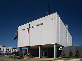
Austin County is a rural, agricultural dominated county in the U.S. state of Texas. As of the 2020 census, the population was 30,167. Its seat is Bellville. The county and region was settled primarily by German emigrants in the 1800s.

<span class="mw-page-title-main">Geneva, Alabama</span> City in Alabama, United States

Geneva is a city in and the county seat of Geneva County, Alabama, United States. It was incorporated in 1875. It is part of the Dothan, Alabama Metropolitan Statistical Area. Since 1940, it has been the largest city of Geneva County, and had a population of 4,292 as of the 2020 census.

<span class="mw-page-title-main">Merryville, Louisiana</span> Town in Louisiana, United States

Merryville is a town in Beauregard Parish, Louisiana, United States. The population was 1,103 at the 2010 census. It is part of the DeRidder Micropolitan Statistical Area.

<span class="mw-page-title-main">New Boston, Ohio</span> Village in Ohio, United States

New Boston is a village in Scioto County, Ohio, United States, along the Ohio River. The population was 2,297 at the 2020 census. Apart from its southern boundary on the Ohio River, New Boston is entirely surrounded by the city of Portsmouth.

<span class="mw-page-title-main">San Felipe, Texas</span> Town in Texas, United States

San Felipe, also known as San Felipe de Austin, is a town in Austin County, Texas, United States. The town was the social, economic, and political center of the early Stephen F. Austin colony. The population was 747 at the 2010 census.

<span class="mw-page-title-main">Wallis, Texas</span> City in Texas, United States

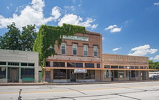
Wallis is a city in far southeastern Austin County, Texas, United States. The city is located along State Highway 36 (SH 36) and the BNSF Railway between Rosenberg and Sealy. The city's population was 1,292 at the 2020 census.

<span class="mw-page-title-main">Brazoria, Texas</span> City in Texas, United States

Brazoria is a city in the U.S. state of Texas, in the Houston–The Woodlands–Sugar Land metropolitan area and Brazoria County. As of the 2020 U.S. Census, the city population was 2,866.

<span class="mw-page-title-main">West Columbia, Texas</span> City in Texas, United States

West Columbia is a city in Brazoria County in the U.S. state of Texas. The city is centered on the intersection of Texas Highways 35 & 36, 55 miles (89 km) southwest of downtown Houston. The population was 3,644 at the 2020 census.

<span class="mw-page-title-main">Millican, Texas</span> Place in Texas, United States

Millican is an unincorporated area and former municipality in Brazos County, Texas, United States. The population was 240 at the 2010 census, up from 108 at the 2000 census. It is part of the Bryan–College Station metropolitan area. Millican is named after Robert Millican, the first white settler of the region that would come to be known as Brazos County.

<span class="mw-page-title-main">Wixon Valley, Texas</span> City in Texas, United States

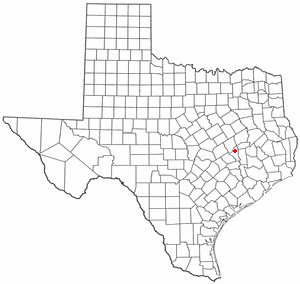
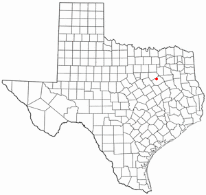
Wixon Valley is a city in Brazos County, Texas, United States. The population was 254 at the 2010 census. It is part of the Bryan-College Station metropolitan area.

<span class="mw-page-title-main">Snook, Texas</span> City in Texas, United States

Snook is a city in Burleson County, Texas, United States. The population was 506 at the 2020 census.

<span class="mw-page-title-main">Somerville, Texas</span> City in Texas, United States

Somerville is a city in Burleson County, Texas, United States. The population was 1,312 at the 2020 census. Somerville is named for Albert Somerville the first president of the Gulf, Colorado and Santa Fe Railway.

<span class="mw-page-title-main">Palm Valley, Cameron County, Texas</span> City in Texas, United States

Palm Valley is a city in Cameron County, Texas, United States. The population was 1,304 at the 2010 census. It is part of the Brownsville–Harlingen–Raymondville and the Matamoros–Brownsville metropolitan areas.

<span class="mw-page-title-main">Teague, Texas</span> City in Texas, United States

Teague is a city in Freestone County, Texas, United States. The population was 3,384 at the 2020 census.

<span class="mw-page-title-main">Keene, Texas</span> City in Texas, United States

Keene is a city in Johnson County, Texas, United States. The population was 6,387 in 2020.

<span class="mw-page-title-main">Rio Vista, Texas</span> City in Texas, United States

Rio Vista is a city in Johnson County, Texas, United States. The population was 1,008 in 2020.

<span class="mw-page-title-main">Willow Park, Texas</span> City in Texas, United States

Willow Park is a city in Parker County, Texas, United States. The population was 4,936 in 2020.

<span class="mw-page-title-main">Horseshoe Bay, Texas</span> City in Texas, United States

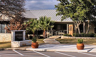
Horseshoe Bay is a city in Llano and Burnet counties in the U.S. state of Texas.

<span class="mw-page-title-main">Bardmoor, Florida</span> Census-designated place in Florida, United States

Bardmoor is a census-designated place (CDP) in Pinellas County, Florida, United States. The population was 9,732 at the 2010 census.

References

  1. "2019 U.S. Gazetteer Files". United States Census Bureau. Retrieved August 7, 2020.
  2. 1 2 "Population and Housing Unit Estimates". United States Census Bureau. May 24, 2020. Retrieved May 27, 2020.
  3. "Geographic Identifiers: 2010 Demographic Profile Data (G001): Brazos Country city, Texas". U.S. Census Bureau, American Factfinder. Archived from the original on February 10, 2020. Retrieved August 26, 2013.
  4. "Google Maps". Google Maps. Retrieved June 17, 2017.
  5. "US Gazetteer Files 2016-Places-Texas". US Census. Retrieved January 11, 2017.
  6. "Census of Population and Housing". Census.gov. Retrieved June 4, 2015.
  7. "River Ridge Golf Club | Home". Archived from the original on November 19, 2017. Retrieved October 22, 2019.
  8. "Boundary Changes". Geographic Change Notes: Texas. Population Division, United States Census Bureau. May 19, 2006. Archived from the original on August 6, 2010. Retrieved May 27, 2008.
  9. Brazos Country, Texas - Handbook of Texas.

29°45′14″N96°03′02″W / 29.75389°N 96.05056°W / 29.75389; -96.05056