Related Research Articles

Yakima County is a county in the U.S. state of Washington. As of the 2010 census, its population was 243,231. The county seat and largest city is Yakima. The county was formed out of Ferguson County in January 1865 and is named for the Yakama tribe of Native Americans.
Kittitas County is a county located in the U.S. state of Washington. At the 2010 census, its population was 40,915. Its county seat and largest city is Ellensburg. The county was created in November 1883 when it was carved out of Yakima County. Kittitas County comprises the Ellensburg, Washington, Micropolitan Statistical Area.

Chelan County is a county in the U.S. state of Washington. As of the 2010 census, its population was 72,453. The county seat and largest city is Wenatchee. The county was created out of Okanogan and Kittitas Counties on March 13, 1899. It derives its name from a Chelan Indian word meaning "deep water," likely a reference to 55-mile (89 km)-long Lake Chelan, which reaches a maximum depth of 1,486 feet.

Easton is an unincorporated community and census-designated place (CDP) in Kittitas County, Washington, United States. The population was 478 at the 2010 census.

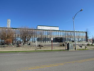
Kittitas is a city in Kittitas County, Washington, United States. The population was 1,381 at the 2010 census and an estimated 1,493 in 2018.

Ronald is an unincorporated community and census-designated place (CDP) in Kittitas County, Washington, United States. The population was 308 at the 2010 census.

Snoqualmie Pass is a census-designated place (CDP) in Kittitas County, Washington, United States. It includes the unincorporated community of Hyak. The population was 311 at the 2010 census.

Thorp is an unincorporated community and census-designated place (CDP) in Kittitas County, Washington, United States. In 2015, the population was 317 according to statistics compiled by Data USA.

The Wenatchee Mountains are a range of mountains in central Washington State, United States of America. A major subrange of the Cascade Range, extending east 50 miles (80 km) from the Cascade crest, the Wenatchee Mountains separate the drainage basins of the Yakima River from the Wenatchee River. The crest of the range forms part of the boundary between Chelan and Kittitas Counties.
State Route 10 (SR 10) is a 16.16-mile-long (26.01 km) state highway in the U.S. state of Washington. The highway is a remnant of U.S. Route 10 (US 10) in Kittitas County, traveling southeast along the Yakima River from SR 970 in Teanaway to US 97 northwest of Ellensburg. SR 10 was established in 1970 as the successor to US 10 after the completion of I-90 across the Snoqualmie Pass in 1968. The highway was previously part of State Road 3 from 1923 to 1937 and Primary State Highway 3 (PSH 3) until the 1964 highway renumbering.

Manastash Ridge is a long anticline mountain ridge located in central Washington state in the United States. Manastash Ridge runs mostly west-to-east in Kittitas and Yakima counties, for approximately 50 miles. The ridge is part of the Yakima Fold Belt of east-tending long ridges formed by the folding of Miocene Columbia River basalt flows.

Keechelus Lake is a lake and reservoir in the northwest United States, near Hyak in Kittitas County, Washington. Approximately fifty miles (80 km) southeast of Seattle and a few miles southeast of Snoqualmie Pass, it is the source of the Yakima River.

The Wild Horse Wind Farm is a 273-megawatt wind farm that generates energy for Puget Sound Energy that consists of one hundred twenty seven 1.8-megawatt Vestas V80 turbines and twenty two 2.0-megawatt Vestas V80 turbines on a 10,800-acre (4,400 ha) site in Kittitas County, Washington, 17 miles (27 km) east of Ellensburg, Washington. The turbines are placed on the high open Shrub-steppe ridge tops of Whiskey Dick Mountain, which was chosen for its energetic wind resource, remote location, and access to nearby power transmission lines. The towers are 221 feet (67 m) tall, and each blade is 129 feet (39 m) long, with a total rotor diameter of 264 feet (80 m), larger than the wingspan of a Boeing 747. The turbines can begin producing electricity with wind speeds as low as 9 mph (14 km/h) and reach full production at 31 mph (50 km/h). They shut down at sustained wind speeds of 56 mph (90 km/h). The site is also home to one of the largest solar array (500 kW) in Washington.

Umtanum Ridge is a long anticline mountain ridge in Yakima County and Kittitas County in the U.S. state of Washington. It runs for approximately 55 miles east-southeast from the Cascade Range, through the Yakima Training Center to the edge of the Columbia River at Priest Rapids Dam and Hanford Reach. The eastern end of Umtanum Ridge enters Hanford Reach National Monument and the Hanford Site. Umtanum Ridge is paralleled on the north by Manastash Ridge and on the south by Yakima Ridge. The Yakima River cuts through the ridge at the Umtanum Ridge Water Gap.

Wenas Wildlife Area is a 105,460-acre (42,680 ha) protected area managed by the Washington Department of Fish and Wildlife located in Yakima and Kittitas counties. The property was acquired in the mid-1960s to provide wintering grounds for the Yakima elk herd and is managed with the chief purpose of providing healthy wildlife habitat.

Bowers Field is a county-owned, public-use airport in Kittitas County, Washington, United States. It is located two nautical miles (4 km) north of the central business district of Ellensburg, Washington. This airport is included in the National Plan of Integrated Airport Systems for 2011–2015, which categorized it as a general aviation facility.

Monitor is a small unincorporated community in Chelan County, Washington, United States. It is situated along the Wenatchee River about 8 miles upstream from its junction with the Columbia River in the fertile Wenatchee Valley.
Teanaway is a small settlement in Kittitas County, Washington. It is located at the junction of State Route 10 and State Route 970. It is located east of Cle Elum and west of Ellensburg. The surrounding area is known as the Teanaway River Valley.
Horlick is an unincorporated community in Kittitas County, in the U.S. state of Washington.
Roza is an extinct town in Kittitas County, in the U.S. state of Washington. The GNIS classifies it as a populated place.
References
Municipalities and communities of Kittitas County, Washington, United States | ||
|---|---|---|
| Cities |  | |
| Town | ||
| CDPs | ||
| Unincorporated communities | ||
| Indian reservation | ||
| Ghost towns | ||
| Footnotes | ‡This populated place also has portions in an adjacent county or counties | |
Coordinates: 47°08′50″N120°47′59″W / 47.147275°N 120.79979°W
| | This Kittitas County, Washington state location article is a stub. You can help Wikipedia by expanding it. |