Hyak, Washington

Last updated
Hyak, Washington
Hyak Wa.jpg
Iron Horse Trailstop in Hyak, WA
USA Washington location map.svg
Red pog.svg
Hyak
Usa edcp location map.svg
Red pog.svg
Hyak
Coordinates: 47°N121°W / 47°N 121°W / 47; -121
Country United States
State Washington
County Kittitas
Time zone UTC-8 (Pacific (PST))
  Summer (DST) UTC-7 (PDT)
ZIP code
98068
Area code(s) 509
FIPS code [1]
GNIS feature ID [2]

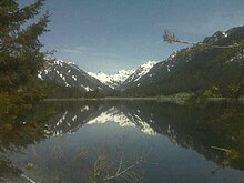
Hyak is an unincorporated community located on Snoqualmie Pass in Kittitas County, Washington. It is located within the Snoqualmie Pass CDP.

Contents

Hyak was established around 1915 at the eastern portal of the Snoqualmie Pass Milwaukee Road Railroad tunnel. Originally a train station, the community began to grow in the 1930s when the railroad built a world class ski area. Today there are approximately 200 full-time residences in Hyak and another 100 part-time.

Hyak is a Chinook Jargon word meaning "hurry", "fast", or "swift". [3]

Geography

Hyak is located two miles (3 km) east of the summit of Snoqulamie Pass at an elevation of 2,600 feet (790 m). It is 16 miles (26 km) northwest of Easton and is part of the Easton school district.

History

Keechelus Lake Hyak wa-keechelus lake.jpg
Keechelus Lake

In 1915, Hyak replaced Laconia as the main train station on Snoqualmie Pass. Hyak had a small school house, and a post office. The Milwaukee road built a ski area at Hyak (from 1937–1950) originally known as The Snoqualmie Ski Bowl until World War II. [4] After the war, it reopened as the Milwaukee Ski Bowl so it was not to be confused by The Snoqualmie Summit ski area located 2 miles north. A Class-A ski jump was built in 1941 and was said to be the largest ski jump in North America and held national championship events from 1941 until 1949 when the lodge was lost to fire. The train station saw its last train roll across its tracks in 1981 when the Milwaukee Road Railroad sold off the line and it was decommissioned. The old line is now part of the parks system called the Iron Horse State Park. The Hyak community still exists in the same area from which it started even though there is no train service. There is no longer a school and post office, but there are many more people living in the area today.

Economy

Summit at Snoqualmie Pass Ski Area Hyak wa-Summit at Snoqualmie Pass Ski Area.jpg
Summit at Snoqualmie Pass Ski Area

Most of the residents of Hyak work in the Seattle-Bellevue area and commute 25–50 miles. Hyak is also home to the Snoqualmie Pass Cable TV company as well as Hyak Ski Area, which is 25% of The Summit at Snoqualmie ski area.

Points of interest

See also

Related Research Articles

North Bend, Washington City in Washington, United States

North Bend is a city in King County, Washington, United States, on the outskirts of the Seattle metropolitan area. The population was 5,731 at the 2010 census and an estimated 7,136 in 2018.

Easton, Washington Census-designated place in Washington, United States

Easton is an unincorporated community and census-designated place (CDP) in Kittitas County, Washington, United States. The population was 478 at the 2010 census.

Snoqualmie Pass, Washington Census-designated place in Washington, United States

Snoqualmie Pass is a census-designated place (CDP) in Kittitas County, Washington, United States. It includes the unincorporated community of Hyak. The population was 311 at the 2010 census.

Chicago, Milwaukee, St. Paul and Pacific Railroad Class I railroad that operated in the Midwest and Northwest of the United States

The Chicago, Milwaukee, St. Paul and Pacific Railroad, often referred to as the "Milwaukee Road", was a Class I railroad that operated in the Midwest and Northwest of the United States from 1847 until 1986.

Stevens Pass

Stevens Pass is a mountain pass through the Cascade Mountains located at the border of King County and Chelan County in Washington, United States. U.S. Route 2 travels over the pass, reaching a maximum elevation of 5,845 feet (1,782 m). The Pacific Crest Trail crosses the highway at Stevens Pass. The BNSF Railway's Cascade Tunnel lies 1,180 feet (400 m) below the pass summit.

Alpental

Alpental, named after the German word for alpine valley, is both a valley in eastern King County, Washington, United States and a ski area in the valley. The valley is about 50 miles (80 km) east of Seattle, Washington and is north of Snoqualmie Pass, in the Washington Cascades. It is a popular outdoor recreation destination in both the summer and winter. The ski area is one of four areas which make up The Summit at Snoqualmie.

Snow shed construction built to protect roads and railway against avalanches

A snow shed, snow bridge or avalanche gallery is a type of rigid snow-supporting structure for avalanche control or to maintain passage in areas where snow removal becomes almost impossible. They can be made of steel, prestressed concrete frames, or timber. These structures can be fully enclosed, like an artificial tunnel, or consist of lattice-like elements. They are typically of robust construction considering the environments they must survive in.

Iron Horse State Park

Iron Horse State Park, part of the Washington State Park System, is a 1,612-acre (7 km2) state park located in the Cascade Mountains and Yakima River Valley, between Cedar Falls on the west and the Columbia River on the east.

Snoqualmie Tunnel

The Snoqualmie Tunnel is a former railroad tunnel near Snoqualmie Pass in the U.S. state of Washington, located east of Seattle. The tunnel crosses the Cascade Range about three miles (5 km) south of pass, which is used by Interstate 90, on the border between King County and Kittitas County. It is 11,894 feet long and is at an approximate elevation of 2,600 feet (790 m) above sea level, just north of Keechelus Lake. Its east portal is at Hyak.

Stampede Pass

Stampede Pass is a mountain pass in the northwest United States, through the Cascade Range in Washington. Southeast of Seattle and east of Tacoma, its importance to transportation lies almost entirely with railroading, as no paved roads cross it. It is approximately twelve miles (20 km) south-southeast of Snoqualmie Pass, the gap for Interstate 90, and two miles (3 km) south of Keechelus Lake.

The Summit at Snoqualmie

The Summit at Snoqualmie, is a winter resort in the northwest United States, located on Snoqualmie Pass, Washington. It provides alpine skiing and snowboarding, Nordic skiing, and winter tubing. Owned and managed by Boyne Resorts, it is 52 miles (80 km) east of downtown Seattle on Interstate 90.

Palouse to Cascades State Park Trail

The Palouse to Cascades State Park Trail, formerly known as the John Wayne Pioneer Trail, is a rail trail that spans most of the U.S. state of Washington. It follows the former railway roadbed of the Chicago, Milwaukee, St. Paul & Pacific Railroad for 300 miles (480 km) across two-thirds of the state, from the western slopes of the Cascade Mountains to the Idaho border.

Keechelus Lake lake in the United States of America

Keechelus Lake is a lake and reservoir in the northwest United States, near Hyak in Kittitas County, Washington. Approximately fifty miles (80 km) southeast of Seattle and a few miles southeast of Snoqualmie Pass, it is the source of the Yakima River.

Interstate 90 (I-90) is a transcontinental Interstate Highway that runs from Seattle, Washington, to Boston, Massachusetts. It crosses Washington state from west to east, traveling 298 miles (480 km) from Seattle across the Cascade Mountains and into Eastern Washington, reaching the Idaho state line east of Spokane. I-90 intersects several of the state's other major highways, including I-5 in Seattle, I-82 and U.S. Route 97 (US 97) near Ellensburg, and US 395 and US 2 in Spokane.

Mount Catherine (Washington) mountain in United States of America

Mount Catherine is a mountain peak in the Cascade Range in Washington state located near Snoqualmie Pass and Keechelus Lake. It is accessible via Forest Road 9070 except in winter. The Nordic Pass snowshoe trail starts near the Summit East ski area, and ends at this popular destination at a low point on the west ridge of Mount Catherine. Winter ascents of Mount Catherine are frequently done by continuing up the ridge to the summit.

State Route 906 (SR 906) is a 2.65-mile-long (4.26 km) state highway in the U.S. state of Washington, serving Snoqualmie Pass and its associated ski areas in King and Kittitas counties. The highway travels southeast between two interchanges with Interstate 90 (I-90) in Snoqualmie Pass and Hyak. SR 906 was formed out of segments of the former Sunset Highway that were bypassed by the construction of the controlled-access Interstate Highway over the pass. Between 360 and 2,100 vehicles use the road on an average day in 2012.

Snoqualmie Pass

Snoqualmie Pass is a mountain pass that carries Interstate 90 (I-90) through the Cascade Range in the U.S. state of Washington. The pass summit is at an elevation of 3,015 feet (919 m), on the county line between Kittitas County and King County.

A ski train is a passenger train which is marketed to carry passengers to ski resorts. A ski train may only operate during the winter sports season, or it may operate more frequently and have extra capacity during the winter sports season.

Milwaukee Ski Bowl

Milwaukee Ski Bowl was an alpine ski area in the northwest United States in Washington, and operated between 1937 and 1950. It was southeast of Seattle in the Cascade Range at Hyak, on the east side of Snoqualmie Pass.

Rockdale, Washington human settlement in Washington, United States of America

Rockdale is an extinct town in the northwest United States, in King County, Washington. The GNIS classifies it as a populated place.

References

  1. "American FactFinder". United States Census Bureau. Archived from the original on 2020-02-12. Retrieved 2008-01-31.
  2. "US Board on Geographic Names". United States Geological Survey. 2007-10-25. Retrieved 2008-01-31.
  3. Phillips, James W. (1971). Washington State Place Names. University of Washington Press. ISBN   0-295-95158-3.
  4. Lost Ski Areas of Washington, retrieved on July 22, 2009

Coordinates: 47°23′34″N121°23′34″W / 47.39278°N 121.39278°W / 47.39278; -121.39278