Easton, Washington

Last updated

Easton, Washington
Easton, WA.jpg
Easton as seen from the west side
Kittitas County Washington Incorporated and Unincorporated areas Easton Highlighted.svg
Location of Easton, Washington
Coordinates: 47°14′18″N121°10′42″W / 47.23833°N 121.17833°W / 47.23833; -121.17833
CountryUnited States
State Washington
County Kittitas
Area
  Total3.22 sq mi (8.34 km2)
  Land3.21 sq mi (8.31 km2)
  Water0.02 sq mi (0.04 km2)
Elevation
2,169 ft (661 m)
Population
 (2010)
  Total478
  Density149/sq mi (57.5/km2)
Time zone UTC−8 (Pacific (PST))
  Summer (DST) UTC−7 (PDT)
ZIP code
98925
Area code 509
FIPS code 53-19700 [1]
GNIS feature ID1519151 [2]

Easton is an unincorporated community and census-designated place (CDP) in Kittitas County, Washington, United States. The population was 478 at the 2010 census. [3] Easton is the annual site of the start/finish line for the Cascade Crest 100-mile ultra-running race.

Contents

History

Easton was platted in 1902. It was given its name by the Northern Pacific Railway due its location near the east end of the Stampede Tunnel through the Cascade Range. [4]

Geography

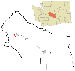
Easton is located in western Kittitas County at 47°14′18″N121°10′42″W / 47.23833°N 121.17833°W / 47.23833; -121.17833 (47.238368, -121.178327), [5] in the Yakima River valley. Interstate 90 passes through the community, with access from Exits 70 and 71. I-90 leads northwest over Snoqualmie Pass 70 miles (110 km) to Seattle and southeast 37 miles (60 km) to Ellensburg, the Kittitas county seat.

According to the United States Census Bureau, the Easton CDP has a total area of 3.2 square miles (8.3 km2), of which 0.02 square miles (0.04 km2), or 0.46%, are water. [3] Lake Easton, a reservoir at the junction of the Yakima and Kachess rivers, and Lake Easton State Park are at the west end of the community.

Climate

This region experiences warm (but not hot) and dry summers, with no average monthly temperatures above 71.6 °F. According to the Köppen Climate Classification system, Easton has a warm-summer Mediterranean climate, abbreviated "Csb" on climate maps. [6]

Climate data for Easton, Washington, 1991–2020 normals, 1905–2023 extremes: 2170ft (661m)
MonthJanFebMarAprMayJunJulAugSepOctNovDecYear
Record high °F (°C)52
(11)
61
(16)
68
(20)
80
(27)
92
(33)
107
(42)
99
(37)
99
(37)
93
(34)
83
(28)
62
(17)
58
(14)
107
(42)
Mean maximum °F (°C)45.9
(7.7)
50.8
(10.4)
58.1
(14.5)
69.6
(20.9)
80.3
(26.8)
87.8
(31.0)
93.1
(33.9)
93.7
(34.3)
86.8
(30.4)
72.2
(22.3)
54.8
(12.7)
46.0
(7.8)
95.4
(35.2)
Mean daily maximum °F (°C)35.5
(1.9)
40.1
(4.5)
46.0
(7.8)
52.5
(11.4)
61.0
(16.1)
66.9
(19.4)
75.5
(24.2)
76.1
(24.5)
69.0
(20.6)
56.0
(13.3)
42.5
(5.8)
35.2
(1.8)
54.7
(12.6)
Daily mean °F (°C)30.0
(−1.1)
32.8
(0.4)
37.3
(2.9)
42.5
(5.8)
50.0
(10.0)
56.0
(13.3)
63.0
(17.2)
63.0
(17.2)
56.2
(13.4)
45.6
(7.6)
35.9
(2.2)
30.1
(−1.1)
45.2
(7.3)
Mean daily minimum °F (°C)24.6
(−4.1)
25.4
(−3.7)
28.7
(−1.8)
32.5
(0.3)
39.0
(3.9)
45.1
(7.3)
50.5
(10.3)
49.8
(9.9)
43.3
(6.3)
35.2
(1.8)
29.4
(−1.4)
25.0
(−3.9)
35.7
(2.1)
Mean minimum °F (°C)9.2
(−12.7)
12.0
(−11.1)
16.6
(−8.6)
23.6
(−4.7)
29.5
(−1.4)
36.8
(2.7)
41.9
(5.5)
41.5
(5.3)
34.1
(1.2)
23.6
(−4.7)
16.5
(−8.6)
10.3
(−12.1)
3.4
(−15.9)
Record low °F (°C)−15
(−26)
−8
(−22)
1
(−17)
10
(−12)
20
(−7)
28
(−2)
25
(−4)
34
(1)
27
(−3)
8
(−13)
−4
(−20)
−6
(−21)
−15
(−26)
Average precipitation inches (mm)8.13
(207)
5.84
(148)
4.94
(125)
3.42
(87)
2.21
(56)
1.77
(45)
0.71
(18)
0.87
(22)
1.88
(48)
4.93
(125)
7.77
(197)
7.37
(187)
49.84
(1,265)
Average snowfall inches (cm)31.3
(80)
21.2
(54)
17.7
(45)
2.5
(6.4)
0.5
(1.3)
0.0
(0.0)
0.0
(0.0)
0.0
(0.0)
0.0
(0.0)
0.1
(0.25)
11.4
(29)
37.3
(95)
122
(310.95)
Average extreme snow depth inches (cm)32
(81)
28
(71)
22
(56)
3
(7.6)
1
(2.5)
0
(0)
0
(0)
0
(0)
0
(0)
0
(0)
7
(18)
24
(61)
46
(120)
Average precipitation days (≥ 0.01 in)201620171411449151920169
Average snowy days (≥ 0.1 in)1066200000041139
Source 1: NOAA [7]
Source 2: XMACIS2 (records, 2002-2020 monthly max/mins & snow) [8]
Climate data for Easton, Washington (1981-2010 Averages)
MonthJanFebMarAprMayJunJulAugSepOctNovDecYear
Record high °F (°C)53
(12)
60
(16)
72
(22)
88
(31)
91
(33)
98
(37)
104
(40)
102
(39)
98
(37)
85
(29)
65
(18)
60
(16)
104
(40)
Mean maximum °F (°C)48
(9)
51
(11)
60
(16)
72
(22)
82
(28)
88
(31)
96
(36)
95
(35)
88
(31)
76
(24)
57
(14)
49
(9)
97
(36)
Mean daily maximum °F (°C)35.4
(1.9)
41.0
(5.0)
46.9
(8.3)
52.9
(11.6)
61.0
(16.1)
67.2
(19.6)
75.9
(24.4)
76.7
(24.8)
70.3
(21.3)
58.1
(14.5)
42.1
(5.6)
35.0
(1.7)
55.1
(12.8)
Mean daily minimum °F (°C)22.5
(−5.3)
23.5
(−4.7)
27.9
(−2.3)
31.8
(−0.1)
38.4
(3.6)
45.5
(7.5)
49.5
(9.7)
49.4
(9.7)
42.3
(5.7)
34.8
(1.6)
28.2
(−2.1)
22.9
(−5.1)
34.7
(1.5)
Mean minimum °F (°C)1
(−17)
6
(−14)
15
(−9)
23
(−5)
29
(−2)
36
(2)
40
(4)
39
(4)
30
(−1)
24
(−4)
16
(−9)
8
(−13)
−5
(−21)
Record low °F (°C)−33
(−36)
−31
(−35)
−8
(−22)
11
(−12)
21
(−6)
29
(−2)
32
(0)
28
(−2)
21
(−6)
12
(−11)
−14
(−26)
−20
(−29)
−33
(−36)
Average precipitation inches (mm)7.45
(189)
4.73
(120)
4.34
(110)
3.26
(83)
2.31
(59)
1.81
(46)
0.94
(24)
0.67
(17)
1.70
(43)
3.62
(92)
8.23
(209)
6.47
(164)
45.53
(1,156)
Average snowfall inches (cm)46.8
(119)
31.9
(81)
22.5
(57)
5.5
(14)
0.1
(0.25)
0.0
(0.0)
0.0
(0.0)
0.0
(0.0)
0.0
(0.0)
1.2
(3.0)
18.4
(47)
38.2
(97)
164.6
(418.25)
Source 1: [9]
Source 2: [10]

Demographics

Some of the abandoned buildings in Easton Easton, WA 2.jpg
Some of the abandoned buildings in Easton

As of the census [1] of 2000, there were 383 people, 151 households, and 104 families residing in the CDP. The population density was 227.3 people per square mile (88.0/km2). There were 228 housing units at an average density of 135.3/sq mi (52.4/km2). The racial makeup of the CDP was 91.91% White, 0.78% Native American, 6.53% from other races, and 0.78% from two or more races. Hispanic or Latino of any race were 9.14% of the population.

There were 151 households, out of which 35.1% had children under the age of 18 living with them, 54.3% were married couples living together, 7.3% had a female householder with no husband present, and 31.1% were non-families. 21.9% of all households were made up of individuals, and 4.0% had someone living alone who was 65 years of age or older. The average household size was 2.54 and the average family size was 2.94.

In the CDP, the population was spread out, with 28.7% under the age of 18, 7.3% from 18 to 24, 29.5% from 25 to 44, 23.0% from 45 to 64, and 11.5% who were 65 years of age or older. The median age was 35 years. For every 100 females, there were 124.0 males. For every 100 females age 18 and over, there were 125.6 males.

The median income for a household in the CDP was $37,708, and the median income for a family was $37,917. Males had a median income of $33,750 versus $20,357 for females. The per capita income for the CDP was $19,773. About 3.7% of families and 7.5% of the population were below the poverty line, including 2.7% of those under age 18 and 26.7% of those age 65 or over.

Notable people

Points of interest

The post office Easton, WA 3.jpg
The post office

See also

Related Research Articles

<span class="mw-page-title-main">Kittitas County, Washington</span> County in Washington, United States

Kittitas County is a county located in the U.S. state of Washington. At the 2020 census, its population was 44,337. Its county seat and largest city is Ellensburg. The county was created in November 1883 when it was carved out of Yakima County. Kittitas County comprises the Ellensburg, Washington, Micropolitan Statistical Area.

<span class="mw-page-title-main">Grant County, Washington</span> County in Washington, United States

Grant County is a county located in the U.S. state of Washington. As of the 2020 census, the population was 99,123. The county seat is Ephrata, and the largest city is Moses Lake. The county was formed out of Douglas County in February 1909 and is named for U.S. President Ulysses S. Grant.

<span class="mw-page-title-main">Desert Aire, Washington</span> Census-designated place in Washington, United States

Desert Aire is a census-designated place (CDP) in Grant County, Washington, United States. Desert Aire's elevation is 560 ft (170 m). The population was 1,626 at the 2010 census, up from 1,124 at the 2000 census.

<span class="mw-page-title-main">Copalis Beach, Washington</span> CDP in Washington, United States

Copalis Beach is a census-designated place (CDP) in Grays Harbor County, Washington, United States. The population was 415 at the 2010 census.

<span class="mw-page-title-main">Neilton, Washington</span> Census-designated place in Washington, United States

Neilton is an unincorporated community and census-designated place (CDP) in Grays Harbor County, Washington, United States. The population was 315 at the 2010 census.

<span class="mw-page-title-main">Ames Lake, Washington</span> Census-designated place in Washington, United States

Ames Lake is an unincorporated community and census-designated place (CDP) in King County, Washington, United States. The population was 1,524 at the 2020 census, up from 1,486 at the 2010 census.

<span class="mw-page-title-main">Baring, Washington</span> Census-designated place in Washington, United States

Baring is an unincorporated community and census-designated place (CDP) in King County, Washington, United States. The population was 255 at the 2020 census, up from 220 at the 2010 census. It is located on U.S. Highway 2 about 23 miles (37 km) west of Stevens Pass, along a very flat and straight three-mile section of highway that has been dubbed the "Baring Straight", since US-2 is otherwise hilly and curvy through the mountains. The settlement was first known as "Salmon", but by 1909 it was known as Baring.

<span class="mw-page-title-main">Hobart, Washington</span> Census-designated place in Washington, United States

Hobart is an unincorporated community and census-designated place (CDP) in King County, Washington, United States. The population was 6,767 at the 2020 census.

<span class="mw-page-title-main">Lake Marcel-Stillwater, Washington</span> Census-designated place in Washington, United States

Lake Marcel-Stillwater is a census-designated place (CDP) in King County, Washington, United States. The population was 1,277 at the 2010 census.

<span class="mw-page-title-main">Cle Elum, Washington</span> City in Washington, United States

Cle Elum is a city in Kittitas County, Washington, United States. The population was 1,872 at the 2010 census. About 84 miles (135 km) by car from Seattle, Cle Elum is a popular area for camping and outdoor activities. It is also unofficially considered the starting point of Eastern Washington when driving east on I-90 from Seattle, although this is somewhat arbitrary since many consider either the town of Easton, anywhere east of Keechelus Lake, or the wildlife crossing bridge over I-90 to be the starting point.

<span class="mw-page-title-main">Kittitas, Washington</span> City in Washington, United States

Kittitas is a city in Kittitas County, Washington, United States. The population was 1,381 at the 2010 census and an estimated 1,493 in 2018. It is also a part of the Ellensburg micropolitan area.

<span class="mw-page-title-main">Ronald, Washington</span> Census-designated place in Washington, United States

Ronald is an unincorporated community and census-designated place (CDP) in Kittitas County, Washington, United States. The population was 308 at the 2010 census.

<span class="mw-page-title-main">Snoqualmie Pass, Washington</span> Census-designated place in Washington, United States

Snoqualmie Pass is a census-designated place (CDP) in Kittitas County, Washington, United States. It includes the unincorporated community of Hyak. The population was 311 at the 2010 census.

<span class="mw-page-title-main">Dallesport, Washington</span> Census-designated place in Washington, United States

Dallesport is an unincorporated community and census-designated place (CDP) in Klickitat County, Washington, United States. The population was 1,328 at the 2020 census.

<span class="mw-page-title-main">Greenwater, Washington</span> CDP in Washington, United States

Greenwater is a census-designated place (CDP) in the northwest United States in Pierce County, Washington. Southeast of Seattle, the population was 67 at the 2010 census, down from 91 in 2000.

<span class="mw-page-title-main">Lake Roesiger, Washington</span> CDP in Washington, United States

Lake Roesiger is a census-designated place (CDP) in Snohomish County, Washington, United States. The population was 503 at the 2010 census.

<span class="mw-page-title-main">Gleed, Washington</span> CDP in Washington, United States

Gleed is a census-designated place (CDP) in Yakima County, Washington, United States. The population was 2,906 at the 2010 census.

<span class="mw-page-title-main">Satus, Washington</span> CDP in Washington, United States

Satus is a census-designated place (CDP) in Yakima County, Washington, United States, located on the eastern corner of the Yakama Indian Reservation. The population was 746 at the 2000 census. It is southwest from the Toppenish National Wildlife Refuge. The community was not recognized in the 2010 census. The area was first settled and established as a post office location in 1890.

<span class="mw-page-title-main">Terrace Heights, Washington</span> CDP in Washington, United States

Terrace Heights is a census-designated place (CDP) in Yakima County, Washington, United States. The population was 9,244 at the 2020 census. It is essentially a suburb of the city of Yakima.

<span class="mw-page-title-main">White Swan, Washington</span> CDP in Washington, United States

White Swan is a census-designated place (CDP) in Yakima County, Washington, United States. The population was 3,033 at the 2000 census.

References

  1. 1 2 "U.S. Census website". United States Census Bureau . Retrieved January 31, 2008.
  2. "Easton". Geographic Names Information System . United States Geological Survey, United States Department of the Interior.
  3. 1 2 "Geographic Identifiers: 2010 Census Summary File 1 (G001), Easton CDP, Washington". American FactFinder. U.S. Census Bureau. Archived from the original on February 13, 2020. Retrieved July 5, 2019.
  4. Majors, Harry M. (1975). Exploring Washington. Van Winkle Publishing Co. p. 87. ISBN   978-0-918664-00-6.
  5. "US Gazetteer files: 2010, 2000, and 1990". United States Census Bureau. February 12, 2011. Retrieved April 23, 2011.
  6. Climate Summary for Easton, Washington
  7. "Easton, Washington 1991-2020 Monthly Normals" . Retrieved March 13, 2024.
  8. "xmACIS". National Oceanic and Atmospheric Administration. Retrieved March 13, 2024.
  9. NOWData – Climate. Retrieved May 20, 2023.
  10. [wrcc.dri.edu/cgi-bin/cliMAIN.pl?wa4406]. Retrieved May 20, 2023.