Saskatoon is the largest city in the Canadian province of Saskatchewan. It straddles a bend in the South Saskatchewan River in the central region of the province. It is located along the Trans-Canada Yellowhead Highway, and has served as the cultural and economic hub of central Saskatchewan since its founding in 1882 as a Temperance colony.

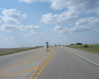
Highway 16 is a provincial highway in the Canadian province of Saskatchewan. It is the Saskatchewan section of the Yellowhead Highway, and also the Trans-Canada Highway Yellowhead section. The main purpose of this highway is to connect Saskatchewan with Canadian cities such as Edmonton and Winnipeg. The highway runs from the Alberta boundary in Lloydminster to the Manitoba boundary near Marchwell. Major cities it passes through are Saskatoon, North Battleford in the central part of the province, Yorkton in the far east and Lloydminster to the far west.

Saskatoon Arena was an indoor arena located in Saskatoon, Saskatchewan, which opened in October 1937, and which was demolished in March 1989. The arena was situated in downtown Saskatoon, on a site overlooking the South Saskatchewan River. It was the city's main entertainment venue for a half-century, before it was replaced in 1988 by Saskatchewan Place.

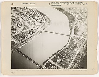
The Traffic Bridge is the name given to two truss bridges constructed across the South Saskatchewan River, connecting Victoria Avenue to 3rd Avenue South and Spadina Crescent in Saskatoon, Saskatchewan, Canada. The original bridge opened on October 10, 1907, and was the first bridge to carry motor vehicle traffic in Saskatoon, replacing an unreliable ferry service. The promised construction of the bridge was considered a prime factor in the amalgamation of the towns of Saskatoon, Nutana and Riversdale into one city named Saskatoon. The Traffic Bridge was the only road bridge in Saskatoon until 1916, when the University Bridge was completed. In 2010, the bridge was permanently closed due to severe corrosion and was demolished by 2016.

The University Bridge spans the South Saskatchewan River between Clarence Avenue and College Drive on the east shore with 25th Street on the west in Saskatoon, Saskatchewan Canada. The bridge is also known as the 25th Street Bridge and is a major commuter route between the two halves of Saskatoon. Between its opening in 1916 and the opening of the Circle Drive Bridge in 1983, it was the northernmost vehicular river crossing in the city. It is named for the fact that it provides access to the University of Saskatchewan.
Ring Road is a 4 lane controlled access highway in Regina, Saskatchewan, Canada. Ring Road is a partial ring road or beltway that forms a partial circle around Regina, bypasses the city on the north, east, and south sides, with Lewvan Drive and Pasqua Street N functioning as the de facto western leg. East of Pasqua Street, Ring Road continues west as 9th Avenue N, an arterial road. Ring Road has a speed limit of 100 km/h (60 mph) and consists of 13 interchanges.

The CPR Bridge is a Canadian railway bridge that spans the South Saskatchewan River in Saskatoon, Saskatchewan.

Saskatoon Transit is the public transport arm of the City of Saskatoon, Saskatchewan, Canada. It operates a fleet of diesel buses. A total of 23 bus routes serve every area of the city, carrying approximately 11 million passengers in 2008. Saskatoon Transit is a member of the Canadian Urban Transit Association. The major bus terminal is located Downtown.

Nutana is a primarily residential neighbourhood located near the centre of Saskatoon, Saskatchewan, Canada. It includes the business district of Broadway Avenue. It comprises a nearly even mixture of low-density, single detached dwellings and apartment-style multiple unit dwellings. As of 2009, the area is home to 6,261 residents. The neighbourhood is considered a middle to upper-income area, with an average family income of $67,657, an average dwelling value of $206,830 and a home ownership rate of 51.3%. First established in 1883, Nutana was the original settlement of what now makes up the city of Saskatoon.

The Central Business District is one of seven development districts in Saskatoon, Saskatchewan, Canada. The central business district is Ward 6 of a Mayor-Council government represented by councillor Cynthia Block. Formerly called West Saskatoon, this area arose when the steam engines built their pumping stations on the lower west bank of the South Saskatchewan River. Retail enterprises sprang up around the newly created train station and rail yards. The city of Saskatoon's Central Business District has shopping malls and boutiques.

Haultain is a mostly residential neighbourhood located in south-central Saskatoon, Saskatchewan, Canada. It is a suburban subdivision, consisting mostly of low-density, single detached dwellings. As of 2007, the area is home to 2,742 residents. The neighbourhood is considered a middle-income area, with an average family income of $47,890, an average dwelling value of $201,503 and a home ownership rate of 59.3%.

Central Industrial is a light industrial area in Saskatoon, Saskatchewan, Canada, that comprises educational, recreational facilities, hotels and businesses along Idylwyld Drive. The community meets up with the Central Business District CBD to the west and south, and residential areas east and north.

Avalon is a mostly residential neighbourhood located in south-central Saskatoon, Saskatchewan, Canada. It is a suburban subdivision, consisting mostly of low-density, single detached dwellings. As of 2007, the area is home to 3,214 residents. The neighbourhood is considered a middle-income area, with an average family income of $65,000, an average dwelling value of $168,444 and a home ownership rate of 77.3%.

The history of Saskatoon began with the first permanent non-indigenous settlement of Saskatoon, Saskatchewan, Canada, in 1883 when Toronto Methodists, wanting to escape the liquor trade in that city, decided to set up a "dry" community in the rapidly growing prairie region. As of 1882 this area was a part of the provisional district named Saskatchewan, North-West Territories (NWT). Their organization, the Temperance Colonization Society, first examined this area in 1882 and found that it would make an excellent location to found their community based on the ideals of the temperance movement; Saskatoon traditionally considers 1882 its founding year and thus marked its centennial in 1982. The settlers, led by John Neilson Lake, arrived on the site of what is now Saskatoon by traveling by railway from Ontario to Moose Jaw, Assiniboia, NWT, and then completing the final leg via horse-drawn cart. The plan for the Temperance Colony soon failed as the group was unable to obtain a large block of land within the community. Nonetheless, John Lake is commonly identified as the founder of Saskatoon; a public school, a park and two streets are named after him.

Stonebridge is a mostly residential neighbourhood located in south-central Saskatoon, Saskatchewan, Canada. It is a suburban subdivision, consisting of low-density, single detached dwellings and a mix of medium-density apartment and semi-detached dwellings. As of 2009, the area is home to 994 residents. The neighbourhood is considered a middle-income area, with an average family income of $67,642, an average dwelling value of $321,004 and a home ownership rate of 72.4%.

Circle Drive is a major road constructed as a ring road in Saskatoon, Saskatchewan, Canada. Its route constitutes both part of the Yellowhead Highway and Highway 11, signed as both along the entire length. It was first conceived in 1913 by the city commissioner and completed exactly 100 years later in 2013. Most of the route is a fully-controlled access freeway, however the segment between Airport Drive and Millar Avenue has at-grade intersections.

Broadway Avenue is an arterial road and commercial street in Saskatoon, Saskatchewan. It begins at the east end of the Broadway Bridge and continues south for about 4 kilometres until terminating at a cul-de-sac in the Avalon neighbourhood. The commercial portion, and the section usually referred to colloquially as "Broadway," is composed of the five blocks running south from the Broadway Bridge to 8th Street East, as well as the adjoining blocks east and west. This section makes up the Broadway Business Improvement District, and is a popular shopping and cultural destination of Saskatoon, featuring many restaurants and bars, boutique shops, local businesses, and annual street festivals, including the Saskatoon Fringe Theatre Festival.
Saskatchewan has a transportation infrastructure system of roads, highways, freeways, airports, ferries, pipelines, trails, waterways, and railway systems serving a population of approximately 1,132,505 inhabitants year-round.

The CN Industrial Area is the industrial subdivision located in southern Saskatoon. It is also known as South Saskatoon, after the CN rail siding located in the area. It is a part of the Nutana Suburban Development Area. This industrial park was established with the Grand Trunk Pacific Railway crossing the South Saskatchewan River.
The St. Louis Bridge is a Canadian traffic bridge that spans the South Saskatchewan River in St. Louis, Saskatchewan. It crosses the river from St. Louis into the Rural Municipality of Prince Albert No. 461. After having been closed for many years, the bridge reopened in October 2014.


