Brookfield, Washington

Last updated

Brookfield, Washington
View of Brookfield, Washington, from J.G.Megler Co. Prospectus, 1926.png
Impression of Brookfield, 1926
USA Washington location map.svg
Red pog.svg
Brookfield, Washington
Coordinates: 46°15′53″N123°33′38″W / 46.26472°N 123.56056°W / 46.26472; -123.56056
CountryUnited States
State Washington
County Wahkiakum
Established1873
Elevation
20 ft (6 m)
Population
 (1900)
  Total479 (peak)
Time zone UTC-8 (Pacific (PST))
  Summer (DST) UTC-7 (PDT)
GNIS feature ID1510839 [1]

Brookfield was a salmon-canning and fishing town located on the Columbia River in Wahkiakum County, Washington, United States, from 1873 to 1957. It was the home of the J.G. Megler Company.

Contents

History

Brookfield was established in 1873, when J.G.Megler built a salmon cannery [2] in the sheltered bay on the Washington side of the Columbia River between Jim Crow Point and the mouth of Jim Crow Creek (then part of Pacific County, later part of Wahkiakum County). He named the cannery "Brookfield Fisheries", after his wife Nellie E. Megler's birthplace of North Brookfield, Massachusetts. [3] The Brookfield post office opened on February 24, 1874 [4] with Joseph G. Megler as postmaster.

The majority of the residents were workers at the cannery and fishermen for the cannery. J.G. Megler & Co imported Croatian fishermen from Komiza to fish for them, and these families formed many of the Brookfield residents. The company also hired a Chinese canning crew seasonally to work at the cannery.

Around 1880 the Finke Brothers opened a barrel manufacture plant on Jim Crow Creek at Brookfield. The mill burned in 1923 and the brothers moved the plant to Kalama, Washington.

The first one-room school was established in Brookfield in 1888. Around 1924, a new two-room school was built, and a second teacher added. [5] The large, multi-docked salmon cannery commanded the bay. The Megler Mansion, a large turreted mansion, dominated the town, sitting on a ridge that provided a view across the Columbia River; the gardens featured trees from every state in the union, brought by visiting dignitaries. A street of houses ran along a road that encircled the bay, then led along Jim Crow Creek back into valley behind. The town was only accessible by boat, and was a regular stop on the ferry routes from Astoria, Oregon to Portland. [6] After a number of years of decline, the cannery burned on July 17, 1931 [7] and was not rebuilt. With the end of salmon canning in Brookfield, families continued to move away. By the late 1930s only a few families remained, but the school apparently remained open until 1945. [5]

The land was purchased by Crown Zellerbach Company in 1951 for its timber. The logging company built a road into Brookfield that finally connected the town to the state road system. [8] The post office finally closed on September 30, 1954. [9] At the time only three families remained living at Brookfield. In 1957, Crown Zellerbach bulldozed the remains of the town, in order to protect the timber from the risk of fire. [8]

In 2017, Jim Crow Point and Jim Crow Creek were renamed to Brookfield Point and Harlows Creek respectively. [10] [11]

Geography

Brookfield is situated in a bay on the North shore of the Columbia River, sheltered from Pacific storms by Brookfield Point on the West, and bounded by Harlows Creek on the East, which also provided the town with fresh water via a small damn and pipe system.

Originally the bay sported a wide sandy beach and easy access to deep water via the J.G. Megler cannery dock. [12] Crown Zellerbach modified the bay to create a log dump, filling part of the bay. [8] Later, dredgings of the Columbia River were piled on the old Brookfield waterfront, creating large hillocks used for four-wheeling.

Demographics

Historical population
CensusPop.Note
1880 196
1900 479
1910 361−24.6%
1920 241−33.2%
1930 90−62.7%
1940 24−73.3%
U.S. Decennial Census [13]

As a town dominated by one business - salmon canning - Brookfield's population varied seasonally, with the population rising during the summer/fall salmon canning months, when seasonal workers would move to the town for the duration of the canning season. The census numbers fluctuate wildly depending on the alignment of the date of the census with the seasonal nature of the business; thus the 1885, 1887 and 1920 numbers are likely to reflect permanent residents and exclude seasonal cannery workers.

The census records also show a significant change in the heritage of the inhabitants over the life of the town, beginning with a population consisting primarily of contract Chinese cannery workers in 1880, a large "Indian half-breed" (territorial census classification) population in 1885, and shifting to a largely Austria-Hungarian population of fishermen in the later years.

Related Research Articles

<span class="mw-page-title-main">Astoria, Oregon</span> City in Oregon, United States

Astoria is a port city and the seat of Clatsop County, Oregon, United States. Founded in 1811, Astoria is the oldest city in the state and was the first permanent American settlement west of the Rocky Mountains. The county is the northwest corner of Oregon, and Astoria is located on the south shore of the Columbia River, where the river flows into the Pacific Ocean. The city is named for John Jacob Astor, an investor and entrepreneur from New York City, whose American Fur Company founded Fort Astoria at the site and established a monopoly in the fur trade in the early 19th century. Astoria was incorporated by the Oregon Legislative Assembly on October 20, 1856.

<span class="mw-page-title-main">Dillingham, Alaska</span> City in Alaska, United States

Dillingham, also known as Curyung, is a city in Dillingham Census Area, Alaska, United States. Incorporated in 1963, it is an important commercial fishing port on Nushagak Bay. As of the 2020 census, the population of the city was 2,249, down from 2,329 in 2010.

<span class="mw-page-title-main">Petersburg, Alaska</span> CDP in Alaska, United States

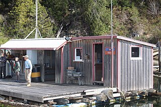
Petersburg is a census-designated place (CDP) in and essentially the borough seat of Petersburg Borough, Alaska, United States. The population was 3,043 at the 2020 census, up from 2,948 in 2010.

<span class="mw-page-title-main">Pacific City, Oregon</span> Unincorporated community in the state of Oregon, United States

Pacific City is a census-designated place (CDP) and unincorporated community in Tillamook County, Oregon, United States. The population was 1,076 at the 2019 census. Pacific City's main attraction is the Cape Kiwanda State Natural Area.

<span class="mw-page-title-main">Chinook, Washington</span> CDP in Washington, United States

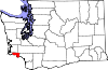
Chinook is a census-designated place (CDP) in Pacific County, Washington, United States. The population was 457 at the 2000 census and increased to 466 at the 2010 census.

<span class="mw-page-title-main">Chinookan peoples</span> Group of Indigenous people in the Pacific Northwest

Chinookan peoples include several groups of Indigenous people of the Pacific Northwest in the United States who speak the Chinookan languages. Since at least 4000 BCE Chinookan peoples have resided along the Lower and Middle Columbia River (Wimahl) from the river's gorge downstream (west) to the river's mouth, and along adjacent portions of the coasts, from Tillamook Head of present-day Oregon in the south, north to Willapa Bay in southwest Washington. In 1805 the Lewis and Clark Expedition encountered the Chinook Tribe on the lower Columbia.

Grays River is a tributary of the Columbia River, approximately 30 miles (48 km) long, in southwestern Washington in the United States. One of the last tributaries of the Columbia on the Washington side, it drains an area of low hills north of the mouth of the river.
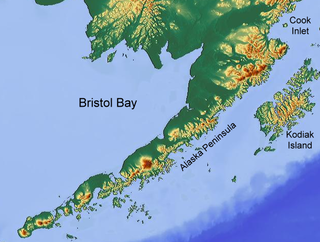
Steveston, founded in the 1880s, is a neighbourhood of Richmond in Metro Vancouver. On the southwest tip of Lulu Island, the village is a historic port and salmon canning centre at the mouth of the South Arm of the Fraser River. The early 1900s style architecture attracts both the film and tourism industries.

<span class="mw-page-title-main">Westport, Oregon</span> Unincorporated community in the state of Oregon, United States

Westport is an unincorporated community and census-designated place on the Columbia River in Clatsop County, Oregon, United States. As of the 2010 census, it had a population of 321.

The Ilwaco Railway and Navigation Company operated a 3 ft narrow gauge railroad that ran for over forty years from the bar of the Columbia River up the Long Beach Peninsula to Nahcotta, Washington, on Willapa Bay. The line ran entirely in Pacific County, Washington, and had no connection to any outside rail line. The railroad had a number of nicknames, including the "Clamshell Railroad" and the "Irregular, Rambling and Never-Get-There Railroad."

<span class="mw-page-title-main">Washington State Route 409</span> Washington state highway in Wahkiakum County

State Route 409 (SR 409) is a short Washington state highway in Wahkiakum County. The highway runs north from the Wahkiakum County Ferry on Puget Island to SR 4 in the county seat of Cathlamet over a distance of 3.84 miles (6.18 km). The route connects Westport, Oregon, which is served by the county ferry, and Cathlamet. The highway was referred to as Secondary State Highway 12F (SSH 12F) from 1943 until 1964.

<span class="mw-page-title-main">Salmon cannery</span> Factory that commercially cans salmon

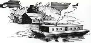
A salmon cannery is a factory that commercially cans salmon. It is a fish-processing industry that became established on the Pacific coast of North America during the 19th century, and subsequently expanded to other parts of the world that had easy access to salmon.

<span class="mw-page-title-main">Astoria–Megler ferry</span> Defunct ferry route between Oregon and Washington

The Astoria–Megler ferry, also called the Astoria–McGowan ferry and the Astoria–North Beach ferry, ran across the Columbia River between Astoria, Oregon, and two ferry docks near the present small community of Megler, Washington, from 1921 to 1966.

<span class="mw-page-title-main">Environmental issues with salmon</span>

Salmon population levels are of concern in the Atlantic and in some parts of the Pacific. Salmon are typically anadromous - they rear and grow in freshwater, migrate to the ocean to reach sexual maturity, and then return to freshwater to spawn. Determining how environmental stressors and climate change will affect these fisheries is challenging due to their lives split between fresh and saltwater. Environmental variables like warming temperatures and habitat loss are detrimental to salmon abundance and survival. Other human influenced effects on salmon like overfishing and gillnets, sea lice from farm raised salmon, and competition from hatchery released salmon have negative effects as well.

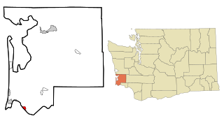
Altoona is a census-designated place (CDP) in Wahkiakum County, Washington, approximately 27 miles northwest of the town of Cathlamet. The population was 39 as of the 2010 census. The CDP includes the communities of Carlson Landing and Dahlia.

<span class="mw-page-title-main">Joseph George Megler</span> American politician

Joseph George Megler, generally known as J.G. Megler, was a German-American salmon cannery owner and politician in Washington. He was a member of the Washington House of Representatives for the first legislature in 1889 and five terms thereafter. He was also a member of the Washington State Senate for two terms.

Kildonan is an unincorporated community in the Alberni Inlet-Barkley Sound region of the west coast of southern Vancouver Island, British Columbia. The former steamboat landing and ferry dock is on the east shore of Uchuchklesit Inlet, which branches northwest of the lower reaches of Alberni Inlet. Adjacent to Pacific Rim National Park Reserve, the locality is by road and ferry about 120 kilometres (75 mi) southwest of Port Alberni.

Puget Sound fishermen's strike of 1949 was a labor strike by fishermen in the Pacific Northwest.

<span class="mw-page-title-main">Harlows Creek (Washington)</span>

Harlows Creek is a stream in Wahkiakum County in the U.S. state of Washington. The name of the stream used to be Jim Crow Creek until it was changed by the U.S. Board of Geographic Names effective May 10, 2017 as part of an nationwide effort to remove offensive and/or derogatory names from geographic features. The new name commemorates John (1872-1953) and Mary (1888-1963) Harlow, who lived in the area during the 1870s.

Nikola Bezmalinovic, known as Nick Bez was founder of fishing, canning, and shipping companies in Juneau, Alaska. Nick Bez operated the largest fishing ship at the time the 423-foot, Pacific Explorer. Nick Bez also owned and operated the Nornek cannery, two gold mines, Alaska Southern Packing Company, Peter Pan Seafoods, Alaska Southern Airways, Pacific Exploration Company and the Intercoastal Packing Company as well as West Coast Airlines which became part of Air West. Nick Bez became known as a rags to riches entrepreneur. In 1919 Nikola Bezmalinovic changed his name to Nick Bez. Nick Bez died in 1969.

References

  1. "US Board on Geographic Names". United States Geological Survey. October 25, 2007. Retrieved January 31, 2008.
  2. Carlson, Linda (February 10, 2014). Company towns of the Pacific Northwest. University of Washington Press. pp. 116–. ISBN   9780295805535 . Retrieved May 11, 2014.
  3. Names Manuscripts, Origin of Washington Geographic Names, University of Washington Accession 106-3-80-16
  4. Daily Pacific Tribune, March 5, 1874, p.3, col 1; Postmarked Washington: Pacific and Wahkiakum Counties, Guy Reed Ramsey, edited by Alan H. Patera, copyright 1987
  5. 1 2 Sou'wester, Vol 43, pge. 43
  6. State of Washington, 1907 - Its Resources, Natural, Industrial and Commercial. Published by the Bureau of Statistics, Agriculture and Immigration. Olympia, Washington.
  7. Astorian Evening Budget, Friday, July 17, 1931, pg 1: "Fire Wrecks Megler Cannery At Brookfield"
  8. 1 2 3 Oregon Journal, 13 October 1957, p.D1, "Farewell to Old Brookfield"
  9. Postmarked Washington: Pacific and Wahkiakum Counties, Guy Reed Ramsey, 1987
  10. "Domestic Names | U.S. Geological Survey". Usgs.gov. Retrieved January 31, 2022.
  11. "GNIS Detail - Harlows Creek". Archived from the original on July 13, 2020. Retrieved July 8, 2020.
  12. Picture of multi-masted sailing boat moored at cannery dock, Brookfield, Oregon Historical Society
  13. U.S. Census Bureau