Browns Field (New South Wales)

Last updated

Browns Field (New South Wales)
New South Wales
Browns Field with tractor.jpg
Browns Field rainforest NSW.jpg
rainforest at Browns Field
Australia New South Wales relief location map.png
Red pog.svg
Browns Field (New South Wales)
Coordinates 33°44′2.8″S151°06′30.45″E / 33.734111°S 151.1084583°E / -33.734111; 151.1084583 Coordinates: 33°44′2.8″S151°06′30.45″E / 33.734111°S 151.1084583°E / -33.734111; 151.1084583
Website Browns Field (New South Wales)

Browns Field is located in Fox Valley Wahroonga, 17 km (11 mi) north-west from Sydney, in the state of New South Wales, Australia. It contains a small sporting ground and a bushland reserve. A unique rainforest grows nearby, due to enriched soils from ancient volcanic activity. [1]

Wahroonga, New South Wales Suburb of Sydney, New South Wales, Australia

Wahroonga is an affluent north shore suburb on the Upper North Shore of Sydney, in the state of New South Wales, Australia, 22 kilometres north-west of the Sydney central business district, in the local government area of Ku-ring-gai Council and Hornsby Shire.

Sydney City in New South Wales, Australia

Sydney is the state capital of New South Wales and the most populous city in Australia and Oceania. Located on Australia's east coast, the metropolis surrounds Port Jackson and extends about 70 km (43.5 mi) on its periphery towards the Blue Mountains to the west, Hawkesbury to the north, the Royal National Park to the south and Macarthur to the south-west. Sydney is made up of 658 suburbs, 40 local government areas and 15 contiguous regions. Residents of the city are known as "Sydneysiders". As of June 2017, Sydney's estimated metropolitan population was 5,131,326, and is home to approximately 65% of the state's population.

New South Wales State of Australia

New South Wales is a state on the east coast of Australia. It borders Queensland to the north, Victoria to the south, and South Australia to the west. Its coast borders the Tasman Sea to the east. The Australian Capital Territory is an enclave within the state. New South Wales' state capital is Sydney, which is also Australia's most populous city. In March 2018, the population of New South Wales was over 7.9 million, making it Australia's most populous state. Just under two-thirds of the state's population, 5.1 million, live in the Greater Sydney area. Inhabitants of New South Wales are referred to as New South Welshmen.

Contents

Geology

Browns Field is situated on a maar-diatreme. It was around 200 metres in diameter. The mafic soils are a typical dark colour. The diatreme occurred in the early Jurassic, around 200 million years ago. The volcanic explosion erupted through the local Sydney sandstone. Much of the rock formed by the diatreme is buried under soil cover, as well as landfill that helped create the sports oval at Browns Field. The soil is a mixture of organic material, and a soil horizon made up of weathered regolith particles. Rocky evidence of the diatreme is not obviously seen. [1] [2]

Maar Low-relief volcanic crater

A maar is a broad, low-relief volcanic crater caused by a phreatomagmatic eruption. A maar characteristically fills with water to form a relatively shallow crater lake which may also be called a maar. The name comes from a Moselle Franconian dialect word used for the circular lakes of the Daun area of Germany. Maars are shallow, flat-floored craters that scientists interpret as having formed above diatremes as a result of a violent expansion of magmatic gas or steam; deep erosion of a maar presumably would expose a diatreme. Maars range in size from 60 to 8,000 m across and from 10 to 200 m deep; most maars commonly fill with water to form natural lakes. Most maars have low rims composed of a mixture of loose fragments of volcanic rocks and rocks torn from the walls of the diatreme.

Diatreme A volcanic pipe formed by a gaseous explosion

A diatreme, sometimes known as a maar-diatreme volcano, is a volcanic pipe formed by a gaseous explosion. When magma rises up through a crack in the Earth's crust and makes contact with a shallow body of ground water, rapid expansion of heated water vapor and volcanic gases can cause a series of explosions. A relatively shallow crater is left and a rock filled fracture in the Earth's crust. Diatremes breach the Earth's surface and produce a steep inverted cone shape.

Mafic Silicate mineral or igneous rock that is rich in magnesium and iron

Mafic is an adjective describing a silicate mineral or igneous rock that is rich in magnesium and iron, and is thus a portmanteau of magnesium and ferric. Most mafic minerals are dark in color, and common rock-forming mafic minerals include olivine, pyroxene, amphibole, and biotite. Common mafic rocks include basalt, diabase and gabbro. Mafic rocks often also contain calcium-rich varieties of plagioclase feldspar.

History

The local indigenous Australian people, the Kuringgai occupied this area for thousands of years. The emancipated convict Thomas Hyndes settled the nearby area in 1822. In 1838, Governor Darling made a 259 hectare land grant to Hyndes. He worked the land with convict labour supplying timber to the colony of New South Wales. In 1854 the area was sold to John Brown, a merchant and timber getter. He also planted orchards nearby. [3] Locally known as 'Squire Brown', he owned of a square mile of land. At his peak, he employed one hundred pairs of pit-sawyers. These were used for various projects, including the supply of timber for the Pyrmont and Glebe Island Bridges. [4] The area currently used as a sporting field was once indigenous forest, and later, a rubbish tip.

Indigenous Australians are the Aboriginal and Torres Strait Islander people of Australia, descended from groups that existed in Australia and surrounding islands before British colonisation. The time of arrival of the first Indigenous Australians is a matter of debate among researchers. The earliest conclusively human remains found in Australia are those of Mungo Man LM3 and Mungo Lady, which have been dated to around 50,000 years BP. Recent archaeological evidence from the analysis of charcoal and artefacts revealing human use suggests a date as early as 65,000 BP. Luminescence dating has suggested habitation in Arnhem Land as far back as 60,000 years BP. Genetic research has inferred a date of habitation as early as 80,000 years BP. Other estimates have ranged up to 100,000 years and 125,000 years BP.

Kuringgai

Kuringgai is an ethnonym referring to (a) an hypothesis regarding an aggregation of indigenous Australian peoples occupying the territory between the southern borders of the Gamilaraay and the area around Sydney (b) perhaps an historical people with its own distinctive language, now lost, once located in part of that territory, or (c) people of aboriginal origin who identify themselves as descending from the original peoples denoted by (a) or (b) and who call themselves Guringai.

An emancipist was a convict sentenced and transported under the convict system to Australia, who had been given a conditional or absolute pardon. The term was also used to refer to those convicts whose sentences had expired, and might sometimes be used of free settlers who supported full civil rights for emancipated convicts.

Recreation

The oval is used for various activities such as football and cricket. [5] A bushwalking track starts near the field. [6]

Association football Team field sport

Association football, more commonly known as football or soccer, is a team sport played with a spherical ball between two teams of eleven players. It is played by 250 million players in over 200 countries and dependencies, making it the world's most popular sport. The game is played on a rectangular field called a pitch with a goal at each end. The object of the game is to score by moving the ball beyond the goal line into the opposing goal.

Cricket Team sport played with bats and balls

Cricket is a bat-and-ball game played between two teams of eleven players on a field at the centre of which is a 20-metre (22-yard) pitch with a wicket at each end, each comprising two bails balanced on three stumps. The batting side scores runs by striking the ball bowled at the wicket with the bat, while the bowling and fielding side tries to prevent this and dismiss each player. Means of dismissal include being bowled, when the ball hits the stumps and dislodges the bails, and by the fielding side catching the ball after it is hit by the bat, but before it hits the ground. When ten players have been dismissed, the innings ends and the teams swap roles. The game is adjudicated by two umpires, aided by a third umpire and match referee in international matches. They communicate with two off-field scorers who record the match's statistical information.

Hiking walking as a hobby, sport, or leisure activity

Hiking is the preferred term, in Canada and the United States, for a long, vigorous walk, usually on trails (footpaths), in the countryside, while the word walking is used for shorter, particularly urban walks. On the other hand, in the United Kingdom, and the Republic of Ireland, the word "walking" is acceptable to describe all forms of walking, whether it is a walk in the park or backpacking in the Alps. The word hiking is also often used in the UK, along with rambling, hillwalking, and fell walking. The term bushwalking is endemic to Australia, having been adopted by the Sydney Bush Walkers club in 1927. In New Zealand a long, vigorous walk or hike is called tramping. It is a popular activity with numerous hiking organizations worldwide, and studies suggest that all forms of walking have health benefits.

Flora

Many rainforest plants unusual to the Sydney area are present. Such as golden sassafras, [7] jackwood, scrub turpentine, wild quince, giant maidenhair, fishbone water fern, strap water fern, and the sub tropical rainforest tree, the koda. [8] The paucity of fire, dark volcanic soils and high rainfall, contribute to rainforest vegetation. The average annual rainfall is 1,400 mm (55 in) at the nearby Kissing Point Road weather station. [9]

Rainforest type of forest with high rainfall

Rainforests are forests characterized by high rainfall, with annual rainfall in the case of tropical rainforests between 250 and 450 centimetres, and definitions varying by region for temperate rainforests. The monsoon trough, alternatively known as the intertropical convergence zone, plays a significant role in creating the climatic conditions necessary for the Earth's tropical rainforests.

<i>Doryphora sassafras</i> species of plant

Doryphora sassafras, commonly known as sassafras, yellow-, canary- or golden sassafras, or golden deal, is a species of evergreen tree of the family Atherospermataceae native to the subtropical and temperate rainforests of eastern New South Wales and Queensland, Australia. It is a tall tree with green foliage and contrasting white flowers which occur in Autumn and Winter.

<i>Cryptocarya glaucescens</i> species of plant

Cryptocarya glaucescens, commonly known as jackwood, is a rainforest tree of the laurel family growing in eastern Australia.

Fauna

Ring-tail possums, brushtail possums and grey-headed flying foxes are common. Many bird species live nearby, such as rainbow lorikeets, Australian king parrots, crimson rosellas, currawongs, koel and the tawny frogmouth. The powerful owl is known to nest in the reserve. [1]

Common ringtail possum species of mammal

The common ringtail possum is an Australian marsupial. It lives in a variety of habitats and eats a variety of leaves of both native and introduced plants, as well as flowers, fruits and sap. This possum also consumes a special type of faeces that is produced during the daytime when it is resting in a nest. This behaviour is called caecotrophy and is similar to that seen in rabbits.

Brushtail possum genus of mammals

The brushtail possums are the members of the genus Trichosurus in the Phalangeridae, a family of marsupials. They are unique among marsupials for having shifted the hypaxial muscles from the epipubic to the pelvis, much like in placental muscles, meaning that their breathing cycle is more similar to the latter than to that of other non-eutherian mammals. In general, they are more terrestrial oriented than other possums, and in some ways might parallel primates.

Grey-headed flying fox species of mammal

The grey-headed flying fox is a megabat native to Australia. The species shares mainland Australia with three other members of the genus Pteropus: the little red P. scapulatus, spectacled P. conspicillatus, and the black P. alecto.

Bush regeneration

Forest conservation work is in progress. The weeds trad and privet being particularly troublesome. [8]

Related Research Articles

Ku-ring-gai Chase National Park Protected area in New South Wales, Australia

The Ku-ring-gai Chase National Park is a protected national park that is located in New South Wales, Australia. The 14,977-hectare (37,010-acre) national park is situated 25 kilometres (16 mi) north of Sydney located largely within the Ku-ring-gai, Hornsby, and the Northern Beaches Council local government areas. The villages of Cottage Point, Appletree Bay, and Bobbin Head are located within park boundaries. An isolated portion of the park, Barrenjoey Headland, is located to the north of Palm Beach east of the primary park body and is home to Barrenjoey Lighthouse.

Lane Cove National Park Protected area in New South Wales, Australia

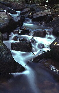
The Lane Cove National Park is a protected national park that is located within metropolitan Sydney, in New South Wales, Australia. The 372-hectare (920-acre) national park is situated about 10 kilometres (6.2 mi) north-west of the Sydney central business district and features various vegetation types, such as, wet and dry sclerophyll forest, heathland, mangroves and tidal flats. The park consists of land near the banks of the Lane Cove River, which flows generally south-east into Sydney Harbour. It also extends to the outskirts of Pennant Hills and Wahroonga at its northern boundaries.

DAguilar National Park Protected area in Queensland, Australia

D'Aguilar is a national park in Queensland, Australia, 31 km northwest of Brisbane. The southern part of the park was formerly known as Brisbane Forest Park, while the northern part of the park is at Mount Mee.

Ku-ring-gai Council Local government area in New South Wales, Australia

Ku-ring-gai Council is a local government area on the Upper North Shore of Sydney, in the state of New South Wales, Australia. The region is named after the Kuringgai tribe who once inhabited the area.

St Ives, New South Wales Suburb of Sydney, New South Wales, Australia

St Ives is a suburb on the Upper North Shore of Sydney in the state of New South Wales, Australia 18 kilometres north of the Sydney Central Business District in the local government area of Ku-ring-gai Council. St Ives Chase is a separate suburb, to the north.

North Shore (Sydney) Region in New South Wales, Australia

The North Shore is the primarily residential area of northern metropolitan Sydney, in New South Wales, Australia. The term generally refers to the suburbs located on the north shore of Sydney Harbour up to Hornsby and between Middle Harbour and the Lane Cove National Park.

Hornsby Shire Local government area in New South Wales, Australia

Hornsby Shire is a local government area situated on the Upper North Shore and Northern Suburbs of Sydney, as well as parts of the Hills District, in the state of New South Wales, Australia. The Shire stretches from the M2 Hills Motorway in the south to the Hawkesbury River town of Wisemans Ferry, some 53 kilometres (33 mi) to the north, making it the largest local government council in the Greater Sydney Metropolitan region in terms of total area. As of the 2016 census the Shire had an estimated population of 142,667.

Wahroonga railway station railway station in Sydney, New South Wales, Australia

Wahroonga railway station is a heritage-listed railway station located on the North Shore line, serving the Sydney suburb of Wahroonga. The station is located in the Ku-ring-gai Council local government area of New South Wales, Australia. It is served by Sydney Trains T1 North Shore line services. It was built from 1890 to 1910 by E. Pritchard & Co., contractor. It is also known as Wahroonga Railway Station group and Pearce's Corner; Noonan's Platform. The property is owned by RailCorp. It was added to the New South Wales State Heritage Register on 2 April 1999.

Mount Kuring-gai, New South Wales Suburb of Sydney, New South Wales, Australia

Mount Kuring-gai is a suburb of northern Sydney, in the state of New South Wales, Australia. Mount Kuring-gai is located 31 kilometres north-west of the Sydney central business district, in the local government area of Hornsby Shire.

North Wahroonga, New South Wales Suburb of Sydney, New South Wales, Australia

North Wahroonga is a suburb on the Upper North Shore of Sydney, in the state of New South Wales, Australia. North Wahroonga is located 23 kilometres north-west of the Sydney central business district, in the local government area of Ku-ring-gai Council. Wahroonga is a separate suburb, to the south.

Electoral district of Ku-ring-gai state electoral district of New South Wales, Australia

Ku-ring-gai is an electoral district of the Legislative Assembly in the Australian state of New South Wales. It is represented by Alister Henskens of the Liberal Party. The electorate covers the suburbs and parts of the suburbs of Gordon, Hornsby, Killara, Lindfield, Normanhurst, North Turramurra, North Wahroonga, Pymble, South Turramurra, Thornleigh, Turramurra, Wahroonga, Waitara, Warrawee, and West Pymble.

Eastern Australian temperate forests

The Eastern Australian temperate forests, or temperate eucalypt forests, are an ecoregion of open forest on uplands starting from the east coast of New South Wales in the South Coast to southern Queensland, Australia. Four distinguishable communities are found within this ecoregion: subtropical rainforest, subtropical dry rainforest, warm temperate rainforest, and cool temperate rainforest, where they may also grade to other biomes, depending on the location.

Booyong Flora Reserve Protected area in New South Wales, Australia

The Booyong Flora Reserve is a protected nature reserve located in Booyong in the Northern Rivers region of New South Wales, Australia. The 13-hectare (32-acre) sub–tropical jungle is situated 18 kilometres (11 mi) northeast of Lismore and is a remnant of the Big Scrub, of which less than one percent of the original Big Scrub remains.

Lane Cove Bushland Park

Lane Cove Bushland Park is located in suburban Lane Cove, 5 kilometres from the centre of Sydney, Australia. It is regarded as one of the more interesting areas of fungi in the country. In the year 2000, Bushland Park was placed on the Register of the National Estate, under the Australian Heritage Commission Act, 1975. Average annual rainfall is 1220 mm. Soils are moderately fertile, based on Hawkesbury sandstone and Ashfield Shale. The climate is warm and humid.

Ferndale Park New South Wales, Australia

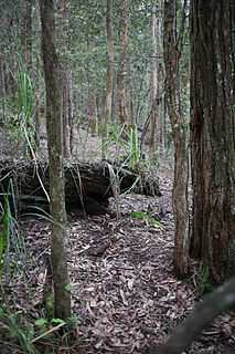
Ferndale Park is located in suburban Chatswood West, 8 km (5 mi) from the centre of Sydney, Australia. It is an important urban forest reserve, preserving Blackbutt forest and the mossy gully rainforest. Most of this original forest was cleared for agriculture and housing in the 19th and 20th century.

Cambewarra Range Nature Reserve nature reserve of New South Wales


The Cambewarra Range Nature Reserve, as part of the Kangaroo Valley Group of Nature Reserves, is a protected area located on the cliffs and plateaus of the Kangaroo Valley in the Southern Highlands and South Coast regions of New South Wales in eastern Australia. The Reserve is situated approximately 150 kilometres (93 mi) south of Sydney, 50 kilometres (31 mi) southwest of Wollongong and 16 kilometres (9.9 mi) northwest of Nowra. The Reserve has a total area of 1684 hectares, and includes 11 privately owned properties. It is critical for it to be pristine for a variety of reasons, not the least the catchment of water, as the Reserve floor flows into the Kangaroo Valley River and the Shoalhaven River, from which the Sydney Water Authority draws water to supply large populations in Sydney and Wollongong.

<i>Mahratta, Wahroonga</i>

Mahratta is a heritage-listed former residence and bank executive training facility and now childcare centre, primary school and community group headquarters at 1526 Pacific Highway, Wahroonga, Ku-ring-gai Council, New South Wales, Australia. It was designed by Douglas S. Agnew, Arthur Palin and Paul Sorensen (garden) and built in 1941. It is also known as Mahratta and Site and Heatherlee. The property is owned by The School of Philosophy. It was added to the New South Wales State Heritage Register on 2 April 1999.

Sydney Sandstone Ridgetop Woodland Indigenous forest communities of Sydney, Australia

The Sydney Sandstone Ridgetop Woodland is one of six main indigenous forest communities of Sydney, Australia. An area of high biodiversity, existing on poor sandstone soils, with regular wildfires, and a high rainfall by Australian standards.

Ecology of Sydney

The ecology of Sydney, located in the state of New South Wales, Australia, is diverse for its size, featuring biomes such as wet and dry sclerophyll forests or woodlands, shrublands, subtropical and evergreen temperate rainforests, heathlands, wetlands and grasslands, with the combination of climate, topography, moisture, and soil influencing the dispersion of these ecological communities across a height gradient from 0 to 200 metres. There are many hiking trails, paved and unpaved roads for exploring the many different biomes and ecosystems.

References

  1. 1 2 3 Field Guide to the Bushland of the Lane Cove Valley - John Martyn ISBN   9780957839021 page 106
  2. Browns Field Diatreme.pdf - Ku-ring-gai Council
  3. FOX VALLEY ROAD WAHROONGA HERITAGE CONSERVATION AREA REVIEW SUMMARY REPORT John Oultram Heritage & Design Level 2, 386 New South Head Road, Double Bay, NSW 2028 retrieved September 27th, 2016
  4. Ku-ring-gai Historical Society - Wahroonga, retrieved September 29th, 2016
  5. Facilities at Browns Field
  6. Ku-ring-gai Council - Twin Creeks and Browns Field Track
  7. Australian Virtual Herbarium: record of Doryphora sassafras at Browns Field, retrieved September 29th, 2016
  8. 1 2 Ku-ring-gai Council - information sign
  9. http://www.bom.gov.au/ Bureau of Meteorology, Australian Government - Kissing Point Road Weather Station