Bruinisse

Last updated
Bruinisse
Village
Welkom in Bruinisse..JPG
Welkom in Bruinisse (Welcome to Bruinisse)
Bruinisse wapen.svg
2010-NL-P09-Zeeland-positiekaart-gemnamen.jpg
Red pog.svg
Bruinisse
Location in the province of Zeeland in the Netherlands
Netherlands location map.svg
Red pog.svg
Bruinisse
Bruinisse (Netherlands)
Coordinates: 51°39′37″N4°5′36″E / 51.66028°N 4.09333°E / 51.66028; 4.09333 Coordinates: 51°39′37″N4°5′36″E / 51.66028°N 4.09333°E / 51.66028; 4.09333
Country Netherlands
Province Zeeland
Municipality Schouwen-Duiveland
Area
[1]
  Total13.23 km2 (5.11 sq mi)
Elevation
[2]
0.8 m (2.6 ft)
Population
 (2021) [1]
  Total3,775
  Density290/km2 (740/sq mi)
Time zone UTC+1 (CET)
  Summer (DST) UTC+2 (CEST)
Postal code
4311 [1]
Dialing code 0111

Bruinisse is a village in the south-west of the Netherlands. It is located in the municipality of Schouwen-Duiveland, Zeeland.

Contents

History

The village was first mentioned in 1480 or 1481 as "Brunesse ... noviter erecta", and is a combination of headland and mud. [3] Bruinisse was originally an island. [4] In 1452, Philip the Good gave permission to build dikes and polder the salt marshes. The polder was completed in 1468. Bruinisse is a front street village with half a ring road around the church. The economy was mainly based on mussel fishing. The harbour was extended in 1872 and 1912. [5]

The Reformed Church is a neoclassic aisleless church built in 1904 as a replacement of the 1868 church. In 1962, it was restored and the entrance was moved to the side. [5] Bruinisse was home to 1,430 people in 1840. [4]

Bruinisse was severely damaged during World War II. On 12 February 1944, the land around Bruinisse was inundated by the Germans and bombed by the Allies on 5 January 1945 causing the destroying of many houses including the church from 1467. [4] The village was flooded during the North Sea flood of 1953. [5] In 1964, the Grevelingendam was built connecting Schouwen-Duiveland with Goeree-Overflakkee. [4] A recreational centre with marina was constructed to the north-west of the village. [5]

Bruinisse was a separate municipality until 1997, when it was merged into Schouwen-Duiveland. [6]

Related Research Articles

<span class="mw-page-title-main">Schouwen-Duiveland</span> Municipality in Zeeland, Netherlands

Schouwen-Duiveland is a municipality and an island in the southwestern Netherlands province of Zeeland. The municipality has 33,737 inhabitants and covers an area of 488.94 square kilometres.

<span class="mw-page-title-main">Zonnemaire</span> Village in Zeeland, Netherlands

Zonnemaire is a village in the municipality of Schouwen-Duiveland in the Dutch province of Zeeland. It lies about 19 kilometres (12 mi) southwest of Hellevoetsluis. In 2021, Zonnemaire had a population of 755.

<span class="mw-page-title-main">Noordgouwe</span> Village in Zeeland, Netherlands

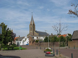
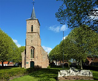
Noordgouwe is a village in the Dutch province of Zeeland. It is a part of the municipality of Schouwen-Duiveland, and lies about 5 km north of Zierikzee.

<span class="mw-page-title-main">Nieuwerkerk</span> Village in Zeeland, Netherlands

Nieuwerkerk is a village in the Dutch province of Zeeland. It is a part of the municipality of Schouwen-Duiveland, and lies about 23 km south of Hellevoetsluis.

<span class="mw-page-title-main">Oosterland, Zeeland</span> Village in Zeeland, Netherlands

Oosterland is a village in the south-west Netherlands. It is located in the municipality of Schouwen-Duiveland, Zeeland, about 22 km south of Hellevoetsluis.

<span class="mw-page-title-main">Sirjansland</span> Village in Zeeland, Netherlands

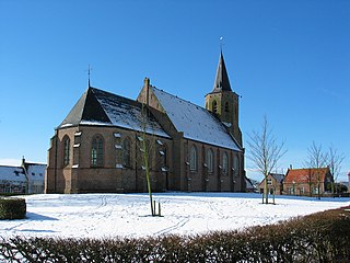
Sirjansland is a village in the Dutch province of Zeeland. It is a part of the municipality of Schouwen-Duiveland, and lies about 19 km south of Hellevoetsluis.

<span class="mw-page-title-main">Ouwerkerk</span> Village in Zeeland, Netherlands

Ouwerkerk is a village in the southwest Netherlands. It is located in the municipality of Schouwen-Duiveland, Zeeland about 60 km south of Rotterdam.

<span class="mw-page-title-main">Scharendijke</span> Village in Zeeland, Netherlands

Scharendijke is a village in the Dutch province of Zeeland. It is a part of the municipality of Schouwen-Duiveland, and lies about 24 km west of Hellevoetsluis.

<span class="mw-page-title-main">Kerkwerve</span> Village in Zeeland, Netherlands

Kerkwerve is a village in the Dutch province of Zeeland. It is a part of the municipality of Schouwen-Duiveland, and lies about 24 km southwest of Hellevoetsluis.

<span class="mw-page-title-main">Ellemeet</span> Village in Zeeland, Netherlands

Ellemeet is a village in the Dutch province of Zeeland. It is a part of the municipality of Schouwen-Duiveland, and lies about 26 km west of Hellevoetsluis.

<span class="mw-page-title-main">Haamstede</span> Village in Zeeland, Netherlands

Haamstede is a village in the Dutch province of Zeeland. It is a part of the municipality of Schouwen-Duiveland. The village is known for Haamstede Castle.

<span class="mw-page-title-main">Burgh, Netherlands</span> Village in Zeeland, Netherlands

Burgh is a village in the Dutch province of Zeeland. It is connected to Haamstede, and therefore generally considered to be part of the village Burgh-Haamstede.

<span class="mw-page-title-main">Renesse</span> Village in Zeeland, Netherlands

Renesse is a village in the Dutch province of Zeeland. It is a part of the municipality of Schouwen-Duiveland, and lies about 28 km west of Hellevoetsluis.

<span class="mw-page-title-main">Noordwelle</span> Village in Zeeland, Netherlands

Noordwelle is a village in the Dutch province of Zeeland. It is a part of the municipality of Schouwen-Duiveland, and lies about 5 km southwest of Scharendijke.

<span class="mw-page-title-main">Serooskerke, Schouwen-Duiveland</span> Village in Zeeland, Netherlands

Serooskerke is a village in the southwest Netherlands. It is located in the municipality of Schouwen-Duiveland, Zeeland about 100 km southwest of Rotterdam.

<span class="mw-page-title-main">Stavenisse</span> Village in Zeeland, Netherlands

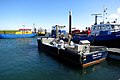
Stavenisse is a village in the Dutch province of Zeeland. It is a part of the municipality of Tholen, and lies about 22 kilometres (14 mi) west of Bergen op Zoom.

<span class="mw-page-title-main">Anna Jacobapolder</span> Village in Zeeland, Netherlands

Anna Jacobapolder is a village in the Dutch province of Zeeland. It is a part of the municipality of Tholen, and lies about 20 km north west of Bergen op Zoom.

<span class="mw-page-title-main">Bommenede</span>

Bommenede or Bommenee is a former island, village, and municipality in the Netherlands, located about 5 km east of the city of Brouwershaven.

<span class="mw-page-title-main">Hoofdplaat</span> Village in Zeeland, Netherlands

Hoofdplaat is a village in the Dutch province of Zeeland. It is located on the Westerschelde, about 7 km east of Breskens, in the municipality of Sluis.

<span class="mw-page-title-main">Herkingen</span> Village in South Holland, Netherlands

Herkingen is a village in the Dutch province of South Holland. It is located on the south coast of the island Goeree-Overflakkee, in the municipality of Goeree-Overflakkee.

References

  1. 1 2 3 "Kerncijfers wijken en buurten 2021". Central Bureau of Statistics. Retrieved 20 April 2022.
  2. "Postcodetool for 4311AA". Actueel Hoogtebestand Nederland (in Dutch). Het Waterschapshuis. Retrieved 20 April 2022.
  3. "Bruinisse - (geografische naam)". Etymologiebank (in Dutch). Retrieved 20 April 2022.
  4. 1 2 3 4 "Bruinisse". Plaatsengids (in Dutch). Retrieved 20 April 2022.
  5. 1 2 3 4 Piet van Cruyningen & Ronald Stenvert (2003). Bruinisse (in Dutch). Zwolle: Waanders. ISBN   90 400 8830 6 . Retrieved 20 April 2022.
  6. Ad van der Meer and Onno Boonstra, Repertorium van Nederlandse gemeenten , KNAW, 2011.