Brønlundhus

Last updated

Brønlundhus, on some maps also Brønlundfjord or Brönlundfjord, is a former research station and radio station located on the western shore of Jørgen Brønlund Fjord in southern Peary Land, in northern Greenland. It is named after Greenlandic Arctic researcher Jørgen Brønlund, or after the namesake fjord on which it is located. It is close to the mouth of Jørgen Brønlund Fjord where it opens into Independence Fjord.

Jørgen Brønlund Fjord

Jørgen Brønlund Fjord is a fjord in southern Peary Land, northern Greenland, with its mouth located at 82°7′N29°58′W. It is about 30 km long and 1 to 2 km wide, and opens out to Independence Fjord in the south. Brønlundhus, a former research station, is located on the west side close to the mouth of the fjord, and Kap Harald Moltke on the east side. It was named after polar explorer Jørgen Brønlund by the Danmark expedition.

Peary Land peninsula

Peary Land is a peninsula in northern Greenland, extending into the Arctic Ocean. It reaches from Victoria Fjord in the west to Independence Fjord in the south and southeast, and to the Arctic Ocean in the north, with Cape Morris Jesup, the northernmost point of Greenland's mainland, and Cape Bridgman in the northeast.

Greenland autonomous country within the Kingdom of Denmark

Greenland is an autonomous constituent country of the Kingdom of Denmark between the Arctic and Atlantic oceans, east of the Canadian Arctic Archipelago. Though physiographically a part of the continent of North America, Greenland has been politically and culturally associated with Europe for more than a millennium. The majority of its residents are Inuit, whose ancestors began migrating from the Canadian mainland in the 13th century, gradually settling across the island.

Contents

History

Brønlundhus was built in 194748 by the Danish Peary Land Expeditions on initiative of Eigil Knuth, through an air lift by PBY Catalina seaplanes from Zackenbergbasen, a station built for that purpose close to a trapper's hut at the site of present Zackenberg research station area 1000 km farther south. Brønlundhus was the first station in Greenland with all equipment transported by airlift. The seaplanes could land in the fjord only during the ice-free period from mid-July to end of August.

Count Eigil Knuth was a Danish explorer, archaeologist, sculptor and writer. He is referred to as the Nestor of Danish polar explorers. His archaeological investigations were made in Peary Land and adjacent areas of High Arctic Greenland. Knuth was made a Knight of the Dannebrog.

Seaplane airplane with an undercarriage capable of operating from water surfaces

A seaplane is a powered fixed-wing aircraft capable of taking off and landing (alighting) on water. Seaplanes that can also take off and land on airfields are in a subclass called amphibious aircraft. Seaplanes and amphibians are usually divided into two categories based on their technological characteristics: floatplanes and flying boats; the latter are generally far larger and can carry far more. These aircraft were sometimes called hydroplanes, but currently this term applies instead to motor-powered watercraft that use the technique of hydrodynamic lift to skim the surface of water when running at speed.

Zackenberg mountain in Greenland

Zackenberg or Zackenburg is a mountain in Wollaston Foreland, NE Greenland.

Brønlundhus was used as a base for the first expedition 194850 when Peary Land was explored by scientists on dog sled. Until the establishment of Alert in Canada in 1950, Brønlundhus was the northernmost station in the world, not counting historical depot huts of polar explorers including Peary's Cape Columbia Depot. From 1963 to 1972 the station was occasionally used during summers (April to August) as a base for smaller groups working in the area around the station. In 1972 a new station, Kap Harald Moltke, was built some ten kilometers east of Brønlundhus, on the opposite side of Jørgen Brønlund Fjord, where an old raised seabed provides a natural runway, making air access possible. In summer, traffic between the two neighboring stations is by boat, depending on ice conditions. Since the death of Eigil Knuth in 1996, the stations have been administered by the Peary Land Foundation.

Dog sled sled pulled by one or more sled dogs

A dog sled or dog sleigh is a sled pulled by one or more sled dogs used to travel over ice and through snow. Numerous types of sleds are used, depending on their function. They can be used for dog sled racing. In Greenland the dogs pull in a fan shape in front of the sled, while in other regions, such as Alaska and Canada the dogs pull side by side in pairs.

Alert, Nunavut Weather station and Canadian Forces Station in Nunavut, Canada

Alert, in the Qikiqtaaluk Region, Nunavut, Canada, is the northernmost permanently inhabited place in the world, at latitude 82°30'05" north, 817 kilometres (508 mi) from the North Pole. The entire population of the census subdivision Baffin, Unorganized is located here. As of the 2016 census, the population was reported as 62, an increase of 57 over the 2011 census. It takes its name from HMS Alert, which wintered 10 km (6.2 mi) east of the present station, off what is now Cape Sheridan, in 1875–1876.

Cape Columbia

Cape Columbia is the northernmost point of land of Canada, located on Ellesmere Island in the Qikiqtaaluk Region of Nunavut. It marks the westernmost coastal point of Lincoln Sea in the Arctic Ocean. It is the world's northernmost point of land outside Greenland and the distance to the North Pole is 769 km (478 mi).

Today, Brønlundhus can be characterised as a museum, with a collection of artefacts from polar explorations. In 2001, a Nanok team found the station in reasonably good condition, and performed minor repairs and exterior maintenance with paint and felt. [1]

See also

Related Research Articles

Knud Rasmussen Danish explorer and anthropologist

Knud Johan Victor Rasmussen was a Greenlandic–Danish polar explorer and anthropologist. He has been called the "father of Eskimology" and was the first European to cross the Northwest Passage via dog sled. He remains well known in Greenland, Denmark and among Canadian Inuit.

Ilulissat Place in Greenland, Kingdom of Denmark

Ilulissat, formerly Jakobshavn or Jacobshaven, is the municipal seat and largest town of the Avannaata municipality in western Greenland, located approximately 350 km (220 mi) north of the Arctic Circle. With the population of 4,541 as of 2013, it is the third-largest city in Greenland, after Nuuk and Sisimiut. The city is home to almost as many sled-dogs as people.

Ludvig Mylius-Erichsen Danish writer

Ludvig Mylius-Erichsen was a Danish author, ethnologist, and explorer, from Ringkøbing. He was most notably an explorer of Greenland.

Johan Peter Koch Danish arctic explorer

Johan Peter Koch was a Danish captain and explorer of the Arctic dependencies of Denmark, born at Vestenskov.

Independence II culture Paleo-Eskimo culture that flourished in northeastern Greenland (700 BCE to 80 BCE), north and south of the Independence Fjord

Independence II was a Paleo-Eskimo culture that flourished in northern and northeastern Greenland from around 700 to 80 BC, north and south of the Independence Fjord. The Independence II culture existed in roughly the same areas of Greenland as the Independence I culture, which became extinct six centuries before the beginning of Independence II.

Independence Fjord bay

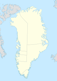
Independence Fjord or Independence Sound is a large fjord or sound in the eastern part of northern Greenland. It is about 200 km (120 mi) long and up to 30 km (19 mi) wide. Its mouth, opening to the Wandel Sea of the Arctic Ocean is located at 82°15′N21°54′W.

Deltaterrasserne is a pre-Inuit occupation archaeological site located near the head of Jørgen Brønlund Fjord on the Peary Land peninsula in northern Greenland. It is one of the largest archaeological sites in Peary Land, and was discovered in September 1948 by the Danish explorer and archaeologist Eigil Knuth during the second summer of the Danish Pearyland Expedition. Occupied during the period of 4000–3700 B.P., the site contains features of Independence I and Independence II culture cultures.

Eivind Astrup Norwegian explorer and writer

Eivind Astrup was a Norwegian explorer and writer. Astrup participated in Robert Peary's expedition to Greenland in 1891–92 and mapped northern Greenland. In the follow-up Greenland expedition by Peary during 1893–94 he explored and mapped Melville Bay on the north-west coast of Greenland. Among his works is Blandt Nordpolens Naboer from 1895. He was awarded the Knight of the Order of St. Olav in 1892.

King Frederick VIII Land Region in Greenland

King Frederick VIII Land is a major geographic division of northeastern Greenland. It extends above the Arctic Circle from 76°N to 81°N in a N/S direction along the coast of the Greenland Sea.

The Mørkefjord expedition of 1938–1939 was sent out by Alf Trolle, Ebbe Munck, and Eigil Knuth in order to continue the work of the Denmark Expedition. It was an exploratory expedition to Northeast Greenland led by Eigil Knuth and had been planned to last from 1938 to 1939. It was affected by the outbreak of World War II.

Denmark expedition 1906–1908 expedition to Greenland

The Denmark expedition, also known as Denmark Expedition to Greenland's Northeast Coast, and as the Danmark Expedition after the ship, was an expedition to the northeast of Greenland in 1906–1908.

Niels Peter Høeg Hagen Danish cartographer

Niels Peter Høeg Hagen, was a Danish military officer, polar explorer and cartographer. He participated in the ill-fated Denmark expedition to NE Greenland in 1906.

Henson Glacier (Greenland)

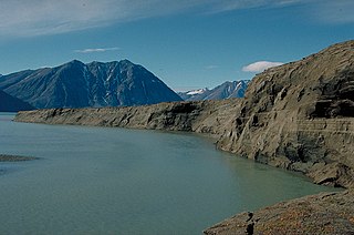
Henson Glacier, is one of the major glaciers in northern Greenland.

References

Coordinates: 82°10′30″N30°40′06″W / 82.17500°N 30.66833°W / 82.17500; -30.66833

Geographic coordinate system Coordinate system

A geographic coordinate system is a coordinate system that enables every location on Earth to be specified by a set of numbers, letters or symbols. The coordinates are often chosen such that one of the numbers represents a vertical position and two or three of the numbers represent a horizontal position; alternatively, a geographic position may be expressed in a combined three-dimensional Cartesian vector. A common choice of coordinates is latitude, longitude and elevation. To specify a location on a plane requires a map projection.