Nualik
Location within Greenland
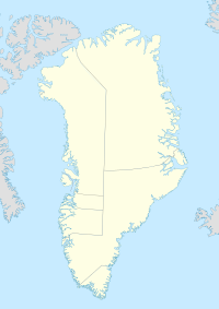
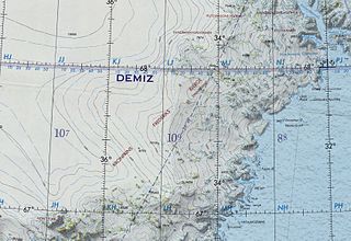
Nualik was a settlement in eastern Greenland. It was located at approximately 67°15′00″N33°21′58″W / 67.25°N 33.366°W Coordinates: 67°15′00″N33°21′58″W / 67.25°N 33.366°W .
Nualik was a settlement in eastern Greenland. It was located at approximately 67°15′00″N33°21′58″W / 67.25°N 33.366°W Coordinates: 67°15′00″N33°21′58″W / 67.25°N 33.366°W .
During the 1898-1900 Carlsberg Fund Expedition to East Greenland, Georg Carl Amdrup landed at Nualik where he found a dwelling with the bodies of 38 dead Inuit. [1]

The Arctic Archipelago, also known as the Canadian Arctic Archipelago, is an archipelago lying to the north of the Canadian continental mainland, excluding Greenland.

Stevens County is a county in the U.S. state of Minnesota. As of the 2020 census, the population was 9,671. Its county seat is Morris.

The "Second Happy Time" was a phase in the Battle of the Atlantic during which Axis submarines attacked merchant shipping and Allied naval vessels along the east coast of North America. The first "Happy Time" was in 1940–1941 in the North Atlantic and North Sea. Adolf Hitler and Benito Mussolini declared war on the United States on 11 December 1941, and as a result their navies could begin the "Second Happy Time".

Davis Strait is a northern arm of the Atlantic Ocean that lies north of the Labrador Sea. It lies between mid-western Greenland and Baffin Island in Nunavut, Canada. To the north is Baffin Bay. The strait was named for the English explorer John Davis (1550–1605), who explored the area while seeking a Northwest Passage. By the 1650s it was used for whale hunting.

This is a list of the extreme points of North America: the points that are highest and lowest, and farther north, south, east or west than any other location on the continent. Some of these points are debatable, given the varying definitions of North America.

In geology, hotspots are volcanic locales thought to be fed by underlying mantle that is anomalously hot compared with the surrounding mantle. Examples include the Hawaii, Iceland, and Yellowstone hotspots. A hotspot's position on the Earth's surface is independent of tectonic plate boundaries, and so hotspots may create a chain of volcanoes as the plates move above them.

European route E22 is one of the longest European routes. It has a length of about 5,320 km (3,310 mi). Many of the E-roads have been extended into Asia since the year 2000; the E22 was extended on 24 June 2002.

Federal Highway 1 is a free (libre) part of the federal highway corridors of Mexico, and the highway follows the length of the Baja California Peninsula from Tijuana, Baja California, in the north to Cabo San Lucas, Baja California Sur, in the south. The road connects with Via Rapida, which merges into the American Interstate 5 (I-5) at the San Ysidro Port of Entry, which crosses the international border south of San Ysidro, California.

ALSIB was the Soviet Union portion of the Alaska-Siberian air road receiving Lend-Lease aircraft from the Northwest Staging Route. Aircraft manufactured in the United States were flown over this route for World War II combat service on the Eastern Front.

Bluie was the United States military code name for Greenland during World War II. It is remembered by the numbered sequence of base locations identified by the 1941 United States Coast Guard South Greenland Survey Expedition, and subsequently used in radio communications by airmen unfamiliar with pronunciation of the Inuit and Old Norse names of those locations. These were typically spoken BLUIE (direction) (number), with direction being east or west along the Greenland coast from Cape Farewell.
Anoritooq is a nunatak in Avannaata municipality in northwestern Greenland.
German submarine U-540 was a Type IXC U-boat of Nazi Germany's Kriegsmarine during World War II.
The Crown Prince Frederick Range is a large mountain range in King Christian IX Land, eastern Greenland. Administratively this range is part of the Sermersooq Municipality.
The 2019 Atlantic hurricane season was an event in the annual tropical cyclone season in the north Atlantic Ocean. It was the fourth consecutive above-normal Atlantic hurricane season. The season officially began on June 1, 2019 and ended on November 30, 2019. These dates, adopted by convention, historically describe the period in each year when most tropical systems form. However, storm formation is possible at any time of the year, as demonstrated in 2019 by the formation of the season's first named storm, Subtropical Storm Andrea, on May 20. The final storm of the season, Tropical Storm Sebastien, transitioned to an extratropical cyclone on November 25.
Abandoned sites in Greenland | ||||||||||||||
|---|---|---|---|---|---|---|---|---|---|---|---|---|---|---|
|
|  | ||||||||||||
|
| |||||||||||||
| ||||||||||||||
| ||||||||||||||
| Polar exploration | ||||||||||||||
| Paleo-Eskimo | ||||||||||||||