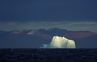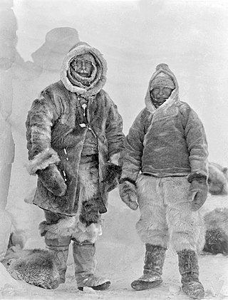
Greenland is located between the Arctic Ocean and the North Atlantic Ocean, northeast of Canada and northwest of Iceland. The territory comprises the island of Greenland—the largest island in the world—and more than a hundred other smaller islands. Greenland has a 1.2 kilometre long border with Canada on Hans Island. A sparse population is confined to small settlements along certain sectors of the coast. Greenland possesses the world's second-largest ice sheet.

The North Pole, also known as the Geographic North Pole, Terrestrial North Pole or 90th Parallel North, is the point in the Northern Hemisphere where the Earth's axis of rotation meets its surface. It is called the True North Pole to distinguish from the Magnetic North Pole.

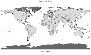
The polar climate regions are characterized by a lack of warm summers but with varying winters. Every month a polar climate has an average temperature of less than 0 °C (32 °F). Regions with a polar climate cover more than 20% of the Earth's area. Most of these regions are far from the equator and near the poles, and in this case, winter days are extremely short and summer days are extremely long. A polar climate consists of cool summers and very cold winters, which results in treeless tundra, glaciers, or a permanent or semi-permanent layer of ice. It is identified with the letter E in the Köppen climate classification.

Verkhoyansk is a town in Verkhoyansky District of the Sakha Republic, Russia, located on the Yana River in the Arctic Circle, 92 kilometers (57 mi) from Batagay, the administrative center of the district, and 675 kilometers (419 mi) north of Yakutsk, the capital of the Sakha republic. As of the 2010 Census, its population was 1,311. Verkhoyansk holds the record for the hottest temperature ever recorded north of the Arctic Circle, with 38.0 °C (100.4 °F), and it also holds the record for the coldest temperature ever recorded in Asia, −67.8 °C (−90.0 °F). The cold record is shared with Oymyakon.

Ellesmere Island is Canada's northernmost and third largest island, and the tenth largest in the world. It comprises an area of 196,236 km2 (75,767 sq mi), slightly smaller than Great Britain, and the total length of the island is 830 km (520 mi).

The Arctic Archipelago, also known as the Canadian Arctic Archipelago, is an archipelago lying to the north of the Canadian continental mainland, excluding Greenland and Iceland.

Baffin Bay, located between Baffin Island and the west coast of Greenland, is defined by the International Hydrographic Organization as a marginal sea of the Arctic Ocean. It is sometimes considered a sea of the North Atlantic Ocean. It is connected to the Atlantic via Davis Strait and the Labrador Sea. The narrower Nares Strait connects Baffin Bay with the Arctic Ocean. The bay is not navigable most of the year because of the ice cover and high density of floating ice and icebergs in the open areas. However, a polynya of about 80,000 km2 (31,000 sq mi), known as the North Water, opens in summer on the north near Smith Sound. Most of the aquatic life of the bay is concentrated near that region.

Eismitte, in English also called Mid-Ice, was a meteorological station established by the 1930-31 German Greenland Expedition in the middle of the Greenland Ice Sheet. The venture took place from July 1930 through August 1931, and established three Arctic stations on the same parallel. A trip back from Eismitte in early November 1930 claimed the life of expedition leader, noted German scientist Alfred Wegener. The station was abandoned on 1 August 1931.
The Poles of Cold are the places in the southern and northern hemispheres where the lowest air temperatures have been recorded.

The Greenland Sea is a body of water that borders Greenland to the west, the Svalbard archipelago to the east, Fram Strait and the Arctic Ocean to the north, and the Norwegian Sea and Iceland to the south. The Greenland Sea is often defined as part of the Arctic Ocean, sometimes as part of the Atlantic Ocean. However, definitions of the Arctic Ocean and its seas tend to be imprecise or arbitrary. In general usage the term "Arctic Ocean" would exclude the Greenland Sea. In oceanographic studies the Greenland Sea is considered part of the Nordic Seas, along with the Norwegian Sea. The Nordic Seas are the main connection between the Arctic and Atlantic oceans and, as such, could be of great significance in a possible shutdown of thermohaline circulation. In oceanography the Arctic Ocean and Nordic Seas are often referred to collectively as the "Arctic Mediterranean Sea", a marginal sea of the Atlantic.

Base Orcadas is an Argentine scientific station in Antarctica, and the oldest of the stations in Antarctica still in operation. It is located on Laurie Island, one of the South Orkney Islands, at 4 meters (13 ft) above sea level and 170 meters (558 ft) from the coastline. Established by the Scottish National Antarctic Expedition in 1903 and transferred to the Argentine government in 1904, the base has been permanently populated since, being one of six Argentine permanent bases in Argentina's claim to Antarctica, and the first permanently inhabited base in Antarctica.

Signy Research Station is an Antarctic research base on Signy Island, run by the British Antarctic Survey.

The British North Greenland expedition was a British scientific mission, led by Commander James Simpson RN, which lasted from July 1952 to August 1954. A total of 30 men took part, though not all stayed for both years.

Dye 3 is an ice core site and previously part of the DYE section of the Distant Early Warning (DEW) line, located at in Greenland. As a DEW line base, it was disbanded in years 1990/1991.

The climate of the Arctic is characterized by long, cold winters and short, cool summers. There is a large amount of variability in climate across the Arctic, but all regions experience extremes of solar radiation in both summer and winter. Some parts of the Arctic are covered by ice year-round, and nearly all parts of the Arctic experience long periods with some form of ice on the surface.

Summit Camp, also known as Summit Station, is a year-round staffed research station near the apex of the Greenland ice sheet. The station is located at 3,216 metres (10,551 ft) above sea level.

Prospect Creek is a very small settlement approximately 180 miles (290 km) north of present-day Fairbanks and 25 miles (40 km) southeast of present-day Bettles, Alaska. Years ago it was home to numerous mining expeditions and the camp for the building of the Trans-Alaska Pipeline System (TAPS). Today, it is the location of Pump Station 5 of the TAPS. Prospect Creek is also home to the United States record for lowest temperature. On January 23, 1971 the record low temperature of −79.8 °F (−62.1 °C) was recorded. Wildlife can be found there even with its extreme changes in temperature; local fauna include anything from black and brown bears to bald eagles. The elevation of Prospect Creek is 643 feet (196 m) above sea level. Nearby Moore Creek is widely known for its gold and quartz mining and sits alongside Prospect Creek in Alaska’s Innoko Mining District. The Innoko Mining District is famous for its findings of large quartz.

The Danish Expedition to Queen Louise Land, also known as the Danish expedition to Queen Louise Land and straight through Greenland’s ice sheet, as well as Danish North Greenland Expedition, was an expedition to northeastern Greenland and across the Greenland ice sheet in 1912–1913. It was the first such venture that went across the broad central part of Greenland. The expedition was led by Johan Peter Koch (1870–1928). Its purpose was to study the vast ice sheet, making glaciological and meteorological observations. Instead of sled dogs, sixteen Icelandic ponies were chosen for transporting 20 tons of materials, including 6 t of compressed hay to feed the ponies.

The German Greenland Expedition, also known as the Wegener Expedition, was an expedition to Greenland in 1930–1931. It was led by German scientist Alfred Wegener (1880–1930), who had previously taken part in two other ventures to Greenland. His purpose was to make a systematic study of the Greenland ice sheet.


