This article relies largely or entirely on a single source .(August 2024) |
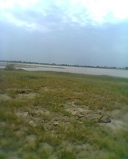
Bugga is a village in Pind Dadan Khan Tehsil of Jhelum District in Punjab, Pakistan. [1] It is commonly known as Bugga Sharif, due to an ancient Islamic University and a Shrine Bawa Shah Zinda, which is situated west to present village.
Bugga | |
---|---|
Coordinates: 32°02′18″N73°2′49″E / 32.03833°N 73.04694°E | |
Country | Pakistan |
Province | Punjab |
District | Jhelum |
It is situated on the right bank of River Jhelum and near the M-2 motorway at a distance of 10 km. Presently this area became a part of China-Pakistan Economic Corridor (CPEC). Bhera is also nearby to Bugga.
Jhelum District, is partially in Pothohar Plateau, and partially in Punjab Plain of the Punjab province of Pakistan. Jhelum is one of the oldest districts of Punjab. It was established on 23 March 1849. Jhelum is known for providing many soldiers to the British and later to the Pakistan armed forces due to which it is also known as 'city of soldiers' or 'land of martyrs and warriors'. The district of Jhelum stretches from the river Jhelum almost to the Indus. Salt is quarried at the Mayo mine in the Salt Range. There are two coal mines in the district from which the North-Western railway obtains parts of its supply. These are the only coal mines in Punjab province which are in working condition. The chief center of the salt trade is Pind Dadan Khan. The district is crossed by the main line of the North-Western railway and also traversed along the south by a branch line. It is located in the north of the Punjab province, Jhelum district is bordered by Sargodha and Mandi Bahauddin to its south, Khushab to its southwest, Jhelum River to its south and east, Gujrat to its east, Chakwal to its west, Mirpur to its northeast, and Rawalpindi to its north.
The Jhelum River is a river in the northern Indian subcontinent. It originates at Verinag and flows through the Indian-administered territory of Jammu and Kashmir, into Pakistan-administered Azad Kashmir, then the Pakistani province of Punjab. It is the westernmost of the five rivers of the Punjab region, and flows through the Kashmir Valley. It is a tributary of the Chenab River and has a total length of about 725 kilometres (450 mi).
Mangla is a town situated in District Mirpur within the region of Azad Kashmir. The village is located in the west of the foothills of Mangla's fort. It is surrounded on three sides by the semicurvature of river Jhelum flowing North to South. It is bordered with Jhelum district and with the right bank of Mangla between the State of Azad Kashmir and Punjab province of Pakistan.
Jhelum is a city on the West Bank of the Jhelum River, which is located in the district of Jhelum in the North of Punjab, Pakistan. It is the 44th largest city of Pakistan by population. Jhelum is known for providing many soldiers to the British Army before independence, and later to the Pakistan armed forces, due to which it is also known as City of Soldiers or Land of Martyrs and Warriors.
Gujar Khan is a city in Rawalpindi District, Punjab, Pakistan. It is also the headquarters of Gujar Khan Tehsil, the largest tehsil of Punjab by land area.
Khushab District, is a district in the province of Punjab, Pakistan, with its administrative capital in Jauharabad. The district is named after the historical city of Khushab.
Malakwal is a city in Mandi Bahauddin District, Punjab, Pakistan.
Lehri Nature Park is situated in Jhelum District, Punjab, Pakistan. The park is almost 90 kilometres on GT Road in the hilly region from Islamabad and almost 40 kilometers from Jhelum City. It is 10 kilometres from GT Road. The park has lodgings for the night. It is named after the Union Council of the village Lehri. Lehri village is approx 10miles from the park. The residents of Lehri village are mainly the descendants of the Gakhar tribe of the Pothohar region in Pakistan.
Thill, also known as Thill Sharif or Thil, is a village in Jhelum District, Punjab, Pakistan. It is located at 32°42'0N' 73°20'0E with an altitude of 279 metres (918 feet). It is situated between the Jhelum River and Pind Dadan Khan Tehsil. Thill is located near the mountain range where the Khewra Salt Mines are located.
Chak Khasa is a village beside the Jhelum River and union council of Jhelum District in the Punjab Province of Pakistan. It is part of Jhelum Tehsil. Majority of the population belongs to the Mughal and Panhwar Sohlan Rajput's, Also the Nawab of Jhelum family resides here.
Nakka Khurd, is a village in the Jhelum District of Punjab, Pakistan. Serving as the central hub for the Nakka Khurd union council within Jhelum Tehsil, it is positioned 14.72 kilometers northwest of Rasul and 13.32 kilometers north of Jalalpur Sharif.
Sanghoi, is a village situated in the Jhelum District of Punjab, Pakistan. It is part of Jhelum Tehsil, serving as the central hub for the Sanghoi union council. Comprising two localities—namely Sanghoi Khas and Malhu, it is located 12.99 kilometers southwest of Jhelum city and 60.64 kilometers northeast of Pind Dadan Khan.
Pindi Said Pur is a village and union council of Jhelum District in the Punjab Province of Pakistan. It is part of Pind Dadan Khan Tehsil. It is located at 32°40'0N 73°20'0E with an altitude of 215 meters. It is widely an agricultural area. The major casts of the village are Mian, Khokhar, Arain, Choudhary, Malik (Awan), Mohajar, Bhatti, Kumhar, Machi,, etc. [2] It is the educational and shopping hub for the surrounding villages. The famous shrines are Darbar Sultan Muhammad Afzal R.A, And Baba Saiden Sherazi, and Masjid Shazli. Masjid Shazli, built by Haji Muhammad Sharif on his own land and with his own resources, is a significant religious landmark of the village, featuring architecture inspired by Faisal Mosque, Islamabad.
New Jhang is a village in Pakistan situated on the Mangla Rd, 4 km from Dina in Jhelum District, Punjab. It is 10 km from the Mangla Dam.
Daulatpur is a village and union council of Jhelum District in the Punjab Province of Pakistan. It is part of Pind Dadan Khan Tehsil. It is located approximately four kilometers away from the Pind Dadan Khan-Jhelum Road on the north side of Pinanwal. The population of this village is approximately 4000.
Mirza Pur is a village in the Pind Dadan Khan Tehsil, Jhelum District, Punjab, Pakistan, about 28 kilometres (17 mi) from the town of Pind Dadan Khan. It has a population of about 4000.
Rasul Barrage is a barrage on the River Jehlum between Jhelum District and Mandi Bahauddin District of the Punjab province of Pakistan. It is situated 72 km downstream of Mangla Dam.
Wagh is an ancient village located about 10 kilometers north of Jalalpur Sharif, in Tehsil Pind Dadan Khan of District Jhelum in Pakistan. It is situated in a valley surrounded by foothills of the Salt Range on the north, east and south and a rain dependent river Nala Banha on the west, nearly 45 kilometres east of Khewra Salt Mines within the jurisdiction of the police station and Union Council at Jalalpur Sharif. Wagh is the largest village in Chamkon Valley.
Abdullahpur is a village situated in the Pind Dadan Khan Tehsil Jhelum District of Punjab, Pakistan. Its geographical coordinates are 32° 38' 0" North, 73° 19' 0" East. It is situated near River Jhelum.
Saghar Pur is a village of Pind Dadan Khan Tehsil, Jhelum District, Punjab Province (Pakistan), Pakistan. It is situated near Salt Range & River Jhelum.