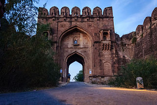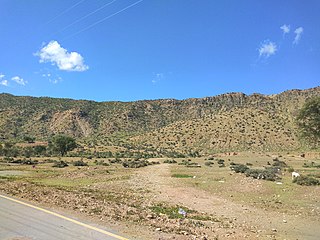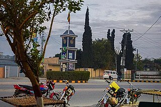
Jhelum District, is partially in Pothohar Plateau, and partially in Punjab Plain of the Punjab province of Pakistan. Jhelum is one of the oldest districts of Punjab. It was established on 23 March 1849. Jhelum is known for providing many soldiers to the British and later to the Pakistan armed forces due to which it is also known as 'city of soldiers' or 'land of martyrs and warriors'. The district of Jhelum stretches from the river Jhelum almost to the Indus. Salt is quarried at the Mayo mine in the Salt Range. There are two coal mines in the district from which the North-Western railway obtains parts of its supply. These are the only coal mines in Punjab province which are in working condition. The chief center of the salt trade is Pind Dadan Khan. The district is crossed by the main line of the North-Western railway and also traversed along the south by a branch line. It is located in the north of the Punjab province, Jhelum district is bordered by Sargodha and Mandi Bahauddin to its south, Khushab to its southwest, Jhelum River to its south and east, Gujrat to its east, Chakwal to its west, Mirpur to its northeast, and Rawalpindi to its north.

Pind Dadan Khan Tehsil is a subdivision of Jhelum District, Punjab, Pakistan. It is headquartered at the town of Pind Dadan Khan located on the bank of River Jhelum, about 22 kilometres from the M2 motorway.

The Khewra Salt Mine, also known as Mayo Salt Mine, is the world's second largest salt mine, located in Khewra, Punjab, Pakistan. The mine is in the Salt Range of the Potohar plateau, which rises from the Indus plain of the Punjab.
Pind Dadan Khan, a city in Jhelum District, Punjab, Pakistan, is the capital of Pind Dadan Khan Tehsil, which is an administrative subdivision of the district.

Khewra is the second most populated city of Jhelum District and the neighbor city of Pind Dadan Khan in Jhelum District, Punjab, Pakistan. The city is administratively subdivided into two union councils and is the location of the Khewra Salt Mine. The population of Khewra city is about 35,000.

Jalalpur Sharif is a town located in the Jhelum district in Punjab, Pakistan.
Nakka Khurd, is a village in the Jhelum District of Punjab, Pakistan. Serving as the central hub for the Nakka Khurd union council within Jhelum Tehsil, it is positioned 14.72 kilometers northwest of Rasul and 13.32 kilometers north of Jalalpur Sharif.
Pindi Said Pur is a village and union council of Jhelum District in the Punjab Province of Pakistan. It is part of Pind Dadan Khan Tehsil. It is located at 32°40'0N 73°20'0E with an altitude of 215 meters It is widely a agricultural area. The major casts of the village are Arain, Jandran, Malik (Awan), Mohajar, Bhatti, Kumhar, Mochi, Muslim sheikh etc.. It is the educational and shopping hub for the suburbs villages. The famous shrines Baba Saiden Sherazi and Sultan Bhau.
Gharibwal is a village that is a part of the Pind Dadan Khan Tehsil of Jhelum District in the Pakistani province of Punjab. It is located between the Khewra Salt Mines, Asia's largest salt mine, and the Jhelum River near Gharibwal Cement Factory.
Ahmedabad is a village and union council of Jhelum District in the Punjab Province of Pakistan. It is part of Pind Dadan Khan Tehsil, and is located at 32°40'0N 73°20'0E with an altitude of 215 metres (708 feet). Ahmedabad is on the bank of the Jhelum River, about 7 km from the M2 motorway Lilah Inter change and about 30 km from Pind Dadan Khan Tehsil and 36 km from Khewra Salt Mines. Ahmadabad is a Khokhar settlement in Jhelum District.
Daulatpur is a village and union council of Jhelum District in the Punjab Province of Pakistan. It is part of Pind Dadan Khan Tehsil. It is located approximately four kilometers away from the Pind Dadan Khan-Jhelum Road on the north side of Pinanwal. The population of this village is approximately 4000.

Chakri is a village in Union Council Daulatpur near Pindi Saidpur in Pind Dadan Khan Tehsil, Jhelum District, Pakistan.

Wagh is an ancient village located about 10 kilometers north of Jalalpur Sharif, in Tehsil Pind Dadan Khan of District Jhelum in Pakistan. It is situated in a valley surrounded by foothills of the Salt Range on the north, east and south and a rain dependent river Nala Banha on the west, nearly 45 kilometres east of Khewra Salt Mines within the jurisdiction of the police station and Union Council at Jalalpur Sharif. Wagh is the largest village in Chamkon Valley.

The topography of Pakistan is divided into seven geographic areas: the northern highlands, the Indus River plain, the desert areas, the Pothohar Plateau, Balochistan Plateau, Salt Range, and the Sistan Basin. All the rivers of Pakistan, i.e. Sindh, Ravi River, Chenab River, Jhelum River, and Sutlej River, originate from the Himalayas mountain range. Some geographers designate Plateau as to the west of the imaginary southwest line; and the Indus Plain lies to the east of that line.

The Pothohar Plateau, also known as Pothwar, is a plateau in the northern region of Punjab, Pakistan, located between the Indus and Jhelum rivers.
Chak Ali Shah is a village approximately 20 kilometres (12 mi) east of tehsil Pind Dadan Khan, Jhelum District, in the province of Punjab, Pakistan.

Shireen Abad (Dandot RS) ( Urdu شیریں آباد ڈنڈوت آر ایس ) is a village, union council Golepur, and administrative subdivision of Jhelum District (Urdu جہلم) in the Punjab Province of Pakistan. It is part of Pind Dadan Khan Tehsil.
Choran (Urduچوران) is a village, union council, and administrative subdivision of Jhelum District in the Punjab Province of Pakistan. It is part of Pind Dadan Khan Tehsil.

Mirza Abad, also known as Mirzaabad, is a village in Union Council Daulatpur Pind Dadan Khan Tehsil, Jhelum District, Pakistan. It is located at 32°41'12.71N' 73°20'48.99E with an altitude of 190 metres, near the Salt Range and Khewra Salt Mine.

Talagang District Talagang is a District of Punjab province of Pakistan. Formerly it was Talagang Tehsil that was made Talagang District in October 2022 by the government. It is situated in the North of the Punjab province. It is part of the Potohar plateau and lies on the north of Salt Range and east of the Kala Chita range. Talagang is 45 km from Chakwal. The motorway M2 is located 30 km from Talagang.


