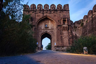
Jhelum District, is partially in Pothohar Plateau, and partially in Punjab Plain of the Punjab province of Pakistan. Jhelum is one of the oldest districts of Punjab. It was established on 23 March 1849. Jhelum is known for providing many soldiers to the British and later to the Pakistan armed forces due to which it is also known as 'city of soldiers' or 'land of martyrs and warriors'. The district of Jhelum stretches from the river Jhelum almost to the Indus. Salt is quarried at the Mayo mine in the Salt Range. There are two coal mines in the district from which the North-Western railway obtains parts of its supply. These are the only coal mines in Punjab province which are in working condition. The chief center of the salt trade is Pind Dadan Khan. The district is crossed by the main line of the North-Western railway and also traversed along the south by a branch line. It is located in the north of the Punjab province, Jhelum district is bordered by Sargodha and Mandi Bahauddin to its south, Khushab to its southwest, Jhelum River to its south and east, Gujrat to its east, Chakwal to its west, Mirpur to its northeast, and Rawalpindi to its north.
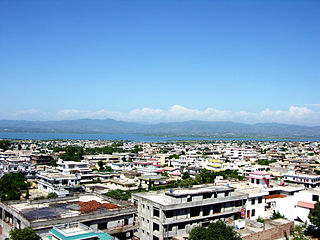
Mirpur, officially known as New Mirpur City, is the capital of Mirpur district located in Azad Kashmir, Pakistan which has been subject of the larger Kashmir dispute between Pakistan and India since 1947. It is the second largest city of Azad Kashmir and the 74th largest city in Pakistan.
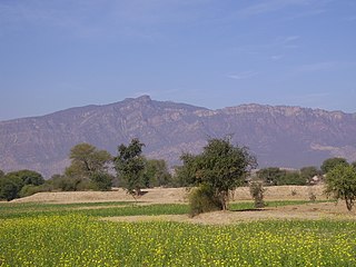
Khukha is a village in Jhelum District, Punjab, Pakistan. It is a Union Council, an administrative subdivision, of Jhelum Tehsil and is a "model" village. It lies 7 km west of Dina, 1 km east of Gaggar Khurd, 5 km north of Rohtas and 10 km north east of Tilla Jogian. Neighbouring villages of khukha include Natain, Khojki and Mota Gharbi.
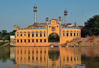
Jhelum is a city on the West Bank of the Jhelum River, which is located in the district of Jhelum in the North of Punjab, Pakistan. It is the 44th largest city of Pakistan by population. Jhelum is known for providing many soldiers to the British Army before independence, and later to the Pakistan armed forces, due to which it is also known as City of Soldiers or Land of Martyrs and Warriors.

Sarai Alamgir is the main town of Sarai Alamgir Tehsil, located in the Gujrat district in the north of the Punjab, a province of Pakistan. Sarai Alamgir is one of four tehsils of Gujrat district.
Chak Dina, is a village in Kharian Tehsil of Gujrat District, Punjab, Pakistan. It is located 16.68 kilometers northeast of Dinga and 7.26 kilometers west of Lalamusa.
Jauharabad/Joharabad is a small city and the district headquarters of Khushab District, Sargodha Division in the Punjab province of Pakistan. Jauharabad was established in 1953 as a planned city. Jauharabad is named after Maulana Muhammad Ali Jauhar, a prominent figure from the Pakistan independence movement. The city is located in the Khushab district of Punjab, located in the northern part of the country. Key locations near Jauharabad include the Salt Range to the north and Khushab, the Jhelum River, and Mianwali District to the west. Educational facilities include District Public School and Inter College(DPS&IC),University of Education Lahore (sub-campus), Government Technical College, Jauhar Memorial Public School, Superior College, Aspire College and Punjab College. It has a public library and many administration offices such as DPO Office DCO Office. It has a Gymkhana under construction where facilities of Tennis and Gymnasium are available. It also has District Headquarters Hospital and there are many private hospitals. It also has a sugar mill named Jauharabad Sugar Mills (JSML).
Zamir Jaffri Cricket Stadium is a cricket stadium in Jhelum, Pakistan. It is named after Jhelum's native poet Syed Zamir Jafri. The stadium is in close proximity to Altaf Park which was built in 1994–95.
The Maliar are a group of mixed origin found in the Potohar region of Punjab, Pakistan as well as the Peshawar valley and some other parts of the North West Frontier Province.
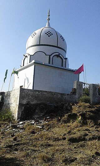
Sultanpure, is a village and union council of the Tehsil Dina Jhelum District in the Punjab Province of Pakistan. Its historical village of Ghakkars tribe & it's located near Mangla Cantt and Mirpur. Before Mangla Dam construction its area was 175,000 kanals.
Saadat Pur is the major village of the Tehsil Sarai Alamgir. It is part of Gujrat district in the north of Punjab province. The village is located on the eastern bank of the Upper Jhelum Canal and is located on road connecting Sarai Alamgir and Mirpur.

The Pothohar Plateau, also known as Pothwar, is a plateau in the northern region of Punjab, Pakistan, located between the Indus and Jhelum rivers.

Gatiali is a village in Jhelum District, Punjab, Pakistan. is north of Jhelum City and South of Mangla Dam.
Dhok Padhal is a village situated in Jhelum District, Punjab, Pakistan. This village was named in 1667 after the a shepherd and in Punjabi Language sheep's are called(phads) so people use to call this as "Village of Phads" so from there the name was derived as "Dhok Padhal" This village is the based on Jutt tribes.
Dhok Masyal is a village in Jhelum District, Punjab Province, Pakistan. The village is located 15 kilometres (9.3 mi) west of Jhelum city on the Jhelum-Pind Dadan Khan road, locally called Rohtas Road. It is on the bank of the Nala Kahan near to the village of Malot.

Shireen Abad (Dandot RS) ( Urdu شیریں آباد ڈنڈوت آر ایس ) is a village, union council Golepur, and administrative subdivision of Jhelum District (Urdu جہلم) in the Punjab Province of Pakistan. It is part of Pind Dadan Khan Tehsil.
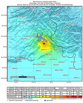
The 2019 Kashmir earthquake struck regions of Pakistan with an epicentre in Azad Kashmir on 24 September at 16:02 local time. It had a magnitude of 5.4 and a maximum felt intensity of VII on the Modified Mercalli intensity scale or VIII on the European macroseismic scale. There was severe damage in Mirpur District, causing the deaths of 40 people and injuring a further 850. The epicentre of the shallow quake was near the city of Mirpur, Pakistan. The tremors were felt in the Kashmir region, Punjab (Pakistan), Punjab (India), Uttarakhand and northern parts of India including New Delhi.
Mota Gharbi is a village in the Dina Tehsil in District Jhelum in Punjab, Pakistan.


