Burnt River (Ontario)

Last updated
Burnt River
River
Burnt River.png
The Burnt River within Kinmount
Country Canada
Province Ontario
Region Central Ontario
SourceMiskwabi Lake
 - location Highlands East, Haliburton County
 - elevation392 m (1,286 ft)
 - coordinates 45°02′29″N78°22′33″W / 45.04139°N 78.37583°W / 45.04139; -78.37583
Mouth Cameron Lake
 - locationCity of Kawartha Lakes
 - elevation253 m (830 ft)
 - coordinates 44°34′52″N78°45′55″W / 44.58111°N 78.76528°W / 44.58111; -78.76528 Coordinates: 44°34′52″N78°45′55″W / 44.58111°N 78.76528°W / 44.58111; -78.76528
Canada Southern Ontario location map 2.png
Red pog.svg
Location of the mouth of the Burnt River in southern Ontario

The Burnt River is a river which flows from its source at Miskwabi Lake in Highlands East, Haliburton County south into the Kawartha Lakes region. It empties into Cameron Lake in the city of Kawartha Lakes, part of the Trent–Severn Waterway. The town of Burnt River is located near its southern end.

Highlands East, Ontario Municipality in Ontario, Canada

Highlands East is a township located in Haliburton County, Ontario, Canada.

Haliburton County County in Ontario, Canada

Haliburton is a county of Ontario, Canada, known as a tourist and cottage area in Central Ontario for its scenery and for its resident artists. Minden Hills is the county seat. Haliburton County and the village of Haliburton are named after Thomas Chandler Haliburton, author, statesman, and the first chairman of the Canadian Land and Emigration Company.

The Kawartha Lakes (/kə'wɔrθɐ/) are a chain of lakes in south-central Ontario, Canada that form the upper watershed of the Trent River. The lakes are located on the boundary between the Paleozoic limestone regions of the Golden Horseshoe, and the Precambrian granite Canadian Shield of northern and central Ontario.

Contents

The river was used to transport lumber to sawmills downstream. Later, the Victoria Railway was built along the river. The old railway bed is now a recreational trail.

Sawmill facility where logs are cut into timber

A sawmill or lumber mill is a facility where logs are cut into lumber. Modern saw mills use a motorized saw to cut logs lengthwise to make long pieces, and crosswise to length depending on standard or custom sizes. The "portable" saw mill is iconic and of simple operation—the logs lay flat on a steel bed and the motorized saw cuts the log horizontally along the length of the bed, by the operator manually pushing the saw. The most basic kind of saw mill consists of a chainsaw and a customized jig, with similar horizontal operation.

The Victoria Railway is a historic 55.52-mile (89.35 km) long Canadian railway that operated in Central Ontario. Construction under Chief Engineer James Ross began in 1874 from Lindsay, Ontario, with authority to build through Victoria County to Haliburton, Ontario, to which it opened on November 24, 1878. The line is best known as having been built by a large group of Icelandic immigrants, who found the Kinmount winters too rough, and so they all moved to Gimli, Manitoba. The line became part of the Midland Railway of Canada and then later part of the Canadian National Railways. The line was abandoned completely by the early 1990s.

The river was given its name after a forest fire in the region left the river's water with an unusual colour.

Fish species

There are three major species of fish in the river including walleye, muskie and smallmouth bass. All three tend to grow smaller than those in the nearby lakes, however they may be legally caught according to local regulations. As well as conventional fishing techniques, the smallmouth bass may be caught while fly fishing. [1]

Walleye species of fish

The walleye, also called the yellow pike, is a freshwater perciform fish native to most of Canada and to the Northern United States. It is a North American close relative of the European zander, also known as the pikeperch. The walleye is sometimes called the yellow walleye to distinguish it from the blue walleye, which is a subspecies that was once found in the southern Ontario and Quebec regions, but is now presumed extinct. However, recent genetic analysis of a preserved (frozen) 'blue walleye' sample suggests that the blue and yellow walleye were simply phenotypes within the same species and do not merit separate taxonomic classification.

Muskellunge species of fish

The muskellunge(Esox masquinongy), also known as muskelunge, muscallonge, milliganong, or maskinonge, is a species of large, relatively uncommon freshwater fish native to North America. The muskellunge is the largest member of the pike family, Esocidae. The common name comes from the Ojibwa word maashkinoozhe, meaning "ugly pike", by way of French masque allongé, "elongated face." The French common name is masquinongé or maskinongé.

Smallmouth bass species of fish

The smallmouth bass is a species of freshwater fish in the sunfish family (Centrarchidae) of the order Perciformes. It is the type species of its genus. One of the black basses, it is a popular game fish sought by anglers throughout the temperate zones of North America, and has been spread by stocking—as well as illegal introductions—to many cool-water tributaries and lakes in Canada and more so introduced in the United States. The maximum recorded size is approximately 27 inches and 12 pounds. The smallmouth bass is native to the upper and middle Mississippi River basin, the Saint Lawrence River–Great Lakes system, and up into the Hudson Bay basin. Its common names include smallmouth, bronzeback, brown bass, brownie, smallie, bronze bass, and bareback bass.

Tributaries

See also

Related Research Articles

Bass fishing is the activity of angling for the North American gamefish known colloquially as the black bass. There are numerous black bass species considered as gamefish in North America, including largemouth bass, smallmouth bass, spotted bass or Kentucky bass, and Guadalupe bass. Black bass are members of the sunfish (Centrarchidae) family.

Lehigh River river located in eastern Pennsylvania, in the United States

The Lehigh River, a tributary of the Delaware River, is a 109-mile-long (175 km) river located in eastern Pennsylvania, in the United States. Part of the Lehigh, along with a number of its tributaries, is designated a Pennsylvania Scenic River by the state's Department of Conservation and Natural Resources. "Lehigh" is an Anglicization of the Lenape name for the river, Lechewuekink, meaning "where there are forks".

Rice Lake (Ontario) lake in Peterborough County, Ontario, Canada

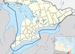
Rice Lake is a lake located in Northumberland and Peterborough counties in south-eastern Ontario. The lake is located south of the city of Peterborough, and the Kawartha Lakes and north of Cobourg. It is part of the Trent-Severn Waterway, which flows into the lake by the Otonabee and out via the Trent. The lake is 28 kilometres (17 mi) long and 5 km wide. Its maximum depth is 10m, with a surface water level at 187 m above sea level, raised to its present height by the Hastings Dam, built in the 19th century as part of the Trent-Severn canal system. Natives called it Pemadashdakota or "lake of the burning plains".

Lake Scugog reservoir

Lake Scugog is an artificially flooded lake in Scugog, Regional Municipality of Durham and the unitary city of Kawartha Lakes in central Ontario, Canada. It lies between the communities of Port Perry and Lindsay. The lake has been raised and lowered several times over its history. Though not technically part of the Kawartha lakes due to its shallow depths, it is often geographically linked to them. Its sole outflow, the Scugog River, connects to Sturgeon Lake. Lake Scugog is in the Great Lakes Basin and forms part of the Trent–Severn Waterway.

Lake Doré lake in Canada

Lake Doré is a freshwater lake in the township of North Algona-Wilberforce, Renfrew County, Ontario, Canada, about 6 kilometres (3.7 mi) north of the community of Eganville in the neighbouring township of Bonnechere Valley.

Balsam Lake (Ontario) lake in Kawartha Lakes, Ontario, Canada

Balsam Lake is a lake in the City of Kawartha Lakes in Central Ontario, Canada. It is in the Great Lakes Basin, is one of the lakes of the Kawartha Lakes, and is at the summit of the Trent–Severn Waterway.

Tangamong Lake is a lake in the Lake Ontario drainage basin in the township of Wollaston, Hastings County in eastern Ontario, Canada, at the easternmost end of the Kawartha Lakes chain. It is also part of area of responsibility of the Crowe Valley Conservation Authority.

Salerno Lake Canadian lake

Salerno Lake, formerly Devil's Lake, is a lake in the municipalities of Highlands East and Minden Hills in Haliburton County in Central Ontario, Canada. The lake is part of the Kawartha Lakes, and lies in the Great Lakes Basin. It is part of cottage country approximately a ​2 12-hour drive away from Toronto.

Queen Elizabeth II Wildlands Provincial Park provincial park in Ontario

The Queen Elizabeth II Wildlands Provincial Park is a provincial park in south-central Ontario, Canada, between Gravenhurst and Minden. The park, named for Elizabeth II, Queen of Canada, is 33,505 hectares in size, making it the second largest park south of Algonquin Park, but it has a fragmented shape as a result of many private lands within its boundary.

Burnt River, Ontario Place in Ontario, Canada

Burnt River is a hamlet located in the middle of the former Township of Somerville, in the City of Kawartha Lakes, Ontario, Canada. The community is on the Burnt River.

Stony Lake (Ontario) lake in Canada

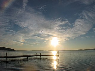
Stony Lake is a lake in Peterborough County in Central Ontario, Canada. There are three interconnected lakes which together are known as Stony or Stoney Lake. Stoney Lake forms the eastern end of the Kawartha lakes region. It is primarily a summer cottage area but there are many permanent residences on the lakes.

The Indian Lake Chain is a tourism designation given to a series of interconnected lakes located northwest of the community of Vermilion Bay in Kenora District, Ontario, Canada. The designation takes its name from Indian Lake that is part of the series. According to maps published by resorts located on the lakes, the Indian Lake Chain consists of ten lakes: Little Boulder Lake, Boulder Lake, Cobble Lake, Bladder Lake, Big Moose Lake, Little Moose Lake, Whitney Lake, Edward Lake, Indian Lake and Forrest Lake. However, the Atlas of Canada shows only seven lakes, as Little Boulder, Boulder, Cobble and Bladder Lakes are all simply designated "Cobble Lake". The surface elevation of the lakes is approximately 377 metres (1,237 ft), and the water level is maintained by the Forest Lake Dam..

Spednic Lake is a mesotrophic lake in the Chiputneticook Lakes chain along the Canada–United States border between the state of Maine and the province of New Brunswick that is best known for its bass fishing. Sometimes it is viewed as the headwaters of the St. Croix River, sometimes a lake further up the chain is considered the headwaters. The international border runs through the lake. A northeastern arm of the lake, located entirely in Canada, retains the name Palfrey Lake. Prior to dam construction that expanded Spednic Lake they were separate lakes, but now they are hydrologically and ecologically a single combined lake.

Eels Lake is a lake located between the Kawartha Lakes and Haliburton Highlands region of Ontario, Canada.

Four Mile Lake (Ontario) lake in Kawartha Lakes, Ontario, Canada

Four Mile Lake is a lake in the city of Kawartha Lakes in Central Ontario, Canada. The lake is 3.56 kilometres (2.21 mi) northeast of Coboconk, Ontario and 2.08 kilometres (1.29 mi) west of Burnt River. It is one of the Kawartha Lakes series of lakes and is in the Great Lakes Basin.

Pigeon Lake (Ontario) lake

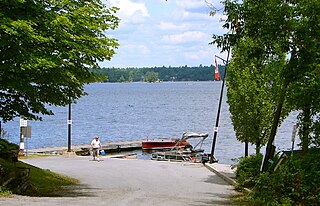
Pigeon Lake is a lake in Ontario, Canada. It is one of a group of lakes called the Kawartha lakes, which are the namesake of the city of Kawartha Lakes, and the Trent-Severn Waterway. Pigeon Lake is 27 km long and up to 3 km wide.

Victoria Road, Ontario Place in Ontario, Canada

Victoria Road is an unincorporated community in the Canadian province of Ontario, located within the single-tier municipality of Kawartha Lakes. The village was built around a station on the Toronto and Nipissing Railway, which was constructed in 1872. The station — the second last on the line — served the community and area until the last train passed through in 1965, after which the tracks were lifted.

Canal Lake lake in Kawartha Lakes, Ontario, Canada

Canal Lake is a lake of Ontario, Canada, situated in the City of Kawartha Lakes. The lake is triangular, roughly 8.4 kilometres (5.2 mi) long and 2.6 kilometres (1.6 mi) at its widest point, with an area of 2,136 acres (864 ha). The depth ranges from 4.44 feet (1.35 m) to a max depth of 15 feet (4.6 m). Canal Lake is a medium size lake with a large diversity of fishing spots.

References

  1. "Cats Whiskers and Skinny Dippers - Fly fishing For Smallmouth". About Fly Fishing.com. Retrieved 2013-04-21.

Sources

The Department of Natural Resources, operating under the FIP applied title Natural Resources Canada (NRCan), is the ministry of the government of Canada responsible for natural resources, energy, minerals and metals, forests, earth sciences, mapping and remote sensing. It was created in 1995 by amalgamating the now-defunct Departments of Energy, Mines and Resources and Forestry. Natural Resources Canada (NRCan) works to ensure the responsible development of Canada's natural resources, including energy, forests, minerals and metals. NRCan also uses its expertise in earth sciences to build and maintain an up-to-date knowledge base of our landmass and resources. To promote internal collaboration, NRCan has implemented a departmental wide wiki based on MediaWiki. Natural Resources Canada also collaborates with American and Mexican government scientists, along with the Commission for Environmental Cooperation, to produce the North American Environmental Atlas, which is used to depict and track environmental issues for a continental perspective.

The Atlas of Canada is an online atlas published by Natural Resources Canada that has information on every city, town, village, and hamlet in Canada. It was originally a print atlas, with its first edition being published in 1906 by geographer James White and a team of 20 cartographers. Much of the geospatial data used in the atlas is available for download and commercial re-use from the Atlas of Canada site or from GeoGratis. Information used to develop the atlas is used in conjunction with information from Mexico and the United States to produce collaborative continental-scale tools such as the North American Environmental Atlas.