Burton View, Illinois | |
|---|---|
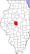
 Burton View Location in Illinois  Burton View Location in the United States | |
| Coordinates: 40°10′15″N89°29′05″W / 40.17083°N 89.48472°W | |
| Country | United States |
| State | Illinois |
| County | Logan |
| Townships | Sheridan, West Lincoln |
| Elevation | 568 ft (173 m) |
| Time zone | UTC-6 (CST) |
| • Summer (DST) | UTC-5 (CDT) |
| Area code | 217 |
| GNIS feature ID | 405276 [1] |
Burton View is an unincorporated community in Logan County, along Illinois Route 10 in Central Illinois. The community lies between Lincoln and New Holland on Route 10.