Rossosh is a town and the administrative center of Rossoshansky District in Voronezh Oblast, Russia. Population: 60,879 (2021 Census); 62,865 (2010 Census); 62,923 (2002 Census); 57,029 (1989 Soviet census).

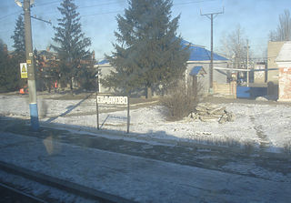
Novokhopyorsk is a town and the administrative center of Novokhopyorsky District in Voronezh Oblast, Russia, located on the right bank of the Khopyor River, 270 kilometers (170 mi) southeast of Voronezh, the administrative center of the oblast. Population: 5,948 (2021 Census); 6,849 (2010 Census); 7,640 (2002 Census); 8,048 (1989 Soviet census).

Ertil is a town and the administrative center of Ertilsky District in Voronezh Oblast, Russia, located on the Ertil River, 145 kilometers (90 mi) east of Voronezh, the administrative center of the oblast. Population: 10,024 (2021 Census); 11,387 (2010 Census); 12,885 (2002 Census); 14,144 (1989 Soviet census).

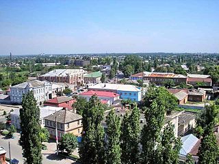
Kalach is a town and the administrative center of Kalacheyevsky District in Voronezh Oblast, Russia, located at the confluence of the Tolucheyevka and Podgornaya Rivers, 294 kilometers (183 mi) from Voronezh, the administrative center of the oblast. Population: 20,046 (2010 Census); 20,950 (2002 Census); 23,183 (1989 Soviet census).
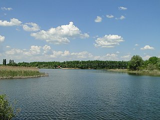
Buturlinovka is a town in Voronezh Oblast, Russia, on the Ossered River, a tributary of the Don. It serves as the administrative center of Buturlinovsky District. Its population as of 2021 was 24,397.

Anninsky District is an administrative and municipal district (raion), one of the thirty-two in Voronezh Oblast, Russia. It is located in the north of the oblast. The area of the district is 2,098 square kilometers (810 sq mi). Its administrative center is the urban locality of Anna. Population: 36,149 (2021 Census); 45,385 (2010 Census); 52,747 (2002 Census); 56,617 (1989 Soviet census). The population of Anna accounts for 42.4% of the district's total population.

Bobrovsky District is an administrative and municipal district (raion), one of the thirty-two in Voronezh Oblast, Russia. It is located in the center of the oblast. The area of the district is 2,233 square kilometers (862 sq mi). Its administrative center is the town of Bobrov. Population: 49,371 (2021 Census); 49,494 (2010 Census); 54,162 (2002 Census); 58,650 (1989 Soviet census). The population of Bobrov accounts for 42.3% of the district's total population.

Ertilsky District is an administrative and municipal district (raion), one of the thirty-two in Voronezh Oblast, Russia. It is located in the north of the oblast. The area of the district is 1,457.81 square kilometers (562.86 sq mi). Its administrative center is the town of Ertil. Population: 20,865 (2021 Census); 25,728 (2010 Census); 31,499 (2002 Census); 36,054 (1989 Soviet census). The population of Ertil accounts for 48.0% of the district's total population.

Kalacheyevsky District is an administrative and municipal district (raion), one of the thirty-two in Voronezh Oblast, Russia. It is located in the east of the oblast. The area of the district is 2,106 square kilometers (813 sq mi). Its administrative center is the town of Kalach. Population: 57,242 ; 61,794 (2002 Census); 61,945 (1989 Soviet census). The population of Kalach accounts for 35.0% of the district's total population.
Kamensky District is an administrative and municipal district (raion), one of the thirty-two in Voronezh Oblast, Russia. It is located in the west of the oblast. The area of the district is 999 square kilometers (386 sq mi). Its administrative center is the urban locality of Kamenka. Population: 17,087 (2021 Census); 20,612 (2010 Census); 21,953 (2002 Census); 22,995 (1989 Soviet census). The population of Kamenka accounts for 47.2% of the district's total population.

Khokholsky District is an administrative and municipal district (raion), one of the thirty-two in Voronezh Oblast, Russia. It is located in the northwest of the oblast. The area of the district is 1,451 square kilometers (560 sq mi). Its administrative center is the urban locality of Khokholsky. Population: 29,639 (2021 Census); 29,814 (2010 Census); 32,889 (2002 Census); 39,700 (1989 Soviet census). The population of the administrative center accounts for 26.8% of the district's total population.

Paninsky District is an administrative and municipal district (raion), one of the thirty-two in Voronezh Oblast, Russia. It is located in the north of the oblast. The area of the district is 1,398 square kilometers (540 sq mi). Its administrative center is the urban locality of Panino. Population: 24,236 (2021 Census); 29,231 (2010 Census); 33,017 (2002 Census); 36,143 (1989 Soviet census). The population of Panino accounts for 24.7% of the district's total population.

Petropavlovsky District is an administrative and municipal district (raion), one of the thirty-two in Voronezh Oblast, Russia. It is located in the southeast of the oblast. The area of the district is 1,643.59 square kilometers (634.59 sq mi). Its administrative center is the rural locality of Petropavlovka. Population: 16,573 (2021 Census); 20,042 (2010 Census); 23,414 (2002 Census); 25,128 (1989 Soviet census). The population of Petropavlovka accounts for 29.0% of the district's total population.

Ramonsky District is an administrative and municipal district (raion), one of the thirty-two in Voronezh Oblast, Russia. It is located in the northwest of the oblast. The area of the district is 1,281 square kilometers (495 sq mi). Its administrative center is the urban locality of Ramon. Population: 38,471 (2021 Census); 32,027 (2010 Census); 33,230 (2002 Census); 43,711 (1989 Soviet census). The population of Ramon accounts for 22.0% of the district's total population.

Repyovsky District is an administrative and municipal district (raion), one of the thirty-two in Voronezh Oblast, Russia. It is located in the northwest of the oblast. The area of the district is 934 square kilometers (361 sq mi). Its administrative center is the rural locality of Repyovka. Population: 15,304 (2021 Census); 16,027 (2010 Census); 17,884 (2002 Census); 20,420 (1989 Soviet census). The population of Repyovka accounts for 35.3% of the district's total population.
Verkhnekhavsky District is an administrative and municipal district (raion), one of the thirty-two in Voronezh Oblast, Russia. It is located in the north of the oblast. The area of the district is 1,253 square kilometers (484 sq mi). Its administrative center is the rural locality of Verkhnyaya Khava. Population: 23,058 (2021 Census); 25,156 (2010 Census); 26,656 (2002 Census); 30,896 (1989 Soviet census). The population of Verkhnyaya Khava accounts for 31.9% of the district's total population.

Anna is an urban locality and the administrative center of Anninsky District of Voronezh Oblast, Russia. Population: 15,316 (2021 Census); 18,032 (2010 Census); 19,416 (2002 Census); 19,080 (1989 Soviet census).

Novaya Usman is a rural locality and the administrative center of Novousmansky District of Voronezh Oblast, Russia. Population: 36,540 (2021 Census); 29,270 (2010 Census); 22,476 (2002 Census); 18,223 (1989 Soviet census).
Petropavlovka is a rural locality and the administrative center of Petropavlovsky District of Voronezh Oblast, Russia. It has a population of 4,819 people.
Vorobyovka is a rural locality and the administrative center of Vorobyovsky District of Voronezh Oblast, Russia. Population: 3,662 (2021 Census); 4,103 (2010 Census); 4,482 (2002 Census); 5,702 (1989 Soviet census).