CN Alderdale Subdivision

Last updated
Alderdale Subdivision
CN Railway logo.svg
Kiosk station.jpg
Canadian National Railway station at Kiosk, c. 1970s
Overview
StatusCeased operation; tracks lifted
Owner Canadian Northern Railway (1915–23)
Canadian National Railway (1923–96)
Locale Northeastern Ontario, Canada
Termini
Service
Type Heavy rail
System Canadian Northern Railway (1915–1923)
Canadian National Railway (1923–1996)
Services CN Railway logo.svg Super Continental
Northlander
History
Opened1915 (1915)
Reorganization1987–88 (into CN Beachburg and CN Newmarket Subdivisions)
Closed1996
Technical
Line length144.76 mi (232.97 km)
Track gauge 1,435 mm (4 ft 8+12 in) standard gauge
Operating speed60 mph (97 km/h)
Route map

Contents

miles
BSicon CONTg.svg
continues as
Sudbury Subdivision
now Bala Subdivision
CN Railway logo.svg
BSicon BHF.svg
144.76
Capreol
VIA Rail Canada simplified.svg
BSicon STR.svg
144.59
junction with Sudbury Subdivision
CN Railway logo.svg
BSicon CONTgq.svg
BSicon HSTq.svg
BSicon LSTRq.svg
BSicon ABZgnr+nr.svg
BSicon ABZgr.svg
144.28
wye to
CN Sudbury Subdivision
now CN Bala Subdivision
and Sudbury Junction
VIA Rail Canada simplified.svg CN Railway logo.svg
BSicon SKRZ-G2BUE.svg
144.27
Ontario 69 crown.svg  Highway 69
BSicon ENDExe.svg
end of existing tracks
BSicon exPSLl.svg
137.8
Hagarty
BSicon dWASSERq.svg
BSicon exWBRUCKE1.svg
BSicon dWASSERq.svg
Massey Creek
BSicon exSTR.svg
BSicon ePSLla.svg
BSicon exWORKS.svg
135.7
East Rim Nickel Mines Ltd.
BSicon exSTR.svg
BSicon RP1q.svg
134.84
McLennan Mine Rd. crossing
BSicon exKMW.svg
134.5
Bowlands Bay
BSicon exWORKS.svg
BSicon exSTR.svg
BSicon ePSLre.svg
134.1
M.J. Poupore Lumber Company (before 1954)
BSicon exHST.svg
134.1
Skead
BSicon exWORKS.svg
BSicon exSTR.svg
BSicon ePSLre.svg
134.0
M.J. Poupore Lumber Company (1954 onward)
BSicon exlv-BHF.svg
BSicon exPSLl.svg
131.1
Spaidal
BSicon WASSER.svg
BSicon exSTR.svg
Kabikotitwia River
BSicon WASSER.svg
BSicon exHST.svg
128.0
Basin Mines
BSicon WASSER.svg
BSicon exSTR.svg
BSicon ePSLre.svg
125.1
H. Goulard & Son No. 3
BSicon WASSER.svg
BSicon exlv-BHF.svg
BSicon exPSLl.svg
122.2
Crerar
BSicon WASSER.svg
BSicon exKMW.svg
120.0
Ess Creek
BSicon WASSER.svg
BSicon exHST.svg
116.7
Washagami
BSicon WASSER.svg
BSicon exHST.svg
114.0
Chudleigh
BSicon WABZg+l.svg
BSicon WASSERq.svg
BSicon exhKRZWae.svg
BSicon WASSERq.svg
Sturgeon River
BSicon GRZq.svg
BSicon WASSER.svg
BSicon GRZq.svg
BSicon exSTR+GRZq.svg
Sudbury District
Nipissing District
BSicon WASSER.svg
BSicon exKMW.svg
109.7
Glen Afton
BSicon WABZgl.svg
BSicon WASSERq.svg
BSicon exWBRUCKE1.svg
BSicon WASSERq.svg
BSicon WABZgl.svg
BSicon WASSERq.svg
BSicon exWBRUCKE1.svg
BSicon WASSERq.svg
BSicon WASSER.svg
BSicon exWORKS.svg
BSicon exPSLl.svg
BSicon exlv-BHF.svg
BSicon ePSLra.svg
107.4
Azen
and J.D. Cockburn siding
BSicon WASSER.svg
BSicon exSTR.svg
BSicon ePSLre.svg
105.9
A.J. Giroux No. 1
BSicon WASSER.svg
BSicon exSTR.svg
BSicon ePSLla.svg
BSicon exWORKS.svg
104.2
Nipissing Black Granite Co.
BSicon WASSER.svg
BSicon WASSER+l.svg
BSicon exhKRZWae.svg
BSicon WASSERq.svg
Temagami River
BSicon WABZg+l.svg
BSicon WASSERr.svg
BSicon exlv-BHF.svg
BSicon exPSLl.svg
102.7
River Valley
BSicon WASSER.svg
BSicon exlv-BHF.svg
BSicon exPSLl.svg
98.3
Desaulniers
BSicon WABZgl.svg
BSicon WASSERq.svg
BSicon exWBRUCKE1.svg
BSicon WASSERq.svg
Hebert Creek
BSicon WASSER.svg
BSicon exPSLr.svg
94.2
Team Track No. 2
BSicon WASSER.svg
BSicon exlv-BHF.svg
BSicon exPSLl.svg
93.7
Field
BSicon WABZgl.svg
BSicon WASSERq.svg
BSicon exWBRUCKE1.svg
BSicon WASSERq.svg
Pike River
BSicon WASSER.svg
BSicon exWORKS.svg
BSicon exSTR.svg
BSicon ePSLra.svg
93.1
Millfield
BSicon WASSER.svg
BSicon exlvBHF-.svg
BSicon exPSLr.svg
92.1
Ashburton
BSicon WASSERl.svg
BSicon WASSERq.svg
BSicon exhKRZWae.svg
BSicon WASSER+r.svg
90.7
Sturgeon River
BSicon exlv-BHF.svg
BSicon exPSLl.svg
BSicon WASSER.svg
86.1
Crystal Falls
BSicon WASSERq.svg
BSicon exhKRZWae.svg
BSicon WASSERr.svg
BSicon exlv-BHF.svg
BSicon exPSLl.svg
67.4
Harfred
BSicon CONT2.svg
BSicon STRc3.svg
BSicon exSTR.svg
BSicon ePSLra.svg
77.0
Team Track No. 1
BSicon STRc1.svg
BSicon STR+4.svg
BSicon exHST.svg
BSicon ePSLra.svg
76.1
Meadowside
BSicon STR.svg
BSicon exKMW.svg
71.4
Beaucage
BSicon STR.svg
BSicon exlv-BHF.svg
BSicon exPSLl.svg
67.4
Yellek
BSicon STR.svg
BSicon exSTR.svg
BSicon ePSLla.svg
BSicon exWORKS.svg
64.1
Great Northern Wood Co. Ltd.
BSicon STR.svg
BSicon exSTR.svg
BSicon ePSLle.svg
BSicon exWORKS.svg
62.8
Imperial Oil
BSicon STR.svg
BSicon exSTR.svg
BSicon ePSLla.svg
BSicon exWORKS.svg
62.5
Shell Oil & R. E.& E. Co.
BSicon STR.svg
BSicon exSTR.svg
BSicon ePSLla.svg
BSicon exWORKS.svg
62.1
J. J. Saya & Son
BSicon STR.svg
BSicon exPSLl.svg
61.8
North Bay West
BSicon STR.svg
BSicon exBHF.svg
61.4
North Bay CN
BSicon eBHF.svg
BSicon exSTR.svg
North Bay CPR
BSicon STR.svg
BSicon exSTR.svg
BSicon ePSLle.svg
BSicon exWORKS.svg
60.8
Trinidad Leaseholds
BSicon STR.svg
BSicon xKRZ+xl.svg
BSicon BHFq.svg
BSicon CONTfq.svg
60.5
North Bay ONR
and ONR Temagami Subdivision
BSicon YRDa.svg
BSicon exSTR.svg
BSicon ePSLra.svg
60.1
right: Durocher Brothers
BSicon YRDe.svg
BSicon ENDExa.svg
end of existing tracks
BSicon ABZgnl.svg
BSicon ABZgnr+nr.svg
59.1
junction to Transfer Yard
BSicon STRl.svg
BSicon KRZo.svg
BSicon CONTfq.svg
Ottawa Valley Railway
originally CP North Bay Subdivision
Canadian Pacific Railway logo 2014.svg
BSicon STRc2.svg
BSicon xABZg3.svg
56.4
Nipissing junction
BSicon CONT1.svg
BSicon exSTR.svg
BSicon STRc4.svg
Huntsville Subdivision
now Bala Subdivision
CN Railway logo.svg
BSicon exHST.svg
56.3
Nipissing
BSicon exHST.svg
52.5
Derland
BSicon exHST.svg
48.7
Astorville
BSicon exPSL.svg
45.5
Grahamvale
BSicon exBHF.svg
42.7
Alderdale
BSicon dWASSERq.svg
BSicon exWBRUCKE1.svg
BSicon dWASSERq.svg
Graham Creek
BSicon dWASSERq.svg
BSicon exWBRUCKE1.svg
BSicon dWASSERq.svg
Wasi River
BSicon exHST.svg
37.3
Wasing
BSicon exHST.svg
34.8
Fossmill
BSicon exHST.svg
BSicon ePSLre.svg
30.6
Kilrush
BSicon exHST.svg
22.3
Coristine
BSicon exWORKS.svg
BSicon exSTR.svg
BSicon ePSLra.svg
21.7
Staniforth Lumber Company No. 3
BSicon exWORKS.svg
BSicon exSTR.svg
BSicon ePSLre.svg
21.7
Staniforth Lumber Company No. 2
BSicon exHST.svg
21.7
Kiosk
BSicon exHST.svg
17.9
Ascalon
BSicon exKMW.svg
14.8
Mink Lake
BSicon exSTR.svg
BSicon ePSLra.svg
10.3
J. D. Campbell & Sons
BSicon exHST.svg
BSicon ePSLre.svg
10.2
Daventry
BSicon exHST.svg
4.0
Government Park
BSicon exBHF.svg
BSicon exYRD.svg
0.0
Brent
BSicon exCONTf.svg
Beachburg Subdivision
CN Railway logo.svg

The Canadian National Railway Alderdale Subdivision was a railway line in Northeastern Ontario, Canada. It originally opened in 1915 as a part of the Canadian Northern Railway's transcontinental mainline. It connected Brent in the east with Capreol in the west. At Capreol it formed the eastern component of an east-west-south wye junction. The line's divisional point was at Alderdale.

History

Origin

Ascalon at Mink Lake, as seen in 1932. Ascalon Station, Mink Lake, 1932.jpg
Ascalon at Mink Lake, as seen in 1932.

The line originated as a part of the Canadian Northern Railway (CNoR) mainline, which was pushing eastward from the Prairies in an effort to connect its network to Montréal. The segment from Capreol to North Bay opened to passenger traffic in 1915. [1] After the Canadian Northern's amalgamation with other railways, resulting in the Canadian National Railway (CN), the line was used as CN's most direct route between Québec and the Prairies, paralleling the competing CP North Bay Subdivision to the north along its eastern stretch and the CP Cartier Subdivision to the south along its western. As part of CN's reorganization of the Canadian Northern lines, the stretch from Brent to Capreol became known as the Alderdale Subdivision and was part of the Capreol Division, Northern Ontario District. [2]

Flagship route

Throughout the mid-20th century, the subdivision formed part of the route for CN's flagship transcontinental passenger trains, such as the Continental and Super Continental . [3] Its main use, however, was as a freight railway, with large amounts of timber from the mills at Kiosk, Fossmill, and Skead, as well as ore from Crerar, being transported along the line. [4] Local passenger services declined and were discontinued by CN in the 1960s, [4] but the Super Continental continued despite repeated applications by CN to the Canadian Transport Commission to end it. [5] In 1977, Via Rail was formed as a Crown corporation under the Canadian federal government and immediately assumed control of CP's passenger service, while also slowly integrating CN services. This resulted in the ex-CP Canadian from Toronto to Vancouver as the primary transcontinental passenger service and CN's Super Continental as the secondary one. [6] By 1979, services had been reorganized such that the Canadian was routed along the CP North Bay Subdivision between Sudbury and North Bay, and the Super Continental routed along the modern-day route of the Canadian south to Toronto from Sudbury along CN tracks, with the Alderdale Subdivision seeing no passenger service along most of its length. [7] However, in 1980, a short stretch of the Alderdale Subdivision near North Bay was used by the Ontario Northland Railway's Northlander passenger train as a way to connect Ontario Northland's Temagami Subdivision with Toronto in the south via the Huntsville Subdivision (which later became part of the Newmarket Subdivision and then the Bala Subdivision after successive reorganizations of the CN system). [8] [9]

Pépin's Axe and end of passenger service

In 1981, Via Rail experienced its first wave of significant cuts, sometimes called "Pépin's Axe" in an evocation of the 1960s Beeching Axe in the United Kingdom, under federal Transport Minister Jean-Luc Pépin (a member of Pierre Trudeau's Liberal cabinet), resulting in the cancellation of the Super Continental and making restoration of service along the Alderdale Subdivision increasingly unlikely. [6] This resulted in protests and a political backlash, [10] and after the 1984 election which resulted in the victory of Brian Mulroney's Progressive Conservatives, the Super Continental was partially reinstated, but only between Winnipeg and Vancouver. [11]

Canadian National Railway station at North Bay, c. 1925. CN North Bay 1925.jpg
Canadian National Railway station at North Bay, c. 1925.

In 1986, ownership of CN's passenger station in North Bay was transferred to Via Rail. [12] At the time, the station saw traffic from Ontario Northland's daytime Northlander running Sunday to Friday, unnamed Via Rail local trains 120 and 123 which served small communities on Fridays and Sundays between Toronto and North Bay, and an overnight Northland sleeper train which ran daily from Toronto to Hearst. [13] In 1990, passenger services through North Bay were cancelled by Via Rail after severe cuts to its funding by the Canadian federal government. [14] [12] With abandonment of services along the CN line, Ontario Northland built a new intermodal station in 1990 along its own track and relocated its services there. [15]

Freight decline

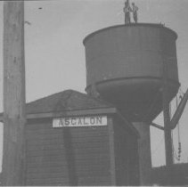
Meanwhile, freight traffic along the line had steeply declined, as available timber in the area had been depleted and several of the sawmills had closed. [4] Around 1987–88, [1] [16] the Alderdale Subdivision was abolished as a designation by CN, with the 51.5-mile (82.9 km) section from Brent to Nipissing combined with the Beachburg Subdivision and the 83.3-mile (134.1 km) section from Nipissing to Capreol combined with the Newmarket Subdivision. [16] This situation would be short-lived, however, as in 1995 CN applied to abandon the Beachburg Subdivision west of Pembroke, which included the Beachburg portion of the former Alderdale Subdivision. [17] The application was approved by the Canadian Transportation Agency in 1996 and the tracks were removed shortly after. [18] A number of existing communities along the line were devastated, such as Kiosk, where residents were forced to leave and their houses were demolished by the Ontario Ministry of Natural Resources as they fell within the boundaries of Algonquin Provincial Park. [4]

Abandonment and redevelopment

The disused rail bridge over Highway 64 at Field in 2013. Hwy 64 ON.JPG
The disused rail bridge over Highway 64 at Field in 2013.

By the early 2000s, a local community group, Rainbow Routes, was organized to promote the conversion of the section from Capreol to North Bay to a rail trail. This was projected to occur in 2001, with a CN Rail transfer of ownership of the disused right of way to the Trans Canada Trail Foundation. [19] However, by 2011, development of the trail had not occurred and was still being pursued by Rainbow Routes. [20]

In 2002, Vic Fedeli was elected Mayor of North Bay. As mayor, he engaged in an aggressive redevelopment policy which saw much of the old CN rail infrastructure dismantled after the right of way was sold to the city for a symbolic $1 sum, including the demolition of many of the rail-over-road trestle bridges around the city in order to widen roads and eliminate "traffic bottlenecks". [21] A development boom ensued, with much of the old railway lands undergoing gentrification. [21] As a result, a large number of single-family detached suburban homes were constructed in neighbourhoods like Pinewood, with some higher-density, more affordable housing also being constructed in other areas. [21]

References

  1. 1 2 "Alderdale Subdivision". CNR in Ontario. 9 July 2019. Retrieved 20 July 2020.
  2. Canadian National Railways Northern Ontario District Timetable, Canadian National Railways, 2 September 1945
  3. Canadian National Railways Public Timetable, Canadian National Railways, 27 October 1957
  4. 1 2 3 4 Brown, Ron (2014). Dundurn Railroad Bundle: In Search of the Grand Trunk / Rails Across Ontario / Rails Across the Prairies / The Train Doesn't Stop Here Anymore. Dundurn Press. ISBN   9781459728363.
  5. "CN gets order to continue Super". The Gazette. Montreal. March 3, 1971. p. 29 via Newspapers.com. Open Access logo PLoS transparent.svg
  6. 1 2 "Pepin's axe falls on Via". Nanaimo Daily News. November 16, 1981. p. 2 via Newspapers.com. Open Access logo PLoS transparent.svg
  7. Gagnon, David J. "Canadian National Railways Super Continental - VIA Train Number 3 Late October 1979" . Retrieved 25 July 2020.
  8. "Huntsville Subdivision". CNR in Ontario. 15 November 2015. Retrieved 20 July 2020.
  9. Canadian National Railways Employee Timetable, Canadian National Railways, 8 June 1980
  10. "Via cutback protest readied". The Chilliwack Progress. Chilliwack, British Columbia. October 21, 1981. p. 35 via Newspapers.com. Open Access logo PLoS transparent.svg
  11. New York Times (April 14, 1985). "Canrailpass Enables Unlimited Travel". The Palm Beach Post. West Palm Beach, FL. p. 125 via Newspapers.com. Open Access logo PLoS transparent.svg
  12. 1 2 North Bay CNR Station . Canadian Register of Historic Places .
  13. System Timetable, Via Rail, 26 October 1986
  14. "Former Canadian National Railway Station". City of North Bay. Retrieved 21 July 2020.
  15. Vollhardt, Frank Jr. (December 1990). "New on the Northland". Trains . Vol. 51, no. 2. pp. 10–12.
  16. 1 2 Chapman, Bruce (December 1987). "Identity Lost" (PDF). Branchline. Bytown Railway Society.
  17. "Beachburg Subdivision". CNR in Ontario. 9 July 2019. Retrieved 21 July 2020.
  18. Canadian Transportation Agency (18 April 1996), Order No. 1996-R-152 , retrieved 25 July 2020
  19. "Rail line put to use". Northern Ontario Business . 18 June 2001. Retrieved 25 July 2020.
  20. Pickard, Arron (14 November 2011). "Rainbow Routes strives to connect Sudbury and North Bay". Sudbury.com. Retrieved 25 July 2020.
  21. 1 2 3 "A Pictorial History: The CN Rail Line & The City of North Bay" (PDF). City of North Bay.

Further reading