Isla Cabras Light, also known as Faro de Isla Cabras, was a lighthouse located on a rocky but flat islet with the same name, which sit just off the coast near Ceiba, Puerto Rico, toward the Vieques Passage.
Île Vierge is a 6-hectare (15-acre) islet lying 1.5 kilometres off the north-west coast of Brittany, opposite the village of Lilia. It is in the commune of Plouguerneau, in the département of Finistère. It is the location of the tallest stone lighthouse in Europe, and the tallest "traditional lighthouse" in the world. The International Hydrographic Organization specifies Île Vierge as marking the south-western limit of the English Channel.

Cape Bojeador Lighthouse, also known as Burgos Lighthouse, is a cultural heritage structure in Burgos, Ilocos Norte, that was established during the Spanish colonial period in the Philippines. The lighthouse was first lit on March 30, 1892, and is set high on Vigia de Nagpartian Hill overlooking the scenic Cape Bojeador where early galleons used to sail by. After over 100 years, it still functions and serves ships that enter the Philippine archipelago from the north and guide them safely away from the rocky coast of the town.

The Pasig River Light was the first light station in the Philippines when it was established in 1642. The first lighthouse tower in the country was erected in the station and first lit in 1846. It was then located on the north jetty at the mouth of the Pasig River in San Nicolas, Manila, marking the entrance of the river for vessels cruising Manila Bay, looking to dock on the inland Port of Manila that was then located along the banks of the Pasig River in Binondo and Intramuros.

The Maniguin Island Lighthouse is a lighthouse that marks the Cuyo East Passage, a main shipping route south into the Sulu Sea. The island, also known as Maningning Island or Hammerhead Island, is located 42.6 kilometres (26.5 mi) off of the coast of Culasi, Antique in the Philippines. It has a narrow ridge 33.5 metres (110 ft) high across its southern end, and the remainder of the island is low and wooded, and not more than 4.5 metres (15 ft) high. It is fringed with coral reefs with deep water at their edges. The round cylindrical concrete tower with a gallery on top is located near the southeastern point of the island.
Batag Island Lighthouse is a historic lighthouse on Batag Island off the coast of the town of Laoang in the province of Northern Samar in the Philippines. The light marks the northeastern point of Samar Island and led international ships to the entrance of the San Bernardino Strait marked by the San Bernardino Light. One of the most traveled waterways in the archipelago, together with the Capul Island Light, these stations are invaluable to vessels coming from the Pacific Ocean and entering the country through the San Bernardino Strait on its way to Manila or any other ports of the Philippines.
The Apo Reef Light was a historic lighthouse built on Bajo Apo Island in Apo Reef Natural Park. The park is located in the middle of Mindoro Strait, west of the province of Occidental Mindoro, in the Philippines. The station was established to warn ships of the dangerous shallow reefs in that part of the strait.

Cape Engaño Lighthouse, also known as Faro de Cabo Engaño, is a historic lighthouse located at Cape Engaño on Palaui Island in the town of Santa Ana, the province of Cagayan, Philippines. Located at the northernmost part of Luzon Island and situated atop the summit of a hill, 92 meters above sea level, the lighthouse provides a 360-degree view of Babuyan Island and the Dos Hermanas Island on the North, Pacific Ocean on the West and Engaño cove on the East.

Capones Island Lighthouse is a historic lighthouse located in Capones Island off the coast of Barangay Pundaquit, San Antonio, in the province of Zambales, in the Philippines. The light guides international vessels coming from the north to northwest towards Subic Bay or to Corregidor Island Lighthouse at the entrance of Manila Bay. It had first-order lenses when it was first lit on August 1, 1890.

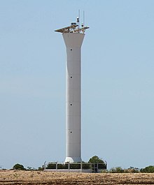
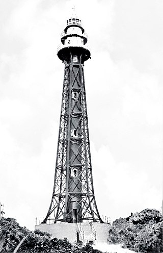
Cape Bowling Green Light is an active lighthouse on Cape Bowling Green, a long headland ending in a long low sandspit, about 30 kilometres (19 mi) from Ayr, Queensland, Australia. The lighthouse is at the end of the headland, near the base of the sandspit. The first lighthouse at the location, established in 1874, was moved multiple times. It was prefabricated in Brisbane, shipped to the location, moved twice due to coastal erosion and finally transferred for display at the Australian National Maritime Museum at Darling Harbour in Sydney.

Dent Island Light is an active lighthouse on Dent Island, a small island off the coast of Queensland, Australia, part of the Whitsunday Group of the Whitsunday Islands. Located on the southwest tip of the island, the light guides ships navigating the Whitsunday Passage, between Whitsunday Island and the islands to the west, and marks the Dent Island Passage.
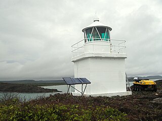
Eborac Island Light is an active lighthouse on Eborac Island, a small rocky island in the Adolphus Channel just off Cape York, the northern tip of Cape York Peninsula, Far North Queensland, Australia. It guides ships into the coastal channel inside the Great Barrier Reef. A concrete structure was built in 1921 and converted to solar power in 1990. It was replaced with a fiberglass structure in 2012.

The first Corregidor Island Lighthouse was a historic lighthouse located on the island of Corregidor, in the province of Cavite, Philippines. The light station was one of the most important lights in the archipelago. It was established in 1853 to guide ships to the entrance of Manila Bay on their way to the port of Manila, the most important trading center in the country. This light occupies the converging point of two lines of approach for vessels from the China Sea which steer for the entrance of Manila Bay. Vessels from Hong Kong and the ports of China to the northwest first sight the Capones Island light off the southwest coast of Zambales. Vessels from ports of Indo-China first sight the Corregidor lights in the center. Vessels from Singapore, Indonesia, India, and all the ports of the Philippine Islands, to the south, first sight the Cabra Island light. All lines converge on Corregidor light at the bay entrance.

Lågskär Lighthouse is an automated lighthouse located on the north side of Lågskär, one of Finland's Åland in the Sea of Åland of the Baltic. It is the only striking feature on Lågskär on the generally uninhabited island.

The Puerto del Rosario Lighthouse also known as the Punta Gaviota Lighthouse is a modern active lighthouse on the Canary island of Fuerteventura. It is located in an industrial area at the north-eastern end of the town of Puerto del Rosario, the capital and major port of the island in the Province of Las Palmas.

Punta Delgada or Alegranza Lighthouse is an active 19th century lighthouse on the Spanish island of Alegranza in the Canary islands. Alegranza lies to the north of the larger island of Lanzarote, it is part of the Chinijo Archipelago within the Teguise municipality.

Cape Santiago Lighthouse, also known as Faro de Cabo Santiago, is a historic lighthouse located about 130 kilometres (81 mi) southwest of Manila in Barangay Bagong Silang, Calatagan, Batangas, Philippines. It is the oldest working lighthouse in Batangas and one of the oldest working lighthouses in the Philippines. It serves as a guide for ships passing through the Verde Island Passage and entering Manila Bay.

Malabrigo Point Lighthouse, also known as Faro de Punta Malabrigo, is a historic lighthouse located about 115 kilometres (71 mi) southeast of Manila in Barangay Malabrigo, Lobo, Batangas, Philippines. Completed and lit in 1896, it is one of the oldest working lighthouses in the Philippines as well as the best preserved lighthouse in the country. It serves as a guide for ships passing through the Verde Island Passage going to either Batangas Bay or Sibuyan Sea.