
The Philippines is an archipelago that comprises 7,641 islands, and with a total land area of 300,000 square kilometers (115,831 sq mi), it is the world's fifth largest island country. The eleven largest islands contain 95% of the total land area. The largest of these islands is Luzon at about 105,000 square kilometers (40,541 sq mi). The next largest island is Mindanao at about 95,000 square kilometers (36,680 sq mi). The archipelago is around 800 kilometers (500 mi) from the Asian mainland and is located between Taiwan and Borneo.

Biliran, officially the Province of Biliran, is an island province in the Philippines located in the Eastern Visayas region. Biliran is one of the country's smallest and newest provinces. Formerly a sub-province of Leyte, it became an independent province in 1992.
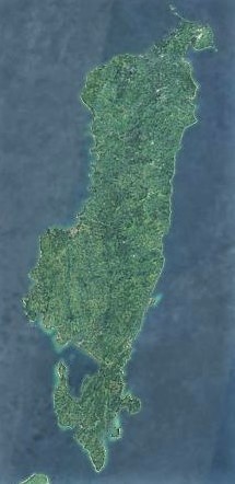
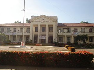
Masbate, officially the Province of Masbate, is an island province in the Philippines located near the midsection of the nation's archipelago. Its provincial capital is Masbate City. The province consists of three major islands: Masbate, Ticao and Burias.
Tablas is the largest of the islands that comprise the province of Romblon in the Philippines. The name of the island was of Spanish origin. Before the colonization of the Philippines, Tablas was known as the Island of Osigan. At the time of contact with Westerners, Osigan had a population of two hundred and fifty people living in small villages. Wax was produced in this island.
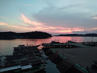
Masbate City, officially the City of Masbate, is a 4th class component city and capital of the province of Masbate, Philippines. According to the 2020 census, it has a population of 104,522 people.
Turtle Islands, officially the Municipality of Turtle Islands, is a 5th class municipality in the province of Tawi-Tawi, Philippines. According to the 2020 census, it has a population of 5,683 people.

Aroroy, officially the Municipality of Aroroy, is a 1st class municipality in the province of Masbate, Philippines. According to the 2020 census, it has a population of 88,351 people. The town is known for the Kalanay Cave, one of the most important archaeological sites in Masbate province.
Batuan, officially the Municipality of Batuan, is a 5th class municipality in the province of Masbate, Philippines. According to the 2020 census, it has a population of 14,610 people.

Esperanza, officially the Municipality of Esperanza, is a 5th class municipality in the province of Masbate, Philippines. According to the 2020 census, it has a population of 17,534 people.

Milagros, officially the Municipality of Milagros, is a 1st class municipality in the province of Masbate, Philippines. According to the 2020 census, it has a population of 57,538 people.

Monreal, officially the Municipality of Monreal, is a 4th class municipality in the province of Masbate, Philippines. According to the 2020 census, it has a population of 25,164 people.

San Fernando, officially the Municipality of San Fernando, is a 5th class municipality in the province of Masbate, Philippines. According to the 2020 census, it has a population of 21,600 people.

San Jacinto, officially the Municipality of San Jacinto, is a 4th class municipality in the province of Masbate, Philippines. According to the 2020 census, it has a population of 29,686 people.. San Jacinto is the commercial capital of Ticao Island.

Uson, officially the Municipality of Uson, is a 3rd class municipality in the province of Masbate, Philippines. According to the 2020 census, it has a population of 57,166 people.
Carles, officially the Municipality of Carles, is a 2nd class municipality in the province of Iloilo, Philippines. According to the 2020 census, it has a population of 72,637 people.
Bagatao Island Lighthouse is a historic lighthouse located on Bagatao Island on the eastern side of the entrance to Sorsogon Bay, in the province of Sorsogon in the Philippines. The 29-foot (8.8 m) white cylindrical iron tower is situated on the rocky headland that forms the southern point in the western end of the Island, giving the total light elevation of {convert|135|ft}}. The light not only marks the entrance to the bay, but also assists ships in navigating the bend around Ticao Island of Masbate province as they head to San Bernardino Strait and exit to the Pacific Ocean.
Bugui Point Lighthouse is a historic lighthouse located on Bugui Point in the town of Aroroy, in the northern tip of Masbate Island, province of Masbate, in the Philippines. It lights the entrance to the channel between Burias Island and Masbate Island and the channel between Burias and Ticao Islands leading to San Bernardino Strait.

Babuyan Island is the highest and northernmost island in the Babuyan Islands in Luzon Strait north of Luzon Island in the Philippines and also directly south of Taiwan via Bashi Channel to Luzon Strait. The whole island makes up the barangay of Babuyan Claro, that constitute the municipality of Calayan in Cagayan province. The volcanic island has a population of 1,910 as of the 2020 census, up from 1,423 in 2010.
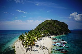
Jintotolo is an island within the Jintotolo Channel, part of the Province of Masbate, Philippines. It constitutes two barangays of the Municipality of Balud and has a population of 3,574 persons in the 2015 census.


