
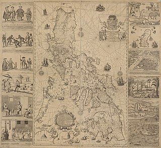
The Philippines is an archipelago that comprises 7,641 islands, and with a total land area of 300,000 square kilometers (115,831 sq mi), it is the world's fifth largest island country. The eleven largest islands contain 95% of the total land area. The largest of these islands is Luzon at about 105,000 square kilometers (40,541 sq mi). The next largest island is Mindanao at about 95,000 square kilometers (36,680 sq mi). The archipelago is around 800 kilometers (500 mi) from the Asian mainland and is located between Taiwan and Borneo.
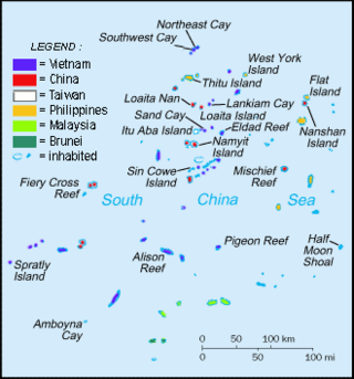
The Spratly Islands are a disputed archipelago in the South China Sea. Composed of islands, islets, cays, and more than 100 reefs, sometimes grouped in submerged old atolls, the archipelago lies off the coasts of the Philippines, Malaysia, and southern Vietnam. Named after the 19th-century British whaling captain Richard Spratly who sighted Spratly Island in 1843, the islands contain less than 2 km2 of naturally occurring land area, which is spread over an area of more than 425,000 km2 (164,000 sq mi).

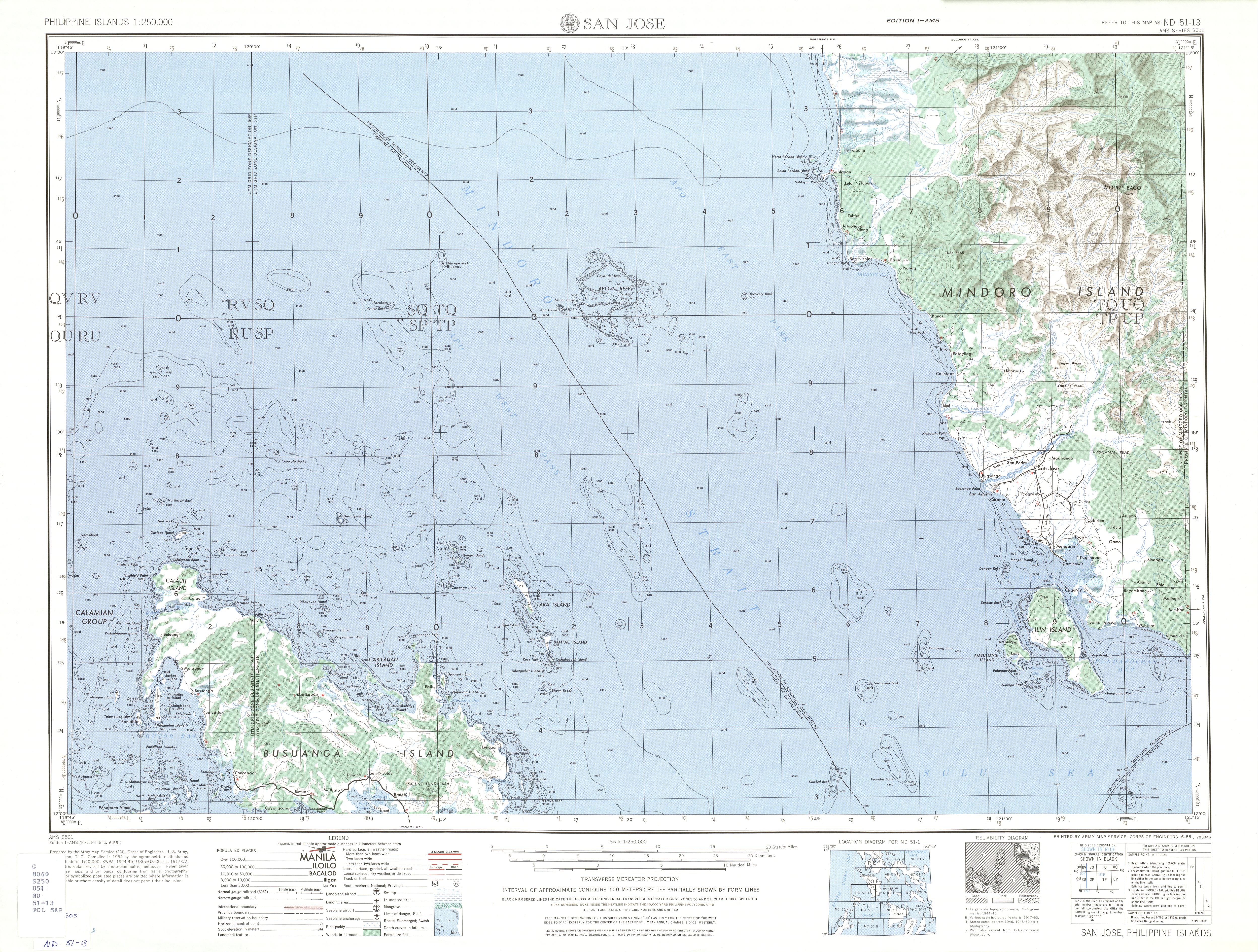
Mindoro is the seventh largest and eighth-most populous island in the Philippines. With a total land area of 10,571 km2, it has a population of 1,408,454, as of the 2020 census. It is located off the southwestern coast of Luzon and northeast of Palawan. Mindoro is divided into two provinces: Occidental Mindoro and Oriental Mindoro. Calapan is the only city in the island while San Jose is the largest settlement on the island with a total population of 143,430 inhabitants as of 2015. The southern coast of Mindoro forms the northeastern extremum of the Sulu Sea. Mount Halcon is the highest point on the island, standing at 8,484 feet (2,586 m) above sea level located in Oriental Mindoro. Mount Baco is the island's second highest mountain with an elevation of 8,163 feet (2,488 m), located in the province of Occidental Mindoro.
The Sulu Sea is a body of water in the southwestern area of the Philippines, separated from the South China Sea in the northwest by Palawan and from the Celebes Sea in the southeast by the Sulu Archipelago. Borneo is found to the southwest and Visayas to the northeast.

Occidental Mindoro, officially the Province of Occidental Mindoro, is a province in the Philippines located in the Mimaropa region. The province occupies the western half of the island of Mindoro. Its capital is Mamburao, but the most populous municipality is San Jose. Sablayan is its largest municipality in terms of area, occupying almost half of the entire province. As of 2020, Occidental Mindoro has 525,354 inhabitants.

Puerto Galera, officially the Municipality of Puerto Galera, is a 1st class municipality in the province of Oriental Mindoro, Philippines. According to the 2020 census, it has a population of 41,961 people.

The Celebes Sea or Sulawesi Sea of the western Pacific Ocean is bordered on the north by the Sulu Archipelago and Sulu Sea and Mindanao Island of the Philippines, on the east by the Sangihe Islands chain, on the south by Sulawesi's Minahasa Peninsula, and the west by northern Kalimantan in Indonesia. It extends 420 miles (675 km) north-south by 520 mi (840 km) east-west and has a total surface area of 110,000 square miles (280,000 km2), to a maximum depth of 20,300 feet (6,200 m). South of the Cape Mangkalihat, the sea opens southwest through the Makassar Strait into the Java Sea.

The Sibuyan Sea is a small sea in the Philippines separating Luzon to the Visayas.
The Philippine archipelago is one of the world's great reservoirs of biodiversity and endemism. The archipelago includes over 7000 islands, and a total land area of 300,780 km2.

The Tubbataha Natural Park, also known as the Tubbataha Reefs Natural Park, is a protected area of the Philippines located in the middle of the Sulu Sea. The marine and bird sanctuary consists of two huge atolls and the smaller Jessie Beazley Reef covering a total area of 97,030 hectares. It is located 150 kilometres (93 mi) southeast of Puerto Princesa, the capital of Palawan. The uninhabited islands and reefs are part of the island municipality of Cagayancillo, located roughly 130 kilometers (81 mi) to the northeast of the reef.

The Camotes Sea is a small sea within the Philippine archipelago, situated between the Central Visayan and the Eastern Visayan regions. It separates Cebu from Leyte hence is bordered by Cebu to the west, Leyte to the east and north, and Bohol to the south. At its center are the Camotes Islands, but it also contains Mactan Island, Olango Island, Lapinig Island, and various other small islets.

The Balabac Strait is one of the straits that connects the South China Sea with the Sulu Sea. It separates Balabac Island, Philippines, from Balambangan and the Banggi Islands north of Borneo that are a part of Malaysia's Sabah state.
The Philippines has claims on territories which include the Spratly Islands, portions of North Borneo, and the Scarborough Shoal.

The Verde Island Passage is a strait that separates the islands of Luzon and Mindoro in the Philippines, connecting the South China Sea with the Tayabas Bay and the Sibuyan Sea beyond. Traditionally, the sea lane has been one of the busiest in the Philippines because it acts as a corridor from the Port of Manila to the Visayas and Mindanao in the south. A network of ferry routes cross the passage and connect the surrounding provinces of Batangas, Marinduque, Occidental Mindoro, Oriental Mindoro and Romblon. The Verde Island Passage is identified as a site of highest marine biodiversity importance in the Coral Triangle. The 1.14 million hectare passage is extremely rich in marine biodiversity and has been called "Center of the Center of Marine Shorefish Biodiversity" with various conservation groups and local government units pushing for its nomination as a UNESCO World Heritage Site.

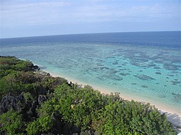
Apo Reef is a coral reef system in the Philippines situated in the western waters of Occidental Mindoro province in the Mindoro Strait. Encompassing 34 km2 (13 sq mi), it is considered the world's second-largest contiguous coral reef system, and is the largest in the country. The reef and its surrounding waters are protected areas administered as the Apo Reef Natural Park (ARNP). It is one of the best known and most popular diving regions in the country, and is on the tentative list for UNESCO World Heritage Sites.
Sibutu Passage is a deep channel some 18 miles wide that separates Borneo from the Sulu Archipelago. It has a deep sill allowing entry of deep water into the Sulu basin while connecting the Sulu Sea with the Sulawesi Sea that feeds from the Pacific Ocean by the Mindanao Current.
Since H. Otley Beyer first proposed his wave migration theory, numerous scholars have approached the question of how, when and why humans first came to the Philippines. The current scientific consensus favors the "Out of Taiwan" model, which broadly match linguistic, genetic, archaeological, and cultural evidence.

Apo is an island located in the Apo Reef in Occidental Mindoro, Philippines. It is approximately 0.5 miles (0.80 km) in length.


