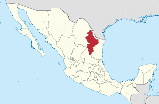
Nuevo León is a state in northeastern Mexico. The state borders the Mexican states of Tamaulipas, Coahuila, Zacatecas, and San Luis Potosi, and has an extremely narrow international border with the U.S. state of Texas. With a population of 5.78 million people, it is the seventh-most populous federal entity in Mexico and the fourtheenth most densely populated as of 2020. Nuevo León is the 13th-largest federal entity in Mexico by area, with a total land area of 64,156 square kilometers.
Santa Catarina is a city in Santa Catarina Municipality in the state of Nuevo León, Mexico that is part of the Monterrey Metropolitan area.

San Pedro Garza García is a city-municipality of the Mexican state of Nuevo León and part of the Monterrey Metropolitan area. It is a contemporary commercial suburb of the larger metropolitan city of Monterrey between Puente de la Unidad and the Alfa Planetarium, including areas surrounding Calzada del Valle/Calzada San Pedro. In 2018 it was evaluated as having the best quality of life in Mexico. It has luxury shopping malls, large green areas, as well as important colleges and hospitals. Cerro de Chipinque and Chipinque Ecological Park are notable aspects of the city. The city hosts the head offices of companies like ALFA, Cemex, Gamesa, Vitro, Pyosa, Softtek and Cydsa.
The Estado Libre y Soberano de Nuevo León was first colonized in the 16th century by immigrants from the Iberian Peninsula. The majority of these were conversos, ethnic Jews converted to Roman Catholicism. Later the state received more arrivals of other Europeans, some Asians and those from North America settled down in the 19th century. Cross-migration of local Mexicans to or from Texas creates strong cultural bonds with the neighboring U.S. The province eventually became a state of Mexico. Today it is one of the most industrialized regions of Latin America and the greater city area of its capital, Monterrey has over 5 million residents.
The governmental structures of Nuevo León, a Mexican state, are organized according to article 30 of the state constitution, which provides for a republican, representative and popular government, divided into three independent branches that cannot be joined together in a single person or institution. Nuevo León's relation with the federal government of Mexico places it in a similar relation to that federal government as any other Mexican state, but it retains certain aspects of sovereignty with respect to other Mexican states and even toward foreign countries, especially with reference to its own internal affairs.

San Nicolás de los Garza, sometimes known only as San Nicolás, is a city and coextensive municipality in the Mexican state of Nuevo León that is part of the Monterrey metropolitan area. It has become primarily a city for residences and family houses, although it still has several factories that tend to relocate to the periphery of the metropolitan area. It is the fifth-largest city in the state, behind Monterrey, Guadalupe, Ciudad Apodaca and General Escobedo.

Guadalupe is a city and surrounding municipality located in the state of Nuevo León, in northern Mexico. It is part of the Greater Monterrey Metropolitan area.
Manuel de Mederos (1539–1613) was a Portuguese explorer and settler who was active in the Spanish conquest of Mexico. He was one of the founders of the city of Saltillo, Coahuila and was the mayor of Monterrey.
Blas María de la Garza Falcón de Villarreal (1712–1767) was a Spanish settler of Tamaulipas and South Texas.

The Monterrey metropolitan area refers to the surrounding urban agglomeration of Monterrey, Nuevo León. Officially called Area Metropolitana de la Ciudad de Monterrey or AMM, the metropolitan area is the 2nd-largest in Mexico.
Camargo is a municipality in the Mexican state of Tamaulipas. It is located on the US border, across from Rio Grande City, Texas. It has an official population of 14,933 inhabitants. The municipal seat is Ciudad Camargo, with a population of 7,984. The municipality is connected to Rio Grande City, Texas, via the Rio Grande City-Camargo International Bridge.
Los Ramones is the name of a municipality and its corresponding seat of government and main population center in Mexican state of Nuevo Leon.

Ciudad Benito Juárez, or simply Juárez, is the name of a city located in the eastern part of the Monterrey metropolitan area in the state of Nuevo León, Mexico. It is the seat of the municipality of the same name. Ciudad Benito Juárez had a 2020 census population of 308,285 and is the sixth-largest city in Nuevo León. It shares borders with the municipalities of Pesquería to the north; to the south with Santiago; to the east with Cadereyta Jiménez; and to the west with Guadalupe.

García is a city and municipality located to the northwest of the Monterrey metropolitan area in the state of Nuevo León, Mexico. The municipality had, according to the 2005 census, a population of 145,867. It borders the municipalities of Mina, Escobedo and Hidalgo to the north; to the south and east with Santa Catarina; and to the west with the state of Coahuila.
Pesquería Municipality is a municipality of the state of Nuevo León in Mexico. It is located at 25º47´N 100º3´W and 330 metres (1,080 ft) above sea level. It is part of the suburban area of the Monterrey Metropolitan area. Its distance to the Monterrey city downtown area is 36 kilometres (22 mi). To the east of Pesquería is Los Ramones, to the north is Doctor González, to the west are Apodaca and General Mariano Escobedo International Airport, and to the south is Cadereyta Jiménez, all of which are in Nuevo León.

Beginning early in the 20th century, Monterrey, Mexico began a successful economic metamorphosis and growth pattern that remains an exception in Mexico. This all began with increased investments in irrigation that fueled a boom in agriculture and ranching for this northern Mexican city. The economic growth has fueled income disparity for the 3.86 million residents who live in the Monterrey Metro area (MMA). In addition, the rapid urbanization has taken a large toll on the water resources. In addressing many of this challenges, the city of Monterrey has become a model for sound and effective Integrated urban water management.

Allende Municipality is a municipality located in the northeastern Mexican state of Nuevo León. It comprises a region known as Región Citrícola, for being a major producer of orange at local, national and even international level. Allende is located at the Sierra Madre Oriental range foothills in the central-southeastern part in the state of Nuevo León. It has a territorial extension of 148.5 km², comprising around 0.22% of the whole extension of Nuevo León. Given its geographic location, the region consists of valleys and hills ranging from 300 meters above sea level on the northeast, to 1,640 meters above sea level in the southwestern part of the municipality. According to the 2010 census data, it had a population of 32,581, of whom 16,436 were men and 16,145 were women. The main economic activities are agriculture, livestock, beekeeping, poultry and transportation, activities that generate many jobs in the region. A sister city of Allende is Conroe, Texas.
The history of the Mexican city of Monterrey is closely linked with the history of the state of Nuevo León. When the New Kingdom of León was founded, it included Monterrey, Monclova, Saltillo and Cerralvo. The founding families formed a group of about thirty people in each locality. Gradually, Nuevo León was populated with families of nomadic herders of Portuguese origin who fought and displaced the native indigenous groups in the region. The city was a step away from the border with the United States and it began to be a strategic location for industry and trade between the two countries. Originally isolated by the Sierra Madre and far from the center of New Spain and independent Mexico, in the late 19th century and throughout the twentieth century various demographic, social, political, and economic issues began to unfold.

José Jerónimo de los Dolores Treviño y Leal, commonly known as Jerónimo Treviño was a prominent Mexican General and politician. He was a veteran of the Reform War and the Second French intervention in Mexico which he gained fame for his participation in several battles. After the fall of the Second Mexican Empire, Treviño served as the Governor of Nuevo León on several terms as well as the Secretary of War and Navy of Mexico from December 1, 1880, to December 31, 1881, under the cabinet of Manuel González Flores.