Cuenca is a city and municipality of Spain located in the autonomous community of Castilla–La Mancha. It is the capital of the province of Cuenca.
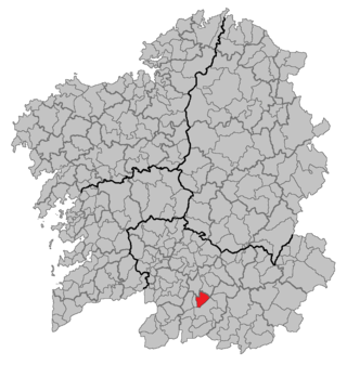
Sandiás is a municipality of Galicia, Spain, next to Xinzo de Limia in the province of Ourense. Its estimated population is 1,585, distributed among 3 parishes. Its area is 53 km2, a great part of which is drained fields from the Antela lagoon. This is an agricultural area. Potatoes and cereals are the most important crop. Sand extractions are also important for local development.
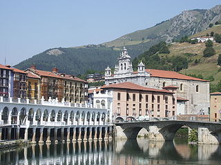
Tolosa is a town and municipality in the Basque province of Gipuzkoa, in northern Spain. It is located in the valley of the river Oria, next by Uzturre, a local mountain topped by a white cross.
Liétor is a municipality in Albacete, Castile-La Mancha, Spain, located southeast of the Iberian peninsula, in the valley of the "Mundo" river. It has a population of 1,279 inhabitants. It comprises the districts of Cañada de Tobarra, Casablanca, El Ginete, Híjar, Mullidar, Talave and La Alcadima.

Torralba de Calatrava is a municipality located in province of Ciudad Real, Castile-La Mancha, Spain. It has a population of 2959 (2021) and located 17 km (11 mi) from the capital city. Some of the municipalities located close by are Carrión de Calatrava, Daimiel, Malagón and Bolaños de Calatrava.

La Aldehuela is a municipality of Spain in the province of Ávila, in the autonomous community of Castile and León. It has a 17.04 km² area, a population of 233 inhabitants (2005) and a density of 13.91 people/km².

The designation artede (la) repoblación was first proposed by José Camón Aznar in 1949 to replace the term Mozarabic as applied to certain works of architecture from the Christian kingdoms of northern Spain between the end of the 9th and beginning of the 11th centuries. Camón argued that these buildings were related stylistically to the architecture of Asturias and owed little to Andalusian styles. Moreover, since they were built by Christians living under Christian rule, neither were they Mozarabic.
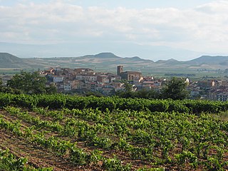
Entrena is a municipality of La Rioja, (Spain), located near the capital Logroño. Its population in January 2010 was 1,503 over an area of 21.03 square kilometres. The nucleus is placed at an altitude of 558 metres. It is bordered by Navarrete and Lardero to the north; Albelda de Iregua to the east; Nalda, Sorzano and Sojuela to the south; and Medrano to the west.
Villanueva de la Jara, popularly called La Jara, is a town and municipality in the Manchuela Conquense comarca, this in turn is part of the La Manchuela comarca, province of Cuenca, in Castile-La Mancha, Spain. It is known for the cultivation of portobellos and other edible fungi which is the main economic activity of the locality.

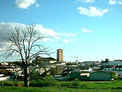
Villalba del Rey is a municipality located in the province of Cuenca, Castile-La Mancha, Spain. It is part of the natural region of La Alcarria. According to the 2004 census (INE), the municipality has a population of 662 inhabitants.
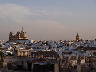
Marchena is a town in the Province of Seville in Andalusia, Spain. From ancient times to the present, Marchena has come under the rule of various powers. Marchena is a service center for its surrounding agricultural lands of olive orchards and fields of cereal crops. It is also a center for the processing of olives and other primary products. Marchena is a town of historic and cultural heritage. Attractions include the Church of San Juan Bautista within the Moorish town walls and the Arco de la Rosa. The town is associated with the folkloric tradition of Flamenco. It is the birthplace of artists including Pepe Marchena and Melchor de Marchena, guitarist. their dukes are descendants of the house of bourbon-braganza.
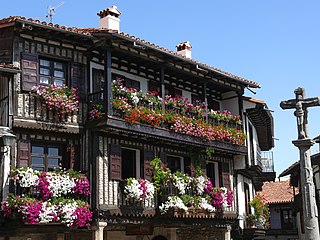
La Alberca is a municipality in the province of Salamanca in the autonomous community of Castilla y León, Spain. It is the capital of Sierra de Francia Comarca.

Manchuela or La Manchuela is a comarca located in Castile-La Mancha and Valencian Community, Spain.

The Monastery of Sant Jeroni de Cotalba is a monastic building of Valencian Gothic, Mudéjar, Renaissance, Baroque and Neoclassical styles constructed between the 14th and 18th centuries, located in the municipal area of Alfauir, (Valencia), Spain, about 8 km. from the well-known city of Gandia.
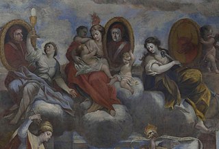
Gaspar de la Huerta (1645–1714) was a Spanish artist born at Campillo de Altobuey in Cuenca.

Ausejo is a town and municipality in the province and autonomous community of La Rioja, Spain. The municipality covers an area of 56.58 square kilometres (21.85 sq mi) and as of 2011 had a population of 1122 people.

Potes is a municipality in the autonomous community of Cantabria in Spain. It is the capital of the Comarca of Liébana and is located in the centre of it. It is bordered to the north by Cillorigo de Liébana, to the west by Camaleño, to the south by Vega de Liébana and to the east by Cabezón de Liébana.

The Route of the Borgias is a cultural route, that includes sites associated with the Borja or Borgia, located in their native Valencian Community, Spain. The marketing of the route was inaugurated in 2007.

Alarcón is a municipality in the province of Cuenca, in the autonomous community of Castilla-La Mancha, Spain.

The Convent of Santo Domingo was a convent of the Dominican Order in the city of Valencia, Spain. Construction of the church began on land granted by King James I of Aragon in 1239, but it was subsequently replaced by a larger structure in 1250. The building went through renovations and expansions during different periods in history, hence it is home to Renaissance, Neoclassical, Valencian Gothic and Baroque styles of architecture. It was classified as a Bien de Interés Cultural in 1931, and is now used as a Spanish Army headquarters.