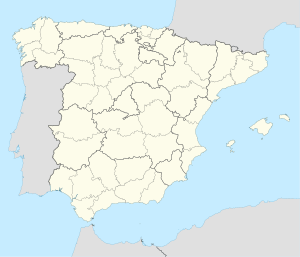
Puerto Rico, officially the Commonwealth of Puerto Rico, is an archipelagic island U.S. territory comprised of the eponymous main island of Puerto Rico and 142 smaller islands, cays, and islets, including Vieques, Culebra, Mona, Desecheo, Caja de Muertos, Palominos, and Icacos, located between the Greater and Lesser Antilles in the northeast Caribbean Sea of theNorth Atlantic Ocean. The main island of Puerto Rico is 113 km east of Hispaniola, 60 km west of the U.S. Virgin Islands, 705 km north of Venezuela, and 120 km south of the Puerto Rico Trench, the deepest point in the Atlantic. The main island is about 178 km long and 65 km. With a land area of 8,868 sq km, it is the 4th largest island in the Caribbean, 81st largest island in the world, and the 174th largest country, dependency, or disputed territory.

Plumas County is a county located in the Sierra Nevada of the U.S. state of California. As of the 2020 census, the population was 19,790. The county seat is Quincy, and the only incorporated city is Portola. The largest community in the county is East Quincy. The county was named for the Spanish Río de las Plumas, which flows through it. The county itself is also the namesake of a native moth species, Hadena plumasata.

Coahuila, formally Coahuila de Zaragoza, officially the Free and Sovereign State of Coahuila de Zaragoza, is one of the 32 states of Mexico.

Maunabo is a town and municipality of Puerto Rico located in the Maunabo Valley on the southeastern coast, northeast of Patillas and south of Yabucoa. Maunabo is spread over eight barrios and Maunabo Pueblo. It is part of the San Juan-Caguas-Guaynabo Metropolitan Statistical Area. The current mayor of the town is Jorge L. Márquez Pérez and the population in 2020 was 10,589.

The Sierra Madre is a mountain range in southwestern California. It forms the southernmost part of the California Coast Ranges and lies mostly in Santa Barbara County, with a small portion extending into Ventura County. The Sierra Madre has a northwest-to-southeast orientation, bordered on the north and northeast by the Cuyama River and Cuyama Valley, and on the south and east by the drainage of the Sisquoc River.

Cerro Las Tetas, nicknamed Las Tetas de Cayey but officially Las Piedras del Collado, are two mountain peaks located in the municipality of Salinas, Puerto Rico, north of the city of Salinas proper. Since September 1, 2000, the peaks have become part of the Las Piedras del Collado Nature Reserve and are protected by law. Their height is 2,762 feet (842 m) above sea level.

The Cordillera Central is the principal and only mountain range in the main island of Puerto Rico, comprised of three subranges, the central Cordillera Central, the southeastern Sierra de Cayey, and the northeastern Sierra de Luquillo. Bordered by the extensive Northern Karst Belt in the northwest and discontinuos, narrow costal plains in the north and south, the numerous ridges and foothills of all three subranges combined extend throughout the island. Concentrated in the central region of the island from west to east, the eponymous main subrange of Cordillera Central originates in the municipality of Mayagüez and merges with the Sierra de Cayey subrange on the town boundary between the municipalities of Barranquitas and Aibonito. At 1,338 meters on the town line between Ponce and Jayuya, Cerro de Punta is the summit of the Cordillera Central and the highest point in Puerto Rico.
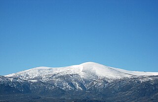
The Central System, Spanish and Portuguese: Sistema Central, is one of the main systems of mountain ranges in the Iberian Peninsula. The 2,592 m high Pico Almanzor is its highest summit.

Buenache de Alarcón is a municipality in the province of Cuenca, Castile-La Mancha, Spain. It has a population of 616.

Campillo de Altobuey is a municipality in Cuenca, Castile-La Mancha, Spain. It has a population of 1,691.
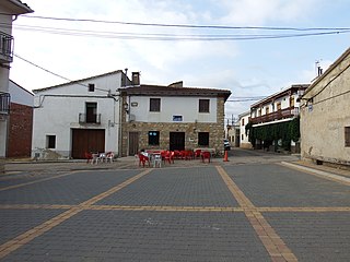
Campillos-Sierra is a municipality in Cuenca, Castile-La Mancha, Spain. It has a population of 96.
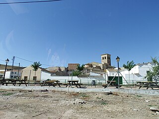
El Cañavate is a municipality in Cuenca, Castile-La Mancha, Spain. It has a population of 238.

Castillejo-Sierra is a municipality in Cuenca, Castile-La Mancha, Spain. It has a population of 48.

The Californias, occasionally known as the Three Californias or the Two Californias, are a region of North America spanning the United States and Mexico, consisting of the U.S. state of California and the Mexican states of Baja California and Baja California Sur. Historically, the term Californias was used to define the vast northwestern region of Spanish America, as the Province of the Californias, and later as a collective term for Alta California and the Baja California Peninsula.

Zacatecas, officially the Free and Sovereign State of Zacatecas, is one of the 31 states of Mexico. It is divided into 58 municipalities and its capital city is Zacatecas.

Manchuela or La Manchuela is a comarca located in Castile-La Mancha and Valencian Community, Spain.
Quebrada Larga is a barrio in the municipality of Añasco, Puerto Rico. Its population in 2010 was 1,532.

Sierra Baja is a rural barrio in the municipality of Guayanilla, Puerto Rico. Its population in 2010 was 602.

Sierra Alta is a barrio in the municipality of Yauco, Puerto Rico. Its population in 2010 was 1,063.
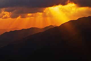
Sierra de Jájome is a mountain massif of the Sierra de Cayey located in the municipalities of Cayey, Guayama and Salinas in southeastern Puerto Rico. The mountain, often referred to as a mountain range (sierra), is protected as the Jájome Protected Natural Area. The Guayama Research Forest Area is also located on the massif. La Robleda, another protected natural area, is located nearby.


