Cuenca is one of the five provinces of the autonomous community of Castilla-La Mancha. It is located in the eastern part of this autonomous community and covers 17,141 square km. It has a population of 203,841 inhabitants – the least populated of the five provinces. Its capital city is also called Cuenca.

The Manzanares is a river in the centre of the Iberian Peninsula, which flows from the Sierra de Guadarrama, passes through Madrid, and eventually empties into the Jarama river, which in turn is a right-bank tributary to the Tagus.
The Saladillo Stream is a small tributary of the Paraná River, that discharges into it between the cities of Rosario and Villa Gobernador Gálvez, in the province of Santa Fe, Argentina. It serves as the political border between these two towns of the Greater Rosario area, and is one of the two important affluents of the Paraná in the area, together with the Ludueña Stream in the north.

Coruña del Conde is a village and municipality in the province of Burgos, Castile and León Spain. The Arandilla River runs through it.
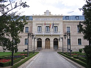
Canalejas del Arroyo is a municipality in Cuenca, Castile-La Mancha, Spain. It has a population of 343.

San Juan Bautista Tuxtepec, or simply referred to as Tuxtepec, is the head of the municipality by the same name and is the second most populous city of the Mexican state of Oaxaca. It is part of the Tuxtepec District of the Papaloapan Region. As of the 2020 census, the city is home to a population of 103,609 and 159,452 in the municipality, though census data are often under reported for various reasons.

Michael Antonio Arroyo Mina is an Ecuadorian professional footballer, who plays for Espartanos as a winger or attacking midfielder.
Pedro Manrique de Lara, commonly called Pedro de Molina or Peter of Lara, was a Castilian nobleman and military leader of the House of Lara. Although he spent most of his career in the service of Alfonso VIII of Castile, he also served briefly Ferdinand II of León (1185–86) and was Viscount of Narbonne by hereditary right after 1192. He was one of the most powerful Castilian magnates of his time, and defended the Kingdom of Toledo and the Extremadura against the Almohads. He also fought the Reconquista in Cuenca, and was a "second founder" of the monasteries of Huerta and Arandilla.

The Madrid–Asturias high-speed rail line connects the city of Madrid with the autonomous community of Asturias and was inaugurated on 29 November 2023. The line is built to standard gauge and gauge changers are provided at strategic points to allow interchange with older Spanish railways which were built to Iberian gauge.

Cuencas Mineras is a comarca in Aragon, Spain. It is located in Teruel Province, in the mountainous area of the Sistema Ibérico. The administrative capital is Utrillas, with 3,346 inhabitants the largest town of the comarca, but the historical and cultural center is Montalbán.
Alain Arroyo Martínez de la Cuadra is a Spanish former professional footballer who played mainly as a forward, and the current manager of Urduliz FT.
Liga Deportiva Universitaria de Quito's 2014 season was the club's 84th year of existence, the 61st year in professional football, and the 53rd in the top level of professional football in Ecuador.

John William Narváez Arroyo is an Ecuadorian footballer who plays for Carlos A. Mannucci as a defender.
Liga Deportiva Universitaria de Quito's 2015 season was the club's 86th year of existence, the 63rd year in professional football, and the 55th in the top level of professional football in Ecuador.
Cura-Mallín Group is a heterogeneous group of volcano-sedimentary formations of Oligocene-Miocene age, Colhuehuapian to Laventan in the SALMA classification, in south-central Chile and nearby parts of Argentina. The sediments belonging to the group were deposited in a lacustrine environment and alongside rivers in an intra-arc basin. Southeast of Laguna del Laja Cura-Mallín Group has a thickness of more than 1,800 metres (5,900 ft). The sediments making up the group deposited in an interval between 22 and 8 million years ago.
Guaytán is an archaeological site of the Maya civilization in the municipality of San Agustín Acasaguastlán, in the department of El Progreso, in Guatemala. It is the most important pre-Columbian archaeological site of the middle drainage of the Motagua River.
The Colorado Basin is a sedimentary basin located in northeastern Patagonia. The basin stretches across an area of approximately 180,000 square kilometres (69,000 sq mi), of which 37,000 square kilometres (14,000 sq mi) onshore in the southern Buenos Aires Province and the easternmost Río Negro Province extending offshore in the South Atlantic Ocean.
The Colorado Creek is a river in Canelones Department in Uruguay. The catchment area for the river includes 18 de Mayo, Cerrillos, La Paz, Las Piedras and Progresso. As of 2011, 108.038 people lived in the zone.
Juan Manuel Zubeldía is an Argentine football manager and former player who played as a midfielder.


